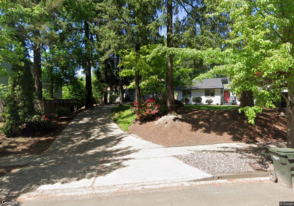
12675 SW Colt Ct Beaverton, OR 97008
South Beaverton NeighborhoodEstimated Value: $626,000 - $666,000
3
Beds
2
Baths
2,313
Sq Ft
$282/Sq Ft
Est. Value
About This Home
This home is located at 12675 SW Colt Ct, Beaverton, OR 97008 and is currently estimated at $651,914, approximately $281 per square foot. 12675 SW Colt Ct is a home located in Washington County with nearby schools including Greenway Elementary School, Conestoga Middle School, and Southridge High School.
Ownership History
Date
Name
Owned For
Owner Type
Purchase Details
Closed on
Jun 8, 2018
Sold by
Hirai Julie Ann
Bought by
Hirai Julie Ann and Julie Ann Hirai Trust
Current Estimated Value
Purchase Details
Closed on
Oct 25, 2011
Sold by
Hirai Julie Ann and Okubo Julie Ann
Bought by
Hirai Julie Ann
Home Financials for this Owner
Home Financials are based on the most recent Mortgage that was taken out on this home.
Original Mortgage
$119,500
Outstanding Balance
$80,849
Interest Rate
4.01%
Mortgage Type
New Conventional
Estimated Equity
$571,065
Purchase Details
Closed on
Apr 3, 2007
Sold by
Okubo Ronald Gene
Bought by
Okubo Julie Ann and Hirai Julie Ann
Create a Home Valuation Report for This Property
The Home Valuation Report is an in-depth analysis detailing your home's value as well as a comparison with similar homes in the area
Home Values in the Area
Average Home Value in this Area
Purchase History
| Date | Buyer | Sale Price | Title Company |
|---|---|---|---|
| Hirai Julie Ann | -- | None Available | |
| Hirai Julie Ann | -- | Wfg Title | |
| Okubo Julie Ann | -- | None Available |
Source: Public Records
Mortgage History
| Date | Status | Borrower | Loan Amount |
|---|---|---|---|
| Open | Hirai Julie Ann | $119,500 |
Source: Public Records
Tax History Compared to Growth
Tax History
| Year | Tax Paid | Tax Assessment Tax Assessment Total Assessment is a certain percentage of the fair market value that is determined by local assessors to be the total taxable value of land and additions on the property. | Land | Improvement |
|---|---|---|---|---|
| 2026 | $7,319 | $357,280 | -- | -- |
| 2025 | $7,319 | $346,880 | -- | -- |
| 2024 | $6,910 | $336,780 | -- | -- |
| 2023 | $6,910 | $326,980 | $0 | $0 |
| 2022 | $6,613 | $326,980 | $0 | $0 |
| 2021 | $6,382 | $308,220 | $0 | $0 |
| 2020 | $6,188 | $299,250 | $0 | $0 |
| 2019 | $5,992 | $290,540 | $0 | $0 |
| 2018 | $5,801 | $282,080 | $0 | $0 |
| 2017 | $5,584 | $273,870 | $0 | $0 |
| 2016 | $5,390 | $265,900 | $0 | $0 |
| 2015 | $5,190 | $258,160 | $0 | $0 |
| 2014 | $5,079 | $250,650 | $0 | $0 |
Source: Public Records
Map
Nearby Homes
- 9020 SW 130th Ave Unit 9020
- 12945 SW Hackamore Ct
- 13140 SW Madison Ct
- 9625 SW 130th Ave
- 8670 SW Indian Hill Ln
- 9750 SW Lookout Terrace
- 12145 SW Gingham Ln
- 12720 SW Brockman St
- 9965 SW Pimlico Terrace
- 13250 SW Weir Rd
- 12062 SW Conestoga Dr Unit 6
- 13850 SW Martingale Ct
- 13180 SW Haystack Dr
- 9964 SW Trapper Terrace Unit 259
- 9970 SW Silver Place
- 10196 SW Trapper Terrace Unit 165
- 7875 SW Green Ln
- 12119 SW Tesla Terrace
- 13465 SW Lancewood St
- 10322 SW Trapper Terrace Unit 339D
- 12645 SW Colt Ct
- 12695 SW Trigger Dr
- 9120 SW Quint Terrace
- 9150 SW Quint Terrace
- 12615 SW Colt Ct
- 12675 SW Trigger Dr
- 12595 SW Colt Ct
- 12630 SW Colt Ct
- 12720 SW Trigger Dr
- 12740 SW Trigger Dr
- 12775 SW Trigger Dr
- 9075 SW Quint Ct
- 12700 SW Trigger Dr
- 12655 SW Trigger Dr
- 12590 SW Colt Ct
- 12565 SW Colt Ct
- 9065 SW Quint Ct
- 12805 SW Trigger Dr
- 12725 SW Scout Dr
- 12635 SW Trigger Dr