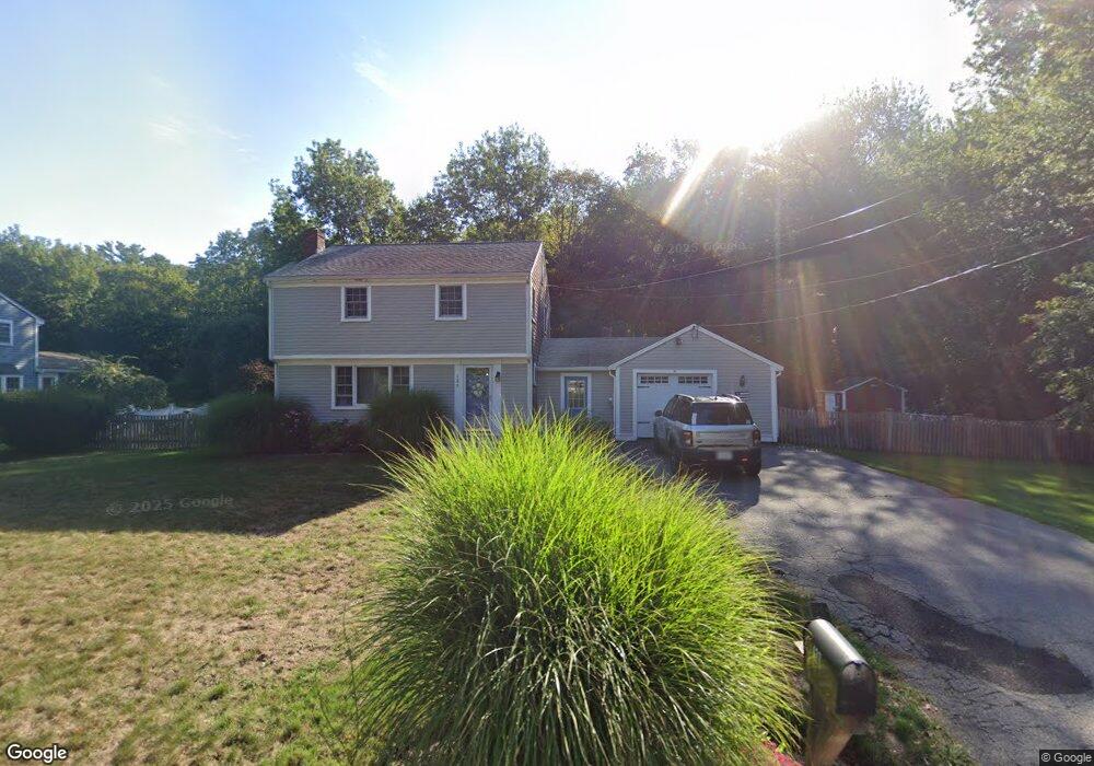
127 Booth Hill Rd Scituate, MA 02066
Estimated Value: $626,000 - $874,000
3
Beds
2
Baths
1,494
Sq Ft
$506/Sq Ft
Est. Value
About This Home
This home is located at 127 Booth Hill Rd, Scituate, MA 02066 and is currently estimated at $756,288, approximately $506 per square foot. 127 Booth Hill Rd is a home located in Plymouth County with nearby schools including Hatherly Elementary School, Lester J. Gates Middle School, and Scituate High School.
Ownership History
Date
Name
Owned For
Owner Type
Purchase Details
Closed on
Apr 28, 1995
Sold by
Emmett Colleen M and Specht Nancy
Bought by
Sugar Joseph P and Sugar Karen A
Current Estimated Value
Purchase Details
Closed on
Oct 15, 1993
Sold by
Donovan Jeremiah A and Donovan Marion J
Bought by
Emmett Colleen M and Specht Nancy
Create a Home Valuation Report for This Property
The Home Valuation Report is an in-depth analysis detailing your home's value as well as a comparison with similar homes in the area
Home Values in the Area
Average Home Value in this Area
Purchase History
| Date | Buyer | Sale Price | Title Company |
|---|---|---|---|
| Sugar Joseph P | $190,000 | -- | |
| Emmett Colleen M | $165,000 | -- |
Source: Public Records
Mortgage History
| Date | Status | Borrower | Loan Amount |
|---|---|---|---|
| Open | Emmett Colleen M | $144,030 | |
| Closed | Emmett Colleen M | $200,000 | |
| Closed | Emmett Colleen M | $166,000 | |
| Closed | Emmett Colleen M | $166,250 |
Source: Public Records
Tax History Compared to Growth
Tax History
| Year | Tax Paid | Tax Assessment Tax Assessment Total Assessment is a certain percentage of the fair market value that is determined by local assessors to be the total taxable value of land and additions on the property. | Land | Improvement |
|---|---|---|---|---|
| 2025 | $5,866 | $587,200 | $343,500 | $243,700 |
| 2024 | $5,748 | $554,800 | $312,300 | $242,500 |
| 2023 | $5,630 | $512,300 | $283,900 | $228,400 |
| 2022 | $5,630 | $446,100 | $254,600 | $191,500 |
| 2021 | $5,507 | $413,100 | $242,500 | $170,600 |
| 2020 | $5,342 | $395,700 | $233,100 | $162,600 |
| 2019 | $5,103 | $371,400 | $215,800 | $155,600 |
| 2018 | $5,226 | $374,600 | $234,600 | $140,000 |
| 2017 | $4,898 | $347,600 | $213,200 | $134,400 |
| 2016 | $4,765 | $337,000 | $202,600 | $134,400 |
| 2015 | $4,275 | $326,300 | $191,900 | $134,400 |
Source: Public Records
Map
Nearby Homes
- 8 Trudys Ln
- 84 Booth Hill Rd
- 11 Forest Ln
- 9 Forest Ln Unit 9
- 9 Kyle Path
- 0 Bates Ln (Lot E Kevin's Way) Unit 73419598
- 817 Country Way
- 40 Brewster Rd
- 449 Clapp Rd
- 455 Clapp Rd
- 453 Clapp Rd
- 451 Clapp Rd
- 453 - 455 Clapp Rd
- 26 Mordecai Lincoln Rd
- 392 S Main St
- 16 3 Ring Rd
- 112 Hollett St
- 14 Aberdeen Dr
- 309 S Main St
- 575 First Parish Rd
- 121 Booth Hill Rd
- 133 Booth Hill Rd
- 133 Booth Hill Rd Unit 1
- 126 Booth Hill Rd
- 10 Heritage Trail
- 120 Booth Hill Rd
- 115 Booth Hill Rd
- 136 Booth Hill Rd
- 118 Booth Hill Rd
- 137 Booth Hill Rd
- 112 Booth Hill Rd
- 109 Booth Hill Rd
- 109B Booth Hill Rd Unit B
- 109B Booth Hill Rd
- 108 Booth Hill Rd
- 9 Trudys Ln
- 5 Trudys Ln
- 139 Booth Hill Rd
- 101 Booth Hill Rd
- 12 Trudys Ln