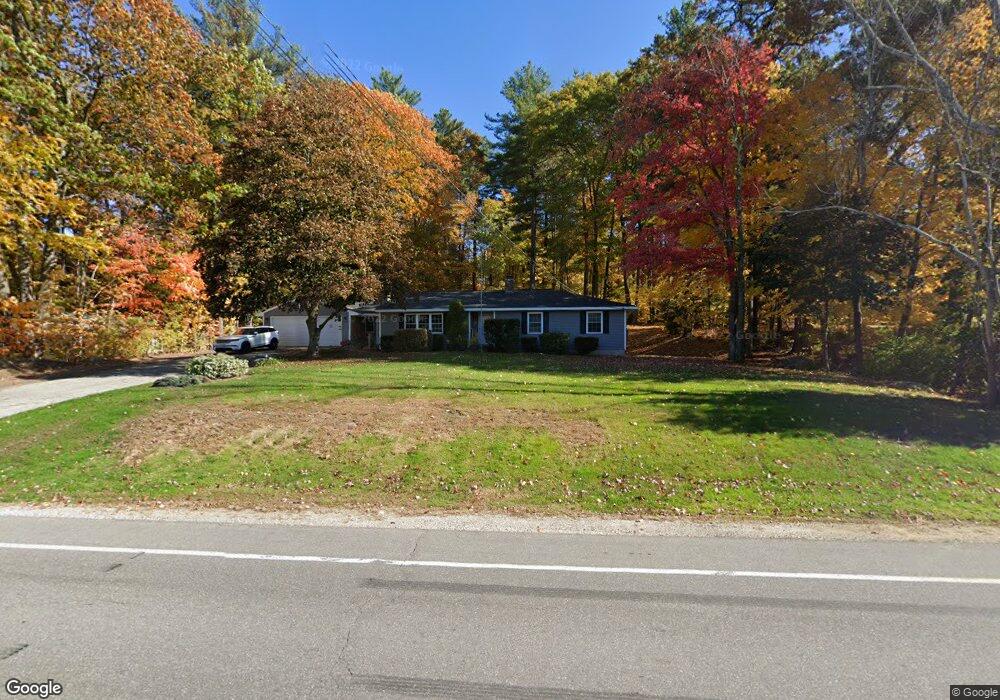
127 Mammoth Rd Hooksett, NH 03106
Estimated Value: $507,351 - $557,000
3
Beds
1
Bath
1,723
Sq Ft
$313/Sq Ft
Est. Value
About This Home
This home is located at 127 Mammoth Rd, Hooksett, NH 03106 and is currently estimated at $538,838, approximately $312 per square foot. 127 Mammoth Rd is a home located in Merrimack County with nearby schools including Fred C. Underhill School, Hooksett Memorial School, and David R. Cawley Middle School.
Ownership History
Date
Name
Owned For
Owner Type
Purchase Details
Closed on
Oct 2, 1997
Sold by
Duhaime Alice
Bought by
Duchesne Paul L and Duchesne Laura A
Current Estimated Value
Home Financials for this Owner
Home Financials are based on the most recent Mortgage that was taken out on this home.
Original Mortgage
$102,450
Interest Rate
7.41%
Create a Home Valuation Report for This Property
The Home Valuation Report is an in-depth analysis detailing your home's value as well as a comparison with similar homes in the area
Home Values in the Area
Average Home Value in this Area
Purchase History
| Date | Buyer | Sale Price | Title Company |
|---|---|---|---|
| Duchesne Paul L | $105,500 | -- |
Source: Public Records
Mortgage History
| Date | Status | Borrower | Loan Amount |
|---|---|---|---|
| Open | Duchesne Paul L | $244,600 | |
| Closed | Duchesne Paul L | $244,000 | |
| Closed | Duchesne Paul L | $102,450 |
Source: Public Records
Tax History
| Year | Tax Paid | Tax Assessment Tax Assessment Total Assessment is a certain percentage of the fair market value that is determined by local assessors to be the total taxable value of land and additions on the property. | Land | Improvement |
|---|---|---|---|---|
| 2024 | $7,554 | $445,400 | $119,200 | $326,200 |
| 2023 | $7,117 | $445,400 | $119,200 | $326,200 |
| 2022 | $5,760 | $239,500 | $81,500 | $158,000 |
| 2021 | $5,322 | $239,500 | $81,500 | $158,000 |
| 2020 | $5,391 | $239,500 | $81,500 | $158,000 |
| 2019 | $5,161 | $239,500 | $81,500 | $158,000 |
| 2018 | $5,298 | $239,500 | $81,500 | $158,000 |
| 2017 | $5,811 | $217,300 | $79,300 | $138,000 |
| 2016 | $5,735 | $217,300 | $79,300 | $138,000 |
| 2015 | $5,372 | $217,300 | $79,300 | $138,000 |
| 2014 | $5,396 | $217,300 | $79,300 | $138,000 |
| 2013 | $5,102 | $217,300 | $79,300 | $138,000 |
Source: Public Records
Map
Nearby Homes
- 1095 1097 1099 Hooksett Rd Unit 73, 74, 75
- 1099 Hooksett Rd Unit 73
- 1097 Hooksett Rd Unit 74
- 1095 Hooksett Rd
- 9 Lancelot Dr
- 267 Londonderry Turnpike
- 36 Prescott Heights Rd
- 13 Johns Dr
- 286 Londonderry Turnpike Unit A
- 286B Londonderry Turnpike Unit A
- 192 Londonderry Turnpike
- 41 Golden Gate Dr
- 6 Deerhead St
- 190 Chase Way
- 10 Dewberry Ln
- 15 Joanne Dr
- 9 Berry Hill Rd
- 141 Chase Way
- 151 N Acres Rd
- 104 N Gate Rd
- 126 Mammoth Rd Unit 20
- 126 Mammoth Rd Unit 25
- 126 Mammoth Rd Unit 330
- 126 Mammoth Rd Unit 329
- 126 Mammoth Rd Unit 328
- 126 Mammoth Rd Unit 327
- 126 Mammoth Rd Unit 326
- 126 Mammoth Rd Unit 325
- 126 Mammoth Rd Unit 324
- 126 Mammoth Rd Unit 323
- 126 Mammoth Rd Unit 322
- 126 Mammoth Rd Unit 321
- 126 Mammoth Rd Unit 320
- 126 Mammoth Rd Unit 319
- 126 Mammoth Rd Unit 318
- 126 Mammoth Rd Unit 317
- 126 Mammoth Rd Unit 316
- 126 Mammoth Rd Unit 315
- 126 Mammoth Rd Unit 314
- 126 Mammoth Rd Unit 313
Your Personal Tour Guide
Ask me questions while you tour the home.