Estimated Value: $166,000 - $211,000
--
Bed
--
Bath
1,426
Sq Ft
$129/Sq Ft
Est. Value
About This Home
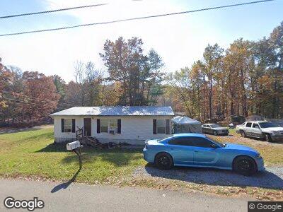
This home is located at 1270 Bill Martin Rd, Afton, TN 37616 and is currently estimated at $184,333, approximately $129 per square foot. 1270 Bill Martin Rd is a home with nearby schools including Chuckey Elementary School, Chuckey Doak Middle School, and Chuckey Doak High School.
Ownership History
Date
Name
Owned For
Owner Type
Purchase Details
Closed on
Jul 20, 2015
Sold by
Tolliver Candy
Bought by
Pena Nick
Current Estimated Value
Purchase Details
Closed on
Apr 17, 2014
Sold by
Vanderbilt Mtg And Finance
Bought by
Tolliver Candy and Pena Nick
Home Financials for this Owner
Home Financials are based on the most recent Mortgage that was taken out on this home.
Original Mortgage
$54,937
Interest Rate
4.37%
Mortgage Type
New Conventional
Purchase Details
Closed on
Mar 8, 2013
Sold by
Seaton Sandra
Bought by
Vanderbilt Mtg And Finance Inc
Purchase Details
Closed on
Nov 23, 1994
Sold by
Reaves Brenda
Bought by
Reynolds Marcella
Purchase Details
Closed on
Jan 1, 1980
Create a Home Valuation Report for This Property
The Home Valuation Report is an in-depth analysis detailing your home's value as well as a comparison with similar homes in the area
Home Values in the Area
Average Home Value in this Area
Purchase History
| Date | Buyer | Sale Price | Title Company |
|---|---|---|---|
| Pena Nick | -- | -- | |
| Tolliver Candy | $57,141 | -- | |
| Vanderbilt Mtg And Finance Inc | $31,500 | -- | |
| Reynolds Marcella | $6,000 | -- | |
| -- | $7,300 | -- |
Source: Public Records
Mortgage History
| Date | Status | Borrower | Loan Amount |
|---|---|---|---|
| Previous Owner | Tolliver Candy | $54,937 | |
| Previous Owner | Sandra Seaton | $54,915 |
Source: Public Records
Tax History Compared to Growth
Tax History
| Year | Tax Paid | Tax Assessment Tax Assessment Total Assessment is a certain percentage of the fair market value that is determined by local assessors to be the total taxable value of land and additions on the property. | Land | Improvement |
|---|---|---|---|---|
| 2024 | $620 | $37,550 | $3,225 | $34,325 |
| 2023 | $620 | $37,550 | $0 | $0 |
| 2022 | $343 | $17,050 | $2,225 | $14,825 |
| 2021 | $354 | $17,575 | $2,225 | $15,350 |
| 2020 | $354 | $17,575 | $2,225 | $15,350 |
| 2019 | $354 | $17,575 | $2,225 | $15,350 |
| 2018 | $354 | $17,575 | $2,225 | $15,350 |
| 2017 | $290 | $14,675 | $2,225 | $12,450 |
| 2016 | $275 | $14,675 | $2,225 | $12,450 |
| 2015 | $275 | $14,675 | $2,225 | $12,450 |
| 2014 | $275 | $14,675 | $2,225 | $12,450 |
Source: Public Records
Map
Nearby Homes
- 570 Anest Rd
- 6840 Greystone Rd
- 400 Union Chapel Rd
- 405 Morgan Branch Ln
- 450 Keller Rd
- 745 Keller Rd
- 625 Seaton Rd
- 215 Fox Rd
- 526 Eads Ln
- 110 Fishpond Rd
- 740 Fishpond Rd
- 7540 Erwin Hwy
- TBD Pleasant Hill Rd
- 000 Fishpond Rd
- 105 Ottinger Ln
- 379 Shaw Rd
- 8055 Erwin Hwy
- 5505 Chuckey Pike
- Tbd Shelton Mission Rd
- 0 Greystone Mountain Rd
- 1270 Bill Martin Rd
- 7545 Greystone Rd
- 1240 Bill Martin Rd
- 7525 Greystone Rd
- 7570 Greystone Rd
- 7635 Greystone Rd
- 7590 Greystone Rd
- 1190 Bill Martin Rd
- 7500 Greystone Rd
- 7455 Greystone Rd
- 7695 Greystone Rd
- 155 Anest Rd
- 7880 Greystone Rd
- 1150 Bill Martin Rd
- 1140 Bill Martin Rd
- 7395 Greystone Rd
- 225 Anest Rd
- 91 Anest Rd
- 70 Anest Rd
- 97 Anest Rd