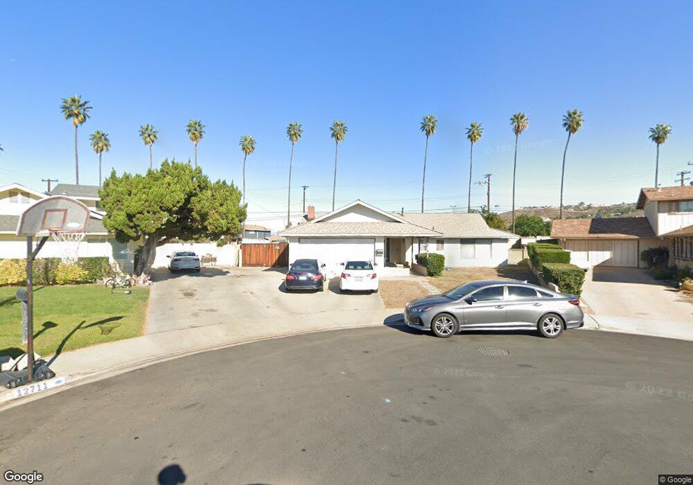
12700 Woodcliff Cir Riverside, CA 92503
Estimated Value: $590,677 - $682,000
3
Beds
2
Baths
1,622
Sq Ft
$395/Sq Ft
Est. Value
About This Home
This home is located at 12700 Woodcliff Cir, Riverside, CA 92503 and is currently estimated at $640,919, approximately $395 per square foot. 12700 Woodcliff Cir is a home located in Riverside County with nearby schools including Lake Hills Elementary School, Ysmael Villegas Middle School, and Hillcrest High School.
Ownership History
Date
Name
Owned For
Owner Type
Purchase Details
Closed on
Jul 12, 2022
Sold by
Gregory Roenbaugh Norman
Bought by
Roenbaugh-Church Family Trust
Current Estimated Value
Purchase Details
Closed on
Nov 13, 2000
Sold by
Knoth Gregory C and Knoth Joani P
Bought by
Roenbaugh Norman G
Home Financials for this Owner
Home Financials are based on the most recent Mortgage that was taken out on this home.
Original Mortgage
$163,551
Interest Rate
7.86%
Mortgage Type
FHA
Create a Home Valuation Report for This Property
The Home Valuation Report is an in-depth analysis detailing your home's value as well as a comparison with similar homes in the area
Home Values in the Area
Average Home Value in this Area
Purchase History
We collect this data history from publicly available records. To have your information removed, we recommend requesting removal directly through your county’s website.
| Date | Buyer | Sale Price | Title Company |
|---|---|---|---|
| Roenbaugh-Church Family Trust | -- | None Listed On Document | |
| Roenbaugh Norman G | $165,000 | First American Title Co |
Source: Public Records
Mortgage History
We collect this data history from publicly available records. To have your information removed, we recommend requesting removal directly through your county’s website.
| Date | Status | Borrower | Loan Amount |
|---|---|---|---|
| Previous Owner | Roenbaugh Norman G | $163,551 |
Source: Public Records
Tax History
| Year | Tax Paid | Tax Assessment Tax Assessment Total Assessment is a certain percentage of the fair market value that is determined by local assessors to be the total taxable value of land and additions on the property. | Land | Improvement |
|---|---|---|---|---|
| 2025 | $2,946 | $247,997 | $75,328 | $172,669 |
| 2023 | $2,946 | $238,368 | $72,403 | $165,965 |
| 2022 | $2,713 | $233,695 | $70,984 | $162,711 |
| 2021 | $2,655 | $229,114 | $69,593 | $159,521 |
| 2020 | $2,611 | $226,766 | $68,880 | $157,886 |
| 2019 | $2,574 | $222,321 | $67,530 | $154,791 |
| 2018 | $2,535 | $217,962 | $66,206 | $151,756 |
| 2017 | $2,486 | $213,689 | $64,908 | $148,781 |
| 2016 | $2,443 | $209,500 | $63,636 | $145,864 |
| 2015 | $2,407 | $206,355 | $62,681 | $143,674 |
| 2014 | $2,397 | $202,314 | $61,454 | $140,860 |
Source: Public Records
Map
Nearby Homes
- 3447 Yuba Cir
- 3772 Camino Tobago
- 3707 Calle Curacso
- 3883 SPC 45 Buchanan St
- 3682 N Pole Ln
- 3700 Buchanan St Unit 105
- 3700 Buchanan St Unit 25
- 3700 Buchanan St Unit 131
- 3700 Buchanan St Unit 189
- 3700 Buchanan St Unit 180
- 3700 Buchanan Ave Unit 25
- 3500 Buchanan St Unit 107
- 3500 Buchanan St Unit 120
- 3500 Buchanan St Unit 24
- 3500 Buchanan St Unit 145
- 3500 Buchanan St Unit 173
- 3500 Buchanan St Unit 103
- 3500 Buchanan St Unit 138
- 3500 Buchanan St Unit 70
- 3500 Buchanan St Unit 117
- 12711 Woodcliff Cir
- 12710 Woodcliff Cir
- 12721 Woodcliff Cir
- 12720 Woodcliff Cir
- 12690 Dogwood Cir
- 12731 Woodcliff Cir
- 12730 Woodcliff Cir
- 12711 Cobblestone Cir
- 12676 Dogwood Cir
- 12689 Dogwood Cir
- 12706 Harlow Ave
- 12716 Harlow Ave
- 12721 Cobblestone Cir
- 12724 Harlow Ave
- 12689 Buttonwood Cir
- 12741 Woodcliff Cir
- 12740 Woodcliff Cir
- 12731 Cobblestone Cir
- 12732 Harlow Ave
- 12690 Harlow Ave
Your Personal Tour Guide
Ask me questions while you tour the home.