12715 210th Ave Bristol, WI 53104
Estimated Value: $1,328,000 - $1,610,848
4
Beds
4
Baths
6,200
Sq Ft
$243/Sq Ft
Est. Value
About This Home
This home is located at 12715 210th Ave, Bristol, WI 53104 and is currently estimated at $1,506,283, approximately $242 per square foot. 12715 210th Ave is a home located in Kenosha County with nearby schools including Salem Elementary School and Central High School.
Ownership History
Date
Name
Owned For
Owner Type
Purchase Details
Closed on
Dec 2, 2019
Sold by
Warrender Robert T and Warrender Laurie L
Bought by
Leone Louis and Leone Amara
Current Estimated Value
Home Financials for this Owner
Home Financials are based on the most recent Mortgage that was taken out on this home.
Original Mortgage
$880,000
Outstanding Balance
$784,372
Interest Rate
3.5%
Mortgage Type
New Conventional
Estimated Equity
$827,450
Purchase Details
Closed on
Apr 7, 2017
Sold by
Warrender Robert T and Warrender Laurie L
Bought by
Warrender Trust
Create a Home Valuation Report for This Property
The Home Valuation Report is an in-depth analysis detailing your home's value as well as a comparison with similar homes in the area
Home Values in the Area
Average Home Value in this Area
Purchase History
| Date | Buyer | Sale Price | Title Company |
|---|---|---|---|
| Leone Louis | $1,100,000 | Blackhawk Title | |
| Warrender Trust | -- | -- |
Source: Public Records
Mortgage History
| Date | Status | Borrower | Loan Amount |
|---|---|---|---|
| Open | Leone Louis P | $502,000 | |
| Open | Leone Louis | $880,000 | |
| Previous Owner | Warrender Ii Robert T | $397,400 | |
| Previous Owner | Warrender Ii Robert T | $40,000 |
Source: Public Records
Tax History Compared to Growth
Tax History
| Year | Tax Paid | Tax Assessment Tax Assessment Total Assessment is a certain percentage of the fair market value that is determined by local assessors to be the total taxable value of land and additions on the property. | Land | Improvement |
|---|---|---|---|---|
| 2024 | $17,773 | $956,700 | $275,000 | $681,700 |
| 2023 | $15,189 | $956,700 | $275,000 | $681,700 |
| 2022 | $15,180 | $956,700 | $275,000 | $681,700 |
| 2021 | $15,314 | $974,000 | $275,000 | $699,000 |
| 2020 | $16,039 | $974,000 | $275,000 | $699,000 |
| 2019 | $12,580 | $803,700 | $275,000 | $528,700 |
| 2018 | $13,171 | $690,700 | $195,900 | $494,800 |
| 2017 | $13,726 | $690,700 | $195,900 | $494,800 |
| 2016 | $13,474 | $690,700 | $195,900 | $494,800 |
Source: Public Records
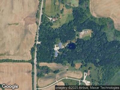
Map
Nearby Homes
- 12101 216th Ave
- 21605 117th St
- 22345 W North Ave
- 42909 N Deep Lake Rd
- 89 Bridgewood Dr
- 107 Bridgewood Dr Unit 1
- 20204 116th St
- 19900 128th St Unit 243
- 19900 128th St Unit 312
- 19900 128th St Unit 310
- 287 Bridgewood Dr Unit 1
- 333 Elmwood Ln
- 369 Maplewood Dr
- 281 E Old Mill Trail
- 151 Lakewood Dr
- 506 Longview Dr
- 177 E Old Mill Trail
- 12606 234th Ave
- 536 Longview Dr
- 57 Van Dyke Dr
- 12715 210th Ave
- 12715 210th Ave
- Lot 1 210th Ave
- 20900 124th St
- 20901 124th St
- 12200 213th Ave
- 21120 122nd St
- 21120 122nd St
- 21108 122nd St
- 12118 213th Ave
- 21108 122nd St
- 12108 213th Ave
- 12108 213th Ave
- 21328 121st St
- 21318 121st St
- 21318 121st St
- 21349 121st St
- 21349 121st St
- 12025 214th Ave
- Lt21 120th St St