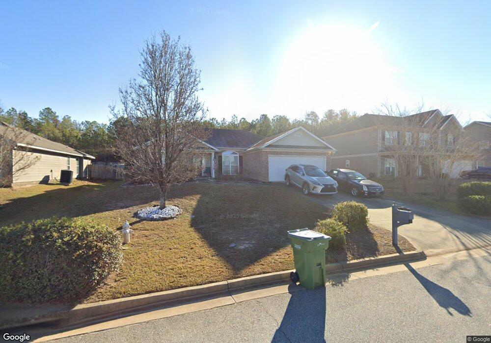
1272 Freedom Ridge Dr Columbus, GA 31907
Eastern Columbus NeighborhoodEstimated Value: $208,000 - $262,000
3
Beds
2
Baths
1,717
Sq Ft
$131/Sq Ft
Est. Value
About This Home
This home is located at 1272 Freedom Ridge Dr, Columbus, GA 31907 and is currently estimated at $224,767, approximately $130 per square foot. 1272 Freedom Ridge Dr is a home located in Muscogee County with nearby schools including Dawson Elementary School, East Columbus Magnet Academy, and Spencer High School.
Ownership History
Date
Name
Owned For
Owner Type
Purchase Details
Closed on
Dec 28, 2016
Sold by
Ciprian Cesar E
Bought by
Harrison Leon and Harrison Doris E
Current Estimated Value
Home Financials for this Owner
Home Financials are based on the most recent Mortgage that was taken out on this home.
Original Mortgage
$132,637
Outstanding Balance
$109,180
Interest Rate
4.08%
Mortgage Type
VA
Estimated Equity
$115,587
Create a Home Valuation Report for This Property
The Home Valuation Report is an in-depth analysis detailing your home's value as well as a comparison with similar homes in the area
Home Values in the Area
Average Home Value in this Area
Purchase History
| Date | Buyer | Sale Price | Title Company |
|---|---|---|---|
| Harrison Leon | $155,500 | -- |
Source: Public Records
Mortgage History
| Date | Status | Borrower | Loan Amount |
|---|---|---|---|
| Open | Harrison Leon | $132,637 |
Source: Public Records
Tax History Compared to Growth
Tax History
| Year | Tax Paid | Tax Assessment Tax Assessment Total Assessment is a certain percentage of the fair market value that is determined by local assessors to be the total taxable value of land and additions on the property. | Land | Improvement |
|---|---|---|---|---|
| 2025 | $1,926 | $75,152 | $16,712 | $58,440 |
| 2024 | $1,925 | $75,152 | $16,712 | $58,440 |
| 2023 | $1,243 | $75,152 | $16,712 | $58,440 |
| 2022 | $2,007 | $60,784 | $16,712 | $44,072 |
| 2021 | $2,000 | $62,384 | $16,712 | $45,672 |
| 2020 | $2,001 | $62,384 | $16,712 | $45,672 |
| 2019 | $2,009 | $62,384 | $16,712 | $45,672 |
| 2018 | $2,009 | $62,384 | $16,712 | $45,672 |
| 2017 | $2,504 | $60,916 | $16,712 | $44,204 |
| 2016 | $2,277 | $68,462 | $13,600 | $54,862 |
| 2015 | $2,280 | $68,462 | $13,600 | $54,862 |
| 2014 | $2,283 | $68,462 | $13,600 | $54,862 |
| 2013 | -- | $68,462 | $13,600 | $54,862 |
Source: Public Records
Map
Nearby Homes
- 5109 Lexington Ln
- 1238 Brandywine Dr
- 5116 Magazine Ln
- 5090 Lexington Ln
- 1210 Bunker Hill Rd
- 5310 Stoney Point Rd
- 1340 Bunker Ridge Ln
- 5219 Argonne Dr
- 5336 Gettysburg Way
- 1513 Alamo Dr
- 1225 Rowell St
- 5613 Quebec Dr
- 1025 Belmar St
- 849 Bunker Hill Rd
- 4462 Walking Stick Way
- 4939 Aaron Dr
- 5644 Quebec Dr
- 5664 St Marys Rd
- 1425 Staunton Dr
- 4408 Walking Stick Way
- 1278 Freedom Ridge Dr
- 1266 Freedom Ridge Dr
- 1260 Freedom Ridge Dr
- 1284 Freedom Ridge Dr
- 1440 Antietam Dr
- 5193 Legion Dr
- 5192 Legion Dr Unit 2685262-41474
- 5192 Legion Dr Unit 2685260-41474
- 5192 Legion Dr Unit 2685261-41474
- 5192 Legion Dr
- 1254 Freedom Ridge Dr
- 1290 Freedom Ridge Dr
- 5189 Legion Dr
- 5188 Legion Dr
- 5192 Magazine Ln
- 5185 Legion Dr
- 1248 Freedom Ridge Dr
- 5195 Lexington Ln
- 1245 Bunker Ridge Ln
- 5176 Magazine Ln