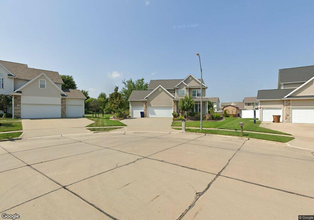
12723 Hammontree Cir Urbandale, IA 50323
Estimated Value: $429,000 - $442,160
3
Beds
3
Baths
2,108
Sq Ft
$207/Sq Ft
Est. Value
About This Home
This home is located at 12723 Hammontree Cir, Urbandale, IA 50323 and is currently estimated at $436,290, approximately $206 per square foot. 12723 Hammontree Cir is a home located in Polk County with nearby schools including Webster Elementary School, Urbandale Middle School, and Urbandale High School.
Ownership History
Date
Name
Owned For
Owner Type
Purchase Details
Closed on
Dec 21, 2004
Sold by
Sunflower Homes Inc
Bought by
Djuric Bojan and Djuric Amila
Current Estimated Value
Home Financials for this Owner
Home Financials are based on the most recent Mortgage that was taken out on this home.
Original Mortgage
$238,900
Outstanding Balance
$120,358
Interest Rate
5.82%
Mortgage Type
Purchase Money Mortgage
Estimated Equity
$315,932
Purchase Details
Closed on
Jun 28, 2004
Sold by
Hubbell Properties Ii Lc
Bought by
Sunflower Homes Inc
Create a Home Valuation Report for This Property
The Home Valuation Report is an in-depth analysis detailing your home's value as well as a comparison with similar homes in the area
Home Values in the Area
Average Home Value in this Area
Purchase History
| Date | Buyer | Sale Price | Title Company |
|---|---|---|---|
| Djuric Bojan | $251,000 | -- | |
| Sunflower Homes Inc | $128,500 | -- |
Source: Public Records
Mortgage History
| Date | Status | Borrower | Loan Amount |
|---|---|---|---|
| Open | Djuric Bojan | $238,900 |
Source: Public Records
Tax History Compared to Growth
Tax History
| Year | Tax Paid | Tax Assessment Tax Assessment Total Assessment is a certain percentage of the fair market value that is determined by local assessors to be the total taxable value of land and additions on the property. | Land | Improvement |
|---|---|---|---|---|
| 2025 | $7,196 | $419,600 | $99,600 | $320,000 |
| 2024 | $7,196 | $407,800 | $95,600 | $312,200 |
| 2023 | $6,704 | $407,800 | $95,600 | $312,200 |
| 2022 | $6,624 | $321,300 | $77,800 | $243,500 |
| 2021 | $6,536 | $321,300 | $77,800 | $243,500 |
| 2020 | $6,422 | $301,100 | $72,700 | $228,400 |
| 2019 | $6,400 | $301,100 | $72,700 | $228,400 |
| 2018 | $6,172 | $282,600 | $66,900 | $215,700 |
| 2017 | $5,796 | $282,600 | $66,900 | $215,700 |
| 2016 | $5,656 | $260,900 | $60,900 | $200,000 |
| 2015 | $5,656 | $260,900 | $60,900 | $200,000 |
| 2014 | $5,130 | $244,300 | $56,400 | $187,900 |
Source: Public Records
Map
Nearby Homes
- 4309 129th St
- 12912 Hammontree Dr
- 4412 125th St
- 12335 Tanglewood Dr
- 12510 Prairie Dr
- 13114 Iltis Dr
- 4016 127th St
- 12527 Airline Ave
- 12515 Airline Ave
- 4143 122nd St
- 12723 Sunflower Dr
- 3935 122nd St
- 12220 Horton Ave
- 12324 Sunflower Dr
- 4111 140th St
- 12202 Madison Ave
- 15217 Springbrook Trail
- 15015 Springbrook Trail
- 15019 Springbrook Trail
- 14509 Persimmon Dr
- 12727 Hammontree Cir
- 12719 Hammontree Cir
- 12730 Tanglewood Dr
- 12734 Tanglewood Dr
- 12726 Tanglewood Dr
- 12715 Hammontree Cir
- 12722 Tanglewood Dr
- 12726 Hammontree Cir
- 12720 Hammontree Cir
- 12716 Tanglewood Dr
- 12714 Hammontree Cir
- 12711 Hammontree Cir
- 12712 Tanglewood Dr
- 12729 Tanglewood Dr
- 12731 Tanglewood Dr
- 12708 Hammontree Cir
- 12725 Tanglewood Dr
- 12735 Tanglewood Dr
- 12707 Hammontree Cir
- 12721 Tanglewood Dr