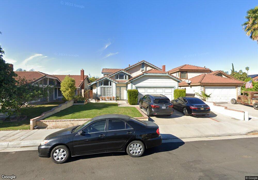
12755 Camino San Benito Dr Riverside, CA 92503
Estimated Value: $667,355 - $737,000
4
Beds
3
Baths
1,847
Sq Ft
$379/Sq Ft
Est. Value
About This Home
This home is located at 12755 Camino San Benito Dr, Riverside, CA 92503 and is currently estimated at $700,089, approximately $379 per square foot. 12755 Camino San Benito Dr is a home located in Riverside County with nearby schools including Lake Hills Elementary School, Ysmael Villegas Middle School, and Hillcrest High School.
Ownership History
Date
Name
Owned For
Owner Type
Purchase Details
Closed on
Aug 31, 2018
Sold by
Deadmon Aundra D
Bought by
Family Trust
Current Estimated Value
Purchase Details
Closed on
Aug 25, 1994
Sold by
Peters William and Peters Jennifer
Bought by
Griffin Demetrius and Deadmon Aundra D
Home Financials for this Owner
Home Financials are based on the most recent Mortgage that was taken out on this home.
Original Mortgage
$139,571
Interest Rate
8.57%
Mortgage Type
FHA
Create a Home Valuation Report for This Property
The Home Valuation Report is an in-depth analysis detailing your home's value as well as a comparison with similar homes in the area
Home Values in the Area
Average Home Value in this Area
Purchase History
| Date | Buyer | Sale Price | Title Company |
|---|---|---|---|
| Family Trust | -- | None Listed On Document | |
| Griffin Demetrius | $144,500 | First American Title Ins Co |
Source: Public Records
Mortgage History
| Date | Status | Borrower | Loan Amount |
|---|---|---|---|
| Previous Owner | Griffin Demetrius | $139,571 |
Source: Public Records
Tax History Compared to Growth
Tax History
| Year | Tax Paid | Tax Assessment Tax Assessment Total Assessment is a certain percentage of the fair market value that is determined by local assessors to be the total taxable value of land and additions on the property. | Land | Improvement |
|---|---|---|---|---|
| 2025 | $5,862 | $434,385 | $134,832 | $299,553 |
| 2023 | $5,862 | $417,520 | $129,598 | $287,922 |
| 2022 | $3,885 | $228,676 | $79,118 | $149,558 |
| 2021 | $3,788 | $224,193 | $77,567 | $146,626 |
| 2020 | $3,684 | $221,895 | $76,772 | $145,123 |
| 2019 | $3,443 | $217,545 | $75,267 | $142,278 |
| 2018 | $3,069 | $213,281 | $73,793 | $139,488 |
| 2017 | $3,006 | $209,100 | $72,347 | $136,753 |
| 2016 | $2,936 | $205,001 | $70,929 | $134,072 |
| 2015 | $2,867 | $201,923 | $69,864 | $132,059 |
| 2014 | $2,832 | $197,970 | $68,497 | $129,473 |
Source: Public Records
Map
Nearby Homes
- 3478 November Dr
- 3585 Dixie Ln
- 3627 Windstorm Way
- 12911 Via Napoi
- 3631 Snowdrift Dr
- 13015 New Haven Loop
- 13006 August Cir
- 3500 Buchanan St Unit 107
- 3500 Buchanan St Unit 181
- 3500 Buchanan St Unit 239
- 3500 Buchanan St
- 3500 Buchanan St Unit 57
- 3500 Buchanan St Unit 240
- 3500 Buchanan St Unit 24
- 3500 Buchanan St Unit 138
- 3500 Buchanan St Unit 193
- 3500 Buchanan St Unit 31
- 3461 Crownsworth St
- 3306 July Dr
- 13042 Avenida Pescador
- 12763 Camino San Benito Dr
- 12749 Camino San Benito Dr
- 12769 Camino San Benito Dr
- 12743 Camino San Benito Dr
- 12756 Tehama Cir
- 12764 Tehama Cir
- 12748 Tehama Cir
- 12772 Tehama Cir
- 12740 Tehama Cir
- 12735 Camino San Benito Dr
- 12777 Camino San Benito Dr
- 3507 Yuba Cir
- 12780 Tehama Cir
- 3508 Yuba Cir
- 12732 Tehama Cir
- 12727 Camino San Benito Dr
- 12783 Camino San Benito Dr
- 3497 Yuba Cir
- 12788 Tehama Cir
- 3506 Siskiyou Cir