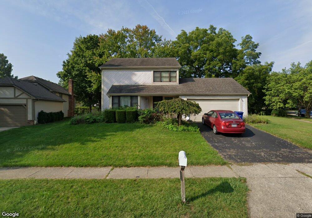
1279 Amol Ln Columbus, OH 43235
Worthingview NeighborhoodEstimated Value: $390,000 - $513,000
3
Beds
3
Baths
2,622
Sq Ft
$180/Sq Ft
Est. Value
About This Home
This home is located at 1279 Amol Ln, Columbus, OH 43235 and is currently estimated at $471,726, approximately $179 per square foot. 1279 Amol Ln is a home located in Franklin County with nearby schools including Bluffsview Elementary School, McCord Middle School, and Worthington Kilbourne High School.
Ownership History
Date
Name
Owned For
Owner Type
Purchase Details
Closed on
Mar 30, 2011
Sold by
Andrews Kittie R and Shea Kittie R
Bought by
Shea Michael J
Current Estimated Value
Purchase Details
Closed on
Apr 27, 1993
Bought by
Shea Michael J and Shea Kittie R
Purchase Details
Closed on
May 22, 1989
Create a Home Valuation Report for This Property
The Home Valuation Report is an in-depth analysis detailing your home's value as well as a comparison with similar homes in the area
Home Values in the Area
Average Home Value in this Area
Purchase History
| Date | Buyer | Sale Price | Title Company |
|---|---|---|---|
| Shea Michael J | -- | None Available | |
| Shea Michael J | $117,500 | -- | |
| -- | $117,500 | -- |
Source: Public Records
Tax History Compared to Growth
Tax History
| Year | Tax Paid | Tax Assessment Tax Assessment Total Assessment is a certain percentage of the fair market value that is determined by local assessors to be the total taxable value of land and additions on the property. | Land | Improvement |
|---|---|---|---|---|
| 2024 | $7,786 | $126,810 | $41,130 | $85,680 |
| 2023 | $7,445 | $126,805 | $41,125 | $85,680 |
| 2022 | $6,459 | $87,290 | $26,180 | $61,110 |
| 2021 | $5,958 | $87,290 | $26,180 | $61,110 |
| 2020 | $5,739 | $87,290 | $26,180 | $61,110 |
| 2019 | $5,567 | $76,410 | $22,750 | $53,660 |
| 2018 | $5,089 | $76,410 | $22,750 | $53,660 |
| 2017 | $4,989 | $76,410 | $22,750 | $53,660 |
| 2016 | $4,784 | $67,380 | $19,600 | $47,780 |
| 2015 | $4,785 | $67,380 | $19,600 | $47,780 |
| 2014 | $4,783 | $67,380 | $19,600 | $47,780 |
| 2013 | $2,164 | $61,250 | $17,815 | $43,435 |
Source: Public Records
Map
Nearby Homes
- 1380 Tiehack Ct
- 7164 Durness Place
- 1620 Park Row Dr Unit A
- 1637 Park Row Dr Unit F
- 1101 Bluffway Dr
- 1041 Rosebank Dr
- 7522 Acela St
- 2687 Snouffer Rd
- 1828 Gardenstone Dr
- 1889 Slaton Ct Unit 1889
- 1930 Shallowford Ave
- 6637 Merwin Rd
- 6550 Winston Ct E
- 6921 Spruce Pine Dr
- 2001 Sawbury Blvd Unit 2001
- 1118 Ravine Ridge Dr
- 1307 Lakeside Ct
- 2056 Fincastle Ct
- 784 Pinecliff Place
- 2074 Hard Rd
- 1275 Amol Ln
- 7044 Linbrook Blvd
- 7036 Linbrook Blvd
- 1269 Amol Ln
- 1300 Churchbell Way
- 1278 Amol Ln
- 7024 Linbrook Blvd
- 1310 Churchbell Way
- 1266 Amol Ln
- 1284 Churchbell Way
- 1265 Amol Ln
- 1302 Cross Country Dr
- 1269 Churchbell Way
- 1297 Worthington Heights Blvd
- 1294 Cross Country Dr
- 7016 Linbrook Blvd
- 1276 Churchbell Way
- 1286 Cross Country Dr
- 1258 Amol Ln
- 1261 Amol Ln