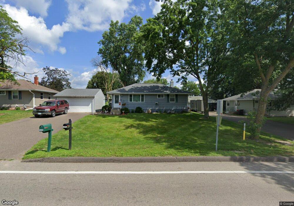
1279 County Road B E Saint Paul, MN 55109
Sherwood Glen NeighborhoodEstimated Value: $294,000 - $309,000
3
Beds
1
Bath
1,504
Sq Ft
$200/Sq Ft
Est. Value
About This Home
This home is located at 1279 County Road B E, Saint Paul, MN 55109 and is currently estimated at $301,134, approximately $200 per square foot. 1279 County Road B E is a home located in Ramsey County with nearby schools including Weaver Elementary School, John Glenn Middle School, and St Jerome Elementary School.
Ownership History
Date
Name
Owned For
Owner Type
Purchase Details
Closed on
Oct 12, 2021
Sold by
Horning Bradley D and Horning Darla J
Bought by
Homing Douglas Dale and Toulouse Robert John
Current Estimated Value
Home Financials for this Owner
Home Financials are based on the most recent Mortgage that was taken out on this home.
Original Mortgage
$260,000
Outstanding Balance
$237,096
Interest Rate
2.8%
Mortgage Type
VA
Estimated Equity
$64,038
Create a Home Valuation Report for This Property
The Home Valuation Report is an in-depth analysis detailing your home's value as well as a comparison with similar homes in the area
Home Values in the Area
Average Home Value in this Area
Purchase History
| Date | Buyer | Sale Price | Title Company |
|---|---|---|---|
| Homing Douglas Dale | $260,000 | Titlesmart Inc |
Source: Public Records
Mortgage History
| Date | Status | Borrower | Loan Amount |
|---|---|---|---|
| Open | Homing Douglas Dale | $260,000 |
Source: Public Records
Tax History
| Year | Tax Paid | Tax Assessment Tax Assessment Total Assessment is a certain percentage of the fair market value that is determined by local assessors to be the total taxable value of land and additions on the property. | Land | Improvement |
|---|---|---|---|---|
| 2025 | $3,266 | $277,200 | $58,300 | $218,900 |
| 2023 | $3,266 | $242,600 | $58,300 | $184,300 |
| 2022 | $2,864 | $231,500 | $58,300 | $173,200 |
| 2021 | $2,962 | $206,900 | $58,300 | $148,600 |
| 2020 | $3,040 | $201,100 | $58,300 | $142,800 |
| 2019 | $2,594 | $192,200 | $58,300 | $133,900 |
| 2018 | $2,442 | $166,500 | $58,300 | $108,200 |
| 2017 | $2,508 | $152,300 | $58,300 | $94,000 |
| 2016 | $2,420 | $0 | $0 | $0 |
| 2015 | $2,186 | $143,400 | $53,500 | $89,900 |
| 2014 | $1,558 | $0 | $0 | $0 |
Source: Public Records
Map
Nearby Homes
- 1200 Leland Rd E
- 1290 Belmont Ln E
- 1461 Grandview Ave E
- 2022 English St
- 1481 Sextant Ave E
- 2125 Hazelwood St
- 1579 Grandview Ave E
- 1984 Prosperity Rd
- 1855 Birmingham St
- 1083 Gordon Ave
- 1800 Edward St
- 1875 E Shore Dr Unit 302
- 1764 English St
- 1894 Maryknoll Ave N
- 1745 Duluth St
- 2457 Dianna Ln
- 2615 Flandrau St
- 822 Palm Ct
- 1669 Clarence St
- 1633 Etna St
- 1271 County Road B E
- 1285 County Road B E
- 1276 Lark Ave
- 1284 Lark Ave
- 1265 County Road B E
- 1291 County Road B E
- 1270 Lark Ave
- 1292 Lark Ave
- 1278 County Road B E
- 1284 County Road B E
- 1259 County Road B E
- 1272 County Road B E
- 1260 Lark Ave
- 1294 County Road B E
- 1264 County Road B E
- 1253 County Road B E
- 1254 Lark Ave
- 1258 County Road B E
- 1279 Lark Ave
- 2226 English St
Your Personal Tour Guide
Ask me questions while you tour the home.