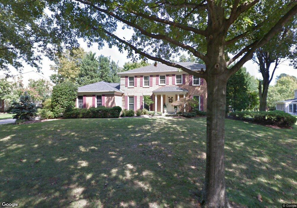
1279 Log Canoe Ct Annapolis, MD 21403
Estimated Value: $870,586 - $1,010,000
--
Bed
3
Baths
2,802
Sq Ft
$333/Sq Ft
Est. Value
About This Home
This home is located at 1279 Log Canoe Ct, Annapolis, MD 21403 and is currently estimated at $932,397, approximately $332 per square foot. 1279 Log Canoe Ct is a home located in Anne Arundel County with nearby schools including Georgetown East Elementary School, Annapolis Middle School, and Annapolis High School.
Ownership History
Date
Name
Owned For
Owner Type
Purchase Details
Closed on
Jun 30, 1981
Bought by
Lounsberry Freddie P and Lounsberry Lynn C
Current Estimated Value
Home Financials for this Owner
Home Financials are based on the most recent Mortgage that was taken out on this home.
Original Mortgage
$120,000
Interest Rate
16.62%
Create a Home Valuation Report for This Property
The Home Valuation Report is an in-depth analysis detailing your home's value as well as a comparison with similar homes in the area
Home Values in the Area
Average Home Value in this Area
Purchase History
| Date | Buyer | Sale Price | Title Company |
|---|---|---|---|
| Lounsberry Freddie P | $171,400 | -- |
Source: Public Records
Mortgage History
| Date | Status | Borrower | Loan Amount |
|---|---|---|---|
| Closed | Lounsberry Freddie P | $120,000 |
Source: Public Records
Tax History Compared to Growth
Tax History
| Year | Tax Paid | Tax Assessment Tax Assessment Total Assessment is a certain percentage of the fair market value that is determined by local assessors to be the total taxable value of land and additions on the property. | Land | Improvement |
|---|---|---|---|---|
| 2025 | $5,277 | $670,167 | -- | -- |
| 2024 | $5,277 | $640,733 | $0 | $0 |
| 2023 | $4,591 | $611,300 | $296,900 | $314,400 |
| 2022 | $4,815 | $605,367 | $0 | $0 |
| 2021 | $9,496 | $599,433 | $0 | $0 |
| 2020 | $4,606 | $593,500 | $281,900 | $311,600 |
| 2019 | $4,530 | $583,833 | $0 | $0 |
| 2018 | $5,822 | $574,167 | $0 | $0 |
| 2017 | $4,298 | $564,500 | $0 | $0 |
| 2016 | -- | $543,733 | $0 | $0 |
| 2015 | -- | $522,967 | $0 | $0 |
| 2014 | -- | $502,200 | $0 | $0 |
Source: Public Records
Map
Nearby Homes
- 3259 Chrisland Dr
- 3117 Port Way
- 3126 Port Way
- 1141 Mainsail Dr
- 1230 Crummell Ave
- 3209 Henson Ave
- 22 E Lake Dr
- 1009 Dulaney Ln
- 2656A Queen Anne Cir
- 48 E Lake Dr
- 3210 Bruce Ave
- 1003 Dulaney Ln
- 45 E Lake Dr
- 1192 Bay Highlands Dr
- 90 River Dr
- 88 River Dr
- 2638 Carrollton Rd
- 1193 Bay Highlands Dr
- 54 River Dr
- 3123 Arundel on The Bay Rd
- 1281 Log Canoe Ct
- 3114 Catrina Ln
- 1278 Log Canoe Ct
- 1275 Log Canoe Ct
- 3116 Catrina Ln
- 1280 Log Canoe Ct
- 1276 Log Canoe Ct
- 1282 Log Canoe Ct
- 1274 Log Canoe Ct
- 3118 Catrina Ln
- 3103 Drogue Ct
- 1273 Log Canoe Ct
- 3105 Drogue Ct
- 3111 Catrina Ln
- 3109 Catrina Ln
- 3113 Catrina Ln
- 3107 Drogue Ct
- 3106 Catrina Ln
- 3120 Catrina Ln
- 1272 Log Canoe Ct