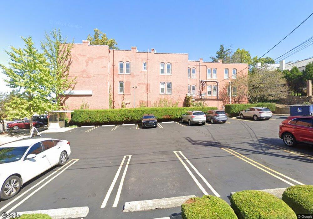
128 N Broad St Lancaster, OH 43130
Estimated Value: $496,488
--
Bed
--
Bath
8,577
Sq Ft
$58/Sq Ft
Est. Value
About This Home
This home is located at 128 N Broad St, Lancaster, OH 43130 and is currently estimated at $496,488, approximately $57 per square foot. 128 N Broad St is a home located in Fairfield County with nearby schools including Thomas Ewing Junior High School, Lancaster High School, and St Mary Elementary School.
Ownership History
Date
Name
Owned For
Owner Type
Purchase Details
Closed on
Dec 6, 2022
Sold by
Wardens And Vestrymen Of St Johns Church
Bought by
Saint James Place Ltd
Current Estimated Value
Home Financials for this Owner
Home Financials are based on the most recent Mortgage that was taken out on this home.
Original Mortgage
$393,293
Outstanding Balance
$366,142
Interest Rate
7.08%
Mortgage Type
Credit Line Revolving
Estimated Equity
$130,346
Create a Home Valuation Report for This Property
The Home Valuation Report is an in-depth analysis detailing your home's value as well as a comparison with similar homes in the area
Home Values in the Area
Average Home Value in this Area
Purchase History
| Date | Buyer | Sale Price | Title Company |
|---|---|---|---|
| Saint James Place Ltd | $400,000 | -- |
Source: Public Records
Mortgage History
| Date | Status | Borrower | Loan Amount |
|---|---|---|---|
| Open | Saint James Place Ltd | $393,293 |
Source: Public Records
Tax History Compared to Growth
Tax History
| Year | Tax Paid | Tax Assessment Tax Assessment Total Assessment is a certain percentage of the fair market value that is determined by local assessors to be the total taxable value of land and additions on the property. | Land | Improvement |
|---|---|---|---|---|
| 2024 | $6,138 | $68,270 | $9,850 | $58,420 |
| 2023 | $3,992 | $68,270 | $9,850 | $58,420 |
| 2022 | $4,001 | $68,270 | $9,850 | $58,420 |
| 2021 | $4,069 | $68,270 | $9,850 | $58,420 |
| 2020 | $4,266 | $68,270 | $9,850 | $58,420 |
| 2019 | $4,122 | $68,270 | $9,850 | $58,420 |
| 2018 | $4,335 | $77,330 | $9,850 | $67,480 |
| 2017 | $4,326 | $74,620 | $9,850 | $64,770 |
| 2016 | $4,206 | $74,620 | $9,850 | $64,770 |
| 2015 | $3,472 | $74,620 | $9,850 | $64,770 |
| 2014 | $3,318 | $74,620 | $9,850 | $64,770 |
| 2013 | $3,318 | $74,620 | $9,850 | $64,770 |
Source: Public Records
Map
Nearby Homes
- 115 E Wheeling St
- 154 E Main St
- 0 N Columbus St
- 0 N Memorial Dr
- 153 King St
- 0 Slocum Ave
- 515 N Columbus St
- 113 N George St
- 187 E Allen St
- 510 W Wheeling St
- 441 E Locust St
- 708 N High St
- 534 E Wheeling St
- 123 Arnold Ave
- 545 E Main St
- 311 E Allen St
- 820 N Broad St
- 308 Wheat St
- 573 Willow St
- 571 E Chestnut St
- 118 E Wheeling St
- 118 E Wheeling St
- 122 E Wheeling St
- 128 E Wheeling St
- 123 N Broad St
- 101 E Wheeling St
- 125 E Wheeling St
- 111 E Main St
- 129 E Main St
- 136 E Wheeling St
- 109 N Broad St
- 109 N Broad St Unit C
- 129 E Wheeling St
- 140 E Wheeling St
- 113 W Wheeling St
- 145 E Main St
- 145 E Main St
- 111 W Wheeling St Unit 202
- 111 W Wheeling St Unit 206
- 111 W Wheeling St Unit 210