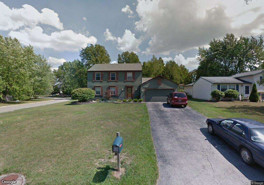
1281 Cedarwood Dr Mineral Ridge, OH 44440
Austintown NeighborhoodEstimated Value: $201,000 - $266,000
4
Beds
3
Baths
1,792
Sq Ft
$136/Sq Ft
Est. Value
About This Home
This home is located at 1281 Cedarwood Dr, Mineral Ridge, OH 44440 and is currently estimated at $243,823, approximately $136 per square foot. 1281 Cedarwood Dr is a home located in Mahoning County with nearby schools including Seaborn Elementary School, Mineral Ridge High School, and Stambaugh Charter Academy.
Ownership History
Date
Name
Owned For
Owner Type
Purchase Details
Closed on
May 19, 2015
Sold by
Beatrice Mark A
Bought by
Anderson Crystal J
Current Estimated Value
Purchase Details
Closed on
Jan 5, 2015
Sold by
Anderson Kenneth J and Anderson Crystal J
Bought by
Anderson Crystal J
Purchase Details
Closed on
Jun 30, 2002
Sold by
Morgan Diane L and Morgan Daniel J
Bought by
Anderson Kenneth J and Anderson Crystal J
Home Financials for this Owner
Home Financials are based on the most recent Mortgage that was taken out on this home.
Original Mortgage
$104,000
Interest Rate
6.91%
Purchase Details
Closed on
Jul 5, 1988
Bought by
Morgan Daniel S
Create a Home Valuation Report for This Property
The Home Valuation Report is an in-depth analysis detailing your home's value as well as a comparison with similar homes in the area
Home Values in the Area
Average Home Value in this Area
Purchase History
| Date | Buyer | Sale Price | Title Company |
|---|---|---|---|
| Anderson Crystal J | $6,000 | Attorney | |
| Anderson Crystal J | -- | Attorney | |
| Anderson Kenneth J | $130,000 | -- | |
| Morgan Daniel S | $66,000 | -- |
Source: Public Records
Mortgage History
| Date | Status | Borrower | Loan Amount |
|---|---|---|---|
| Previous Owner | Anderson Kenneth J | $104,000 |
Source: Public Records
Tax History Compared to Growth
Tax History
| Year | Tax Paid | Tax Assessment Tax Assessment Total Assessment is a certain percentage of the fair market value that is determined by local assessors to be the total taxable value of land and additions on the property. | Land | Improvement |
|---|---|---|---|---|
| 2024 | $3,319 | $64,360 | $7,030 | $57,330 |
| 2023 | $3,288 | $64,360 | $7,030 | $57,330 |
| 2022 | $2,723 | $47,030 | $7,030 | $40,000 |
| 2021 | $2,724 | $47,030 | $7,030 | $40,000 |
| 2020 | $2,733 | $47,030 | $7,030 | $40,000 |
| 2019 | $2,689 | $42,120 | $7,030 | $35,090 |
| 2018 | $2,593 | $42,120 | $7,030 | $35,090 |
| 2017 | $2,572 | $42,120 | $7,030 | $35,090 |
| 2016 | $2,609 | $41,110 | $7,030 | $34,080 |
| 2015 | $2,534 | $41,110 | $7,030 | $34,080 |
| 2014 | $2,550 | $41,110 | $7,030 | $34,080 |
| 2013 | $2,530 | $41,110 | $7,030 | $34,080 |
Source: Public Records
Map
Nearby Homes
- 1239 Woodledge Dr
- 5085 Winslow Dr
- 0 W Webb Rd
- 1467 E County Line Rd
- 21 E Liberty St
- 1445 E County Line Rd
- 1684 Morris St
- 3872 Main St
- 3907 Edwards St
- 645 Carlin Dr
- 3579 Bee St
- 6360 Meander Glen Dr
- 6393 Meander Glen Dr
- 3474 S Main St
- 5231 W Rockwell Rd
- 3440 Lakeside Dr
- 0 W Liberty Unit 5153649
- 176 N Canfield Niles Rd
- 159 N Canfield Niles Rd
- 236 Charlestown Place
- 1275 Cedarwood Dr
- 1287 Cedarwood Dr
- 1284 Cedarwood Dr
- 1269 Cedarwood Dr
- 5147 Clearfield Dr
- 1282 Cedarwood Dr
- 1276 Cedarwood Dr
- 1293 Cedarwood Dr
- 1292 Cedarwood Dr
- 1265 Cedarwood Dr
- 5143 Clearfield Dr
- 1268 Cedarwood Dr
- 5134 Winslow Dr
- 5130 Winslow Dr
- 5142 Winslow Dr
- 1299 Cedarwood Dr
- 1303 Northfield Dr
- 5140 Clearfield Dr
- 5139 Clearfield Dr
- 1261 Cedarwood Dr