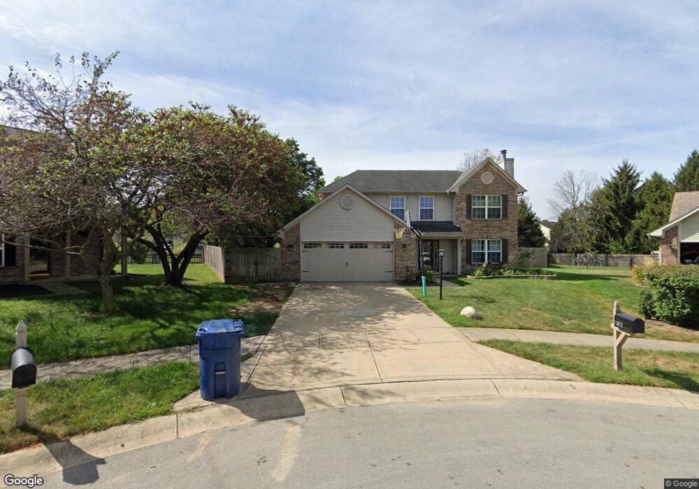
12812 Ramsgate Ct Fishers, IN 46038
Estimated Value: $339,000 - $383,000
3
Beds
3
Baths
2,035
Sq Ft
$178/Sq Ft
Est. Value
About This Home
This home is located at 12812 Ramsgate Ct, Fishers, IN 46038 and is currently estimated at $362,821, approximately $178 per square foot. 12812 Ramsgate Ct is a home located in Hamilton County with nearby schools including Cumberland Road Elementary School, East Middle School, and Fishers Junior High School.
Ownership History
Date
Name
Owned For
Owner Type
Purchase Details
Closed on
Nov 25, 2003
Sold by
Bullock Shawn S and Bullock Laura J
Bought by
Sandoval Guadalupe
Current Estimated Value
Home Financials for this Owner
Home Financials are based on the most recent Mortgage that was taken out on this home.
Original Mortgage
$105,000
Outstanding Balance
$49,096
Interest Rate
6.01%
Mortgage Type
Purchase Money Mortgage
Estimated Equity
$313,725
Create a Home Valuation Report for This Property
The Home Valuation Report is an in-depth analysis detailing your home's value as well as a comparison with similar homes in the area
Home Values in the Area
Average Home Value in this Area
Purchase History
| Date | Buyer | Sale Price | Title Company |
|---|---|---|---|
| Sandoval Guadalupe | -- | -- |
Source: Public Records
Mortgage History
| Date | Status | Borrower | Loan Amount |
|---|---|---|---|
| Open | Sandoval Guadalupe | $105,000 |
Source: Public Records
Tax History Compared to Growth
Tax History
| Year | Tax Paid | Tax Assessment Tax Assessment Total Assessment is a certain percentage of the fair market value that is determined by local assessors to be the total taxable value of land and additions on the property. | Land | Improvement |
|---|---|---|---|---|
| 2024 | $3,241 | $311,100 | $41,300 | $269,800 |
| 2023 | $3,241 | $296,500 | $41,300 | $255,200 |
| 2022 | $3,309 | $278,700 | $41,300 | $237,400 |
| 2021 | $2,721 | $228,500 | $41,300 | $187,200 |
| 2020 | $2,384 | $204,300 | $41,300 | $163,000 |
| 2019 | $2,358 | $201,800 | $42,400 | $159,400 |
| 2018 | $2,184 | $190,100 | $42,400 | $147,700 |
| 2017 | $1,932 | $174,800 | $42,400 | $132,400 |
| 2016 | $1,811 | $171,900 | $42,400 | $129,500 |
| 2014 | $1,574 | $162,300 | $45,300 | $117,000 |
| 2013 | $1,574 | $163,700 | $45,300 | $118,400 |
Source: Public Records
Map
Nearby Homes
- 10066 Perlita Place
- 12991 Wingstem Ct
- 12959 Shandon Ln
- 11798 & 11842 E 131st St
- 13068 Lamarque Place
- 12677 Ladson St
- 10150 Beresford Ct
- 12966 Pleasant View Ln
- 13125 Zinfandel Place
- 13048 Ross Crossing
- 10671 Pleasant View Ln
- 10175 Pamona Ct
- 10513 Blue Springs Ln
- 12638 Granite Ridge Cir
- 10713 Summerwood Ln
- 12126 Blue Springs Ln
- 10523 Hollowood Ct
- 12783 Granite Ridge Cir
- 12662 Granite Ridge Cir
- 12807 Granite Ridge Cir
- 9930 Glenburr Ct
- 9920 Glenburr Ct
- 12811 Ramsgate Ct
- 9910 Glenburr Ct
- 12813 Patrick Ct
- 12820 Ramsgate Ct
- 9940 Glenburr Ct
- 12809 Patrick Ct
- 12815 Ramsgate Ct
- 9880 Glenburr Ct
- 12817 Patrick Ct
- 12824 Ramsgate Ct
- 12819 Ramsgate Ct
- 9870 Glenburr Ct
- 9950 Glenburr Ct
- 12823 Ramsgate Ct
- 12821 Patrick Ct
- 12742 Glengary Dr
- 12748 Glengary Dr
- 12734 Glengary Dr