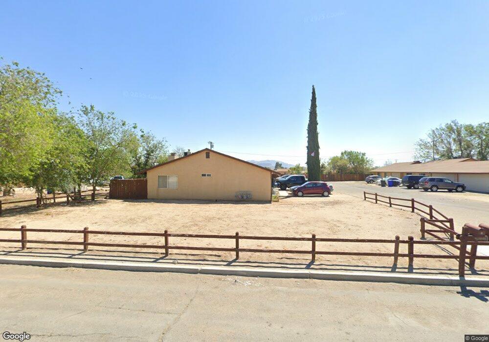
12813 Kiowa Rd Apple Valley, CA 92308
High Desert NeighborhoodEstimated Value: $471,000 - $624,000
2
Beds
3
Baths
3,138
Sq Ft
$173/Sq Ft
Est. Value
About This Home
This home is located at 12813 Kiowa Rd, Apple Valley, CA 92308 and is currently estimated at $541,667, approximately $172 per square foot. 12813 Kiowa Rd is a home located in San Bernardino County with nearby schools including Yucca Loma Elementary School and Apple Valley High School.
Ownership History
Date
Name
Owned For
Owner Type
Purchase Details
Closed on
Jun 8, 2001
Sold by
Washington Mutual Bank Fa
Bought by
Gonzalez Noe Godinez and Godinez Maria Teresa Aguila
Current Estimated Value
Home Financials for this Owner
Home Financials are based on the most recent Mortgage that was taken out on this home.
Original Mortgage
$109,800
Outstanding Balance
$42,191
Interest Rate
7.26%
Estimated Equity
$499,476
Purchase Details
Closed on
Feb 22, 2001
Sold by
Covarrubias Esther
Bought by
Washington Mutual Bank Fa
Create a Home Valuation Report for This Property
The Home Valuation Report is an in-depth analysis detailing your home's value as well as a comparison with similar homes in the area
Home Values in the Area
Average Home Value in this Area
Purchase History
| Date | Buyer | Sale Price | Title Company |
|---|---|---|---|
| Gonzalez Noe Godinez | $122,000 | Fidelity National Title | |
| Washington Mutual Bank Fa | $125,000 | Stewart Title |
Source: Public Records
Mortgage History
| Date | Status | Borrower | Loan Amount |
|---|---|---|---|
| Open | Gonzalez Noe Godinez | $109,800 |
Source: Public Records
Tax History Compared to Growth
Tax History
| Year | Tax Paid | Tax Assessment Tax Assessment Total Assessment is a certain percentage of the fair market value that is determined by local assessors to be the total taxable value of land and additions on the property. | Land | Improvement |
|---|---|---|---|---|
| 2025 | $2,381 | $180,229 | $14,774 | $165,455 |
| 2024 | $2,381 | $176,695 | $14,484 | $162,211 |
| 2023 | $2,356 | $173,230 | $14,200 | $159,030 |
| 2022 | $2,319 | $169,834 | $13,922 | $155,912 |
| 2021 | $2,267 | $166,504 | $13,649 | $152,855 |
| 2020 | $2,238 | $164,797 | $13,509 | $151,288 |
| 2019 | $2,196 | $161,566 | $13,244 | $148,322 |
| 2018 | $2,144 | $158,398 | $12,984 | $145,414 |
| 2017 | $2,113 | $155,292 | $12,729 | $142,563 |
| 2016 | $1,903 | $152,247 | $12,479 | $139,768 |
| 2015 | $1,875 | $149,961 | $12,292 | $137,669 |
| 2014 | $1,849 | $147,023 | $12,051 | $134,972 |
Source: Public Records
Map
Nearby Homes
- 12770 Lakota Rd
- 21018 Little Beaver Rd
- 0 Matawan Rd
- 12715 Tesuque Rd
- 0 Rancho Rd Unit HD25234535
- 12625 Tamiani Rd
- 20726 Nisqually Rd
- 12835 Iroquois Rd
- 20715 Teton Rd
- 20750 Teton Rd
- 12765 Pocomoke Rd
- 12520 Tamiani Rd
- 13130 Kiowa Rd
- 21258 Nisqually Rd
- 21178 Rhone Place
- 21224 Vidal Ct
- 21255 Minnetonka Rd
- 13100 Skiomah Rd
- 12566 Iroquois Rd
- 21152 Reliance Dr
- 12795 Kiowa Rd
- 12828 Kiowa Rd
- 12845 Kiowa Rd
- 12783 Kiowa Rd
- 12814 Red Wing Rd
- 12796 Red Wing Rd
- 12830 Red Wing Rd
- 12814 Kiowa Rd
- 12780 Red Wing Rd Unit A
- 12780 Red Wing Rd Unit B
- 12780 Red Wing Rd
- 12798 Kiowa Rd
- 12840 Red Wing Rd
- 12769 Kiowa Rd Unit 3
- 12769 Kiowa Rd Unit 2
- 12769 Kiowa Rd Unit 1
- 12769 Kiowa Rd
- 20921 Sitting Bull Rd
- 12832 Kiowa Rd
- 12786 Kiowa Rd