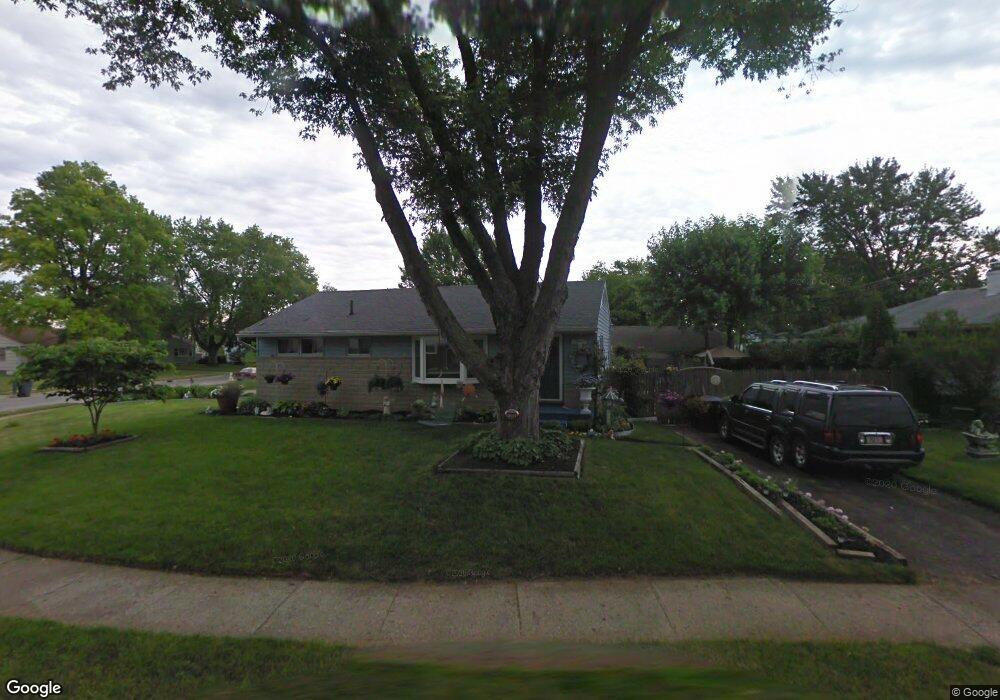
1282 S Weyant Ave Columbus, OH 43227
Linwood NeighborhoodEstimated Value: $158,025 - $248,000
3
Beds
1
Bath
960
Sq Ft
$203/Sq Ft
Est. Value
About This Home
This home is located at 1282 S Weyant Ave, Columbus, OH 43227 and is currently estimated at $195,256, approximately $203 per square foot. 1282 S Weyant Ave is a home located in Franklin County with nearby schools including Scottwood Elementary School, Johnson Park Middle School, and Walnut Ridge High School.
Ownership History
Date
Name
Owned For
Owner Type
Purchase Details
Closed on
Mar 3, 2025
Sold by
Mathews Trust and Mathews John
Bought by
Jal Llc
Current Estimated Value
Home Financials for this Owner
Home Financials are based on the most recent Mortgage that was taken out on this home.
Original Mortgage
$115,500
Outstanding Balance
$114,896
Interest Rate
6.76%
Mortgage Type
New Conventional
Estimated Equity
$80,360
Purchase Details
Closed on
Oct 23, 2023
Sold by
Mathews John
Bought by
Mathews Trust and Mathews
Purchase Details
Closed on
Oct 18, 2023
Sold by
Mathews John
Bought by
Mathews Trust and Mathews
Purchase Details
Closed on
Aug 30, 2022
Sold by
Bissel Christopher M and Bissel Marie Tina
Bought by
Mathews John
Purchase Details
Closed on
Apr 5, 1974
Bought by
Bissel Craig W
Create a Home Valuation Report for This Property
The Home Valuation Report is an in-depth analysis detailing your home's value as well as a comparison with similar homes in the area
Home Values in the Area
Average Home Value in this Area
Purchase History
| Date | Buyer | Sale Price | Title Company |
|---|---|---|---|
| Jal Llc | -- | Valmer Land Title | |
| Mathews Trust | -- | None Listed On Document | |
| Mathews Trust | -- | None Listed On Document | |
| Mathews John | $10,000 | Leaders Title Agency | |
| Bissel Craig W | -- | -- |
Source: Public Records
Mortgage History
| Date | Status | Borrower | Loan Amount |
|---|---|---|---|
| Open | Jal Llc | $115,500 |
Source: Public Records
Tax History Compared to Growth
Tax History
| Year | Tax Paid | Tax Assessment Tax Assessment Total Assessment is a certain percentage of the fair market value that is determined by local assessors to be the total taxable value of land and additions on the property. | Land | Improvement |
|---|---|---|---|---|
| 2024 | $3,865 | $50,690 | $13,970 | $36,720 |
| 2023 | $2,441 | $50,690 | $13,970 | $36,720 |
| 2022 | $1,266 | $24,400 | $8,020 | $16,380 |
| 2021 | $1,268 | $24,400 | $8,020 | $16,380 |
| 2020 | $1,269 | $24,400 | $8,020 | $16,380 |
| 2019 | $1,213 | $19,990 | $6,690 | $13,300 |
| 2018 | $605 | $19,990 | $6,690 | $13,300 |
| 2017 | $1,212 | $19,990 | $6,690 | $13,300 |
| 2016 | $1,343 | $20,270 | $5,500 | $14,770 |
| 2015 | $609 | $20,270 | $5,500 | $14,770 |
| 2014 | $1,222 | $20,270 | $5,500 | $14,770 |
| 2013 | $669 | $22,505 | $6,090 | $16,415 |
Source: Public Records
Map
Nearby Homes
- 1304 Byron Ave
- 1466 Aven Dr
- 3084 Clermont Rd
- 3325 Towers Ct S
- 1054 S Hampton Rd
- 3339 Towers Ct N
- 1624 Miltwood Rd
- 1077-1079 S James Rd
- 1048 S James Rd
- 3566 Seabrook Ave
- 3246 E Deshler Ave
- 1664 Barnett Rd
- 2963 Brownlee Ave
- 3563 Astor Ave
- 2903 Scottwood Rd
- 3325 E Deshler Ave
- 1637 S James Rd
- 3598 Astor Ave
- 891 S Weyant Ave Unit 893
- 2894 Landon Dr
- 1278 S Weyant Ave
- 1294 S Weyant Ave
- 1279 Byron Ave
- 1302 S Weyant Ave
- 1285 S Weyant Ave
- 1279 S Weyant Ave
- 1301 Byron Ave
- 1289 Byron Ave
- 1291 S Weyant Ave
- 1275 S Weyant Ave
- 1267 S Weyant Ave
- 1269 S Weyant Ave
- 1308 S Weyant Ave
- 1307 Byron Ave
- 1270 Byron Ave
- 1297 S Weyant Ave
- 1274 Byron Ave
- 1315 Byron Ave
- 1305 S Weyant Ave
- 1278 Zettler Rd