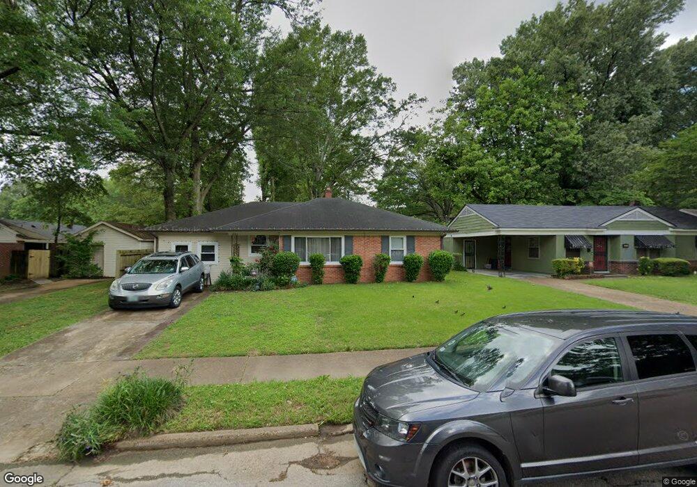
1283 Briarwood Rd Memphis, TN 38111
Audubon Park NeighborhoodEstimated Value: $112,855 - $133,000
3
Beds
1
Bath
1,377
Sq Ft
$86/Sq Ft
Est. Value
About This Home
This home is located at 1283 Briarwood Rd, Memphis, TN 38111 and is currently estimated at $117,964, approximately $85 per square foot. 1283 Briarwood Rd is a home located in Shelby County with nearby schools including South Park Elementary School, Colonial Middle, and Overton High.
Ownership History
Date
Name
Owned For
Owner Type
Purchase Details
Closed on
Mar 31, 2005
Sold by
Jaskco Properties Llc
Bought by
Sims Anthony and Sims Joyce
Current Estimated Value
Home Financials for this Owner
Home Financials are based on the most recent Mortgage that was taken out on this home.
Original Mortgage
$66,400
Outstanding Balance
$34,287
Interest Rate
5.79%
Mortgage Type
Fannie Mae Freddie Mac
Estimated Equity
$83,677
Purchase Details
Closed on
Aug 16, 2004
Sold by
Keller James B
Bought by
Jaskco Properties Llc
Purchase Details
Closed on
Jan 30, 2003
Sold by
Westbrooks Jay S and Westbrooks Essie
Bought by
Hud
Create a Home Valuation Report for This Property
The Home Valuation Report is an in-depth analysis detailing your home's value as well as a comparison with similar homes in the area
Home Values in the Area
Average Home Value in this Area
Purchase History
| Date | Buyer | Sale Price | Title Company |
|---|---|---|---|
| Sims Anthony | $77,950 | -- | |
| Jaskco Properties Llc | -- | -- | |
| Hud | $56,100 | -- |
Source: Public Records
Mortgage History
| Date | Status | Borrower | Loan Amount |
|---|---|---|---|
| Open | Sims Anthony | $66,400 | |
| Closed | Sims Anthony | $16,600 |
Source: Public Records
Tax History Compared to Growth
Tax History
| Year | Tax Paid | Tax Assessment Tax Assessment Total Assessment is a certain percentage of the fair market value that is determined by local assessors to be the total taxable value of land and additions on the property. | Land | Improvement |
|---|---|---|---|---|
| 2025 | $571 | $26,975 | $5,000 | $21,975 |
| 2024 | $571 | $16,850 | $2,825 | $14,025 |
| 2023 | $1,026 | $16,850 | $2,825 | $14,025 |
| 2022 | $1,026 | $16,850 | $2,825 | $14,025 |
| 2021 | $1,038 | $16,850 | $2,825 | $14,025 |
| 2020 | $980 | $13,525 | $2,600 | $10,925 |
| 2019 | $980 | $13,525 | $2,600 | $10,925 |
| 2018 | $980 | $13,525 | $2,600 | $10,925 |
| 2017 | $556 | $13,525 | $2,600 | $10,925 |
| 2016 | $642 | $14,700 | $0 | $0 |
| 2014 | $642 | $14,700 | $0 | $0 |
Source: Public Records
Map
Nearby Homes
- 1265 Wedgewood St
- 4227 Carolyn Dr
- 1293 Carolyn Dr
- 1321 Merrycrest Dr
- 1422 Titus Rd
- 4173 Philsdale Ave
- 3969 Southlawn Ave
- 1218 Merrycrest Dr
- 1231 Cherrydale Cove
- 4222 Vann Ave
- 1260 Cherrydale Cove
- 3909 Fizer Ave
- 4288 Kimball Ave
- 4305 Haverhill Rd
- 1305 Cherry Rd
- 4161 Dunn Rd
- 1467 Wanda St
- 1107 McEvers Rd
- 3845 Kimball Ave
- 949 Hiawatha St
- 1271 Briarwood Rd
- 1289 Briarwood Rd
- 4132 Barron Ave
- 4124 Wildwood Dr
- 1267 Briarwood Dr
- 1267 Briarwood Rd
- 4120 Wildwood Dr
- 4126 Wildwood Dr
- 1276 Briarwood Rd
- 1286 Briarwood Rd
- 1268 Briarwood Rd
- 1257 Briarwood Rd
- 4116 Wildwood Dr
- 4158 Barron Ave
- 1264 Briarwood Rd
- 4143 Barron Ave
- 1251 Briarwood Rd
- 4135 Barron Ave
- 1260 Briarwood Rd
- 4121 Wildwood Dr