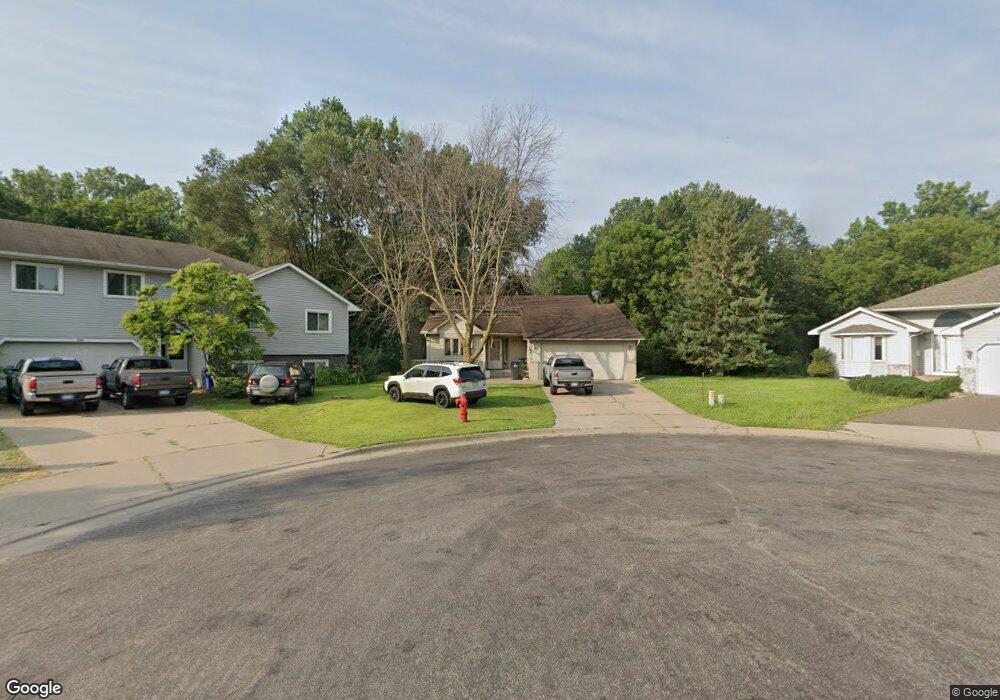
1283 Mcafee St Saint Paul, MN 55106
Estimated Value: $298,000 - $324,000
3
Beds
2
Baths
1,149
Sq Ft
$268/Sq Ft
Est. Value
About This Home
This home is located at 1283 Mcafee St, Saint Paul, MN 55106 and is currently estimated at $307,373, approximately $267 per square foot. 1283 Mcafee St is a home located in Ramsey County with nearby schools including Frost Lake Elementary School, Txuj Ci HMong Language and Culture Upper Campus, and Johnson Senior High School.
Ownership History
Date
Name
Owned For
Owner Type
Purchase Details
Closed on
Feb 20, 2020
Sold by
Birk Matthew and Birk Adrianna
Bought by
Vang Ma and Vang Charlie
Current Estimated Value
Home Financials for this Owner
Home Financials are based on the most recent Mortgage that was taken out on this home.
Original Mortgage
$222,300
Outstanding Balance
$196,831
Interest Rate
3.6%
Mortgage Type
New Conventional
Estimated Equity
$110,542
Create a Home Valuation Report for This Property
The Home Valuation Report is an in-depth analysis detailing your home's value as well as a comparison with similar homes in the area
Home Values in the Area
Average Home Value in this Area
Purchase History
| Date | Buyer | Sale Price | Title Company |
|---|---|---|---|
| Vang Ma | $234,000 | Titlesmart Inc |
Source: Public Records
Mortgage History
| Date | Status | Borrower | Loan Amount |
|---|---|---|---|
| Open | Vang Ma | $222,300 |
Source: Public Records
Tax History Compared to Growth
Tax History
| Year | Tax Paid | Tax Assessment Tax Assessment Total Assessment is a certain percentage of the fair market value that is determined by local assessors to be the total taxable value of land and additions on the property. | Land | Improvement |
|---|---|---|---|---|
| 2025 | $4,094 | $296,800 | $30,000 | $266,800 |
| 2023 | $4,094 | $272,200 | $25,000 | $247,200 |
| 2022 | $3,830 | $302,800 | $25,000 | $277,800 |
| 2021 | $3,328 | $247,300 | $25,000 | $222,300 |
| 2020 | $3,442 | $225,100 | $18,400 | $206,700 |
| 2019 | $3,456 | $202,100 | $18,400 | $183,700 |
| 2018 | $3,240 | $188,900 | $18,400 | $170,500 |
| 2017 | $2,740 | $185,200 | $18,400 | $166,800 |
| 2016 | $2,922 | $0 | $0 | $0 |
| 2015 | $1,601 | $156,200 | $18,400 | $137,800 |
| 2014 | $2,420 | $0 | $0 | $0 |
Source: Public Records
Map
Nearby Homes
- 1229 Clarence St
- 1221 Clarence St
- 1343 Maryland Ave E
- 1377 Clarence St
- 1357 Birmingham St
- 1635 Maryland Ave E
- 1186 Duluth St
- 1114 Lane Place
- 1450 Arlington Ave E
- 866 Clear Ave E
- 1562 Ivy Ave E
- 1567 Atlantic St
- 1162 Lawson Ave E
- 1181 Herbert St
- 1583 Nevada Ave E
- 992 Orange Ave E
- 1664 Orange Ave E
- 1144 Jenks Ave
- 968 Hyacinth Ave E
- 1639 Clarence St
- 1283 1283 McAfee-street-
- 1288 Mcafee St
- 1289 Mcafee St
- 1292 Mcafee St
- 1293 1293 McAfee-street-
- 1293 Mcafee St
- 1299 Mcafee St
- 1315 Topic Ln
- 1315 1315 Topic-Lane-
- 1309 Topic Ln
- 1301 Topic Ln
- 1303 Mcafee St
- 1291 Topic Ln
- 1311 Mcafee St
- 1279 Clarence St
- 1273 Clarence St
- 1273 1273 Clarence-Street-
- 1302 Topic Ln
- 1297 Clarence St
- 1310 Topic Ln