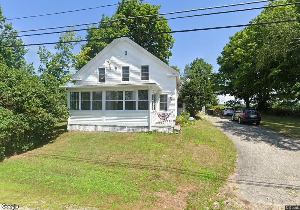
1283 Parker Mountain Rd Strafford, NH 03884
Estimated Value: $417,773 - $506,000
3
Beds
2
Baths
1,742
Sq Ft
$268/Sq Ft
Est. Value
About This Home
This home is located at 1283 Parker Mountain Rd, Strafford, NH 03884 and is currently estimated at $466,693, approximately $267 per square foot. 1283 Parker Mountain Rd is a home located in Strafford County with nearby schools including Strafford School and Coe-Brown Northwood Academy.
Ownership History
Date
Name
Owned For
Owner Type
Purchase Details
Closed on
Aug 15, 2011
Sold by
Calvin W Stiles Ret
Bought by
Evans Rennie L and Coker Donald
Current Estimated Value
Home Financials for this Owner
Home Financials are based on the most recent Mortgage that was taken out on this home.
Original Mortgage
$120,000
Outstanding Balance
$82,854
Interest Rate
4.51%
Mortgage Type
Purchase Money Mortgage
Estimated Equity
$383,839
Create a Home Valuation Report for This Property
The Home Valuation Report is an in-depth analysis detailing your home's value as well as a comparison with similar homes in the area
Home Values in the Area
Average Home Value in this Area
Purchase History
| Date | Buyer | Sale Price | Title Company |
|---|---|---|---|
| Evans Rennie L | $150,000 | -- |
Source: Public Records
Mortgage History
| Date | Status | Borrower | Loan Amount |
|---|---|---|---|
| Open | Evans Rennie L | $120,000 | |
| Closed | Evans Rennie L | $120,000 |
Source: Public Records
Tax History Compared to Growth
Tax History
| Year | Tax Paid | Tax Assessment Tax Assessment Total Assessment is a certain percentage of the fair market value that is determined by local assessors to be the total taxable value of land and additions on the property. | Land | Improvement |
|---|---|---|---|---|
| 2024 | $4,997 | $252,900 | $63,200 | $189,700 |
| 2023 | $4,714 | $252,900 | $63,200 | $189,700 |
| 2022 | $4,332 | $252,900 | $63,200 | $189,700 |
| 2021 | $4,585 | $248,400 | $63,200 | $185,200 |
| 2020 | $4,848 | $189,000 | $54,700 | $134,300 |
| 2019 | $5,366 | $183,700 | $54,700 | $129,000 |
| 2018 | $5,172 | $185,500 | $54,700 | $130,800 |
| 2016 | $3,942 | $185,500 | $54,700 | $130,800 |
| 2015 | $4,015 | $184,100 | $71,900 | $112,200 |
| 2014 | $4,264 | $184,100 | $71,900 | $112,200 |
| 2013 | $4,175 | $184,100 | $71,900 | $112,200 |
| 2012 | $4,151 | $185,500 | $71,900 | $113,600 |
Source: Public Records
Map
Nearby Homes
- 0 Strafford Rd Unit 5057984
- 83 Sloper Rd
- 0 Sloper Rd Unit 6
- 72 Beaver Rd
- 397 Strafford Rd
- 28-1 Range Rd
- 268 Province Rd
- 263 Province Rd
- 825 Second Crown Point Rd
- 11 Drake Hill Rd
- 67 Spruce Pond Dr
- Map 101 Lot 65 Cider Hill
- 14 Lorraines Ln
- 86 Long Shores Dr
- 0 Long Shores Dr Unit 5057687
- 243 Second Crown Point Rd
- 129 Water St
- 34 Misty Ln
- 948 Strafford Rd
- 133 & 137 Browns Pasture Rd
- 1273 Parker Mountain Rd
- 1271 Parker Mountain Rd
- 1270 Parker Mountain Rd
- 1268 Parker Mountain Rd
- 1302 Parker Mountain Rd
- 1309 Parker Mountain Rd
- 1255 Parker Mountain Rd
- 1251 Parker Mountain Rd
- 1324 Parker Mountain Rd
- 1248 Parker Mountain Rd
- 1239 Parker Mountain Rd
- 1246 Parker Mountain Rd
- 1336 Parker Mountain Rd
- 104 Strafford Rd
- 20 Kooakee
- 30 Strafford Rd Unit 16/30-1
- 30 Strafford Rd
- 0 Strafford Rd Unit 30-3 4731181
- 0 Strafford Rd Unit 4801648
- 1344 Parker Mountain Rd