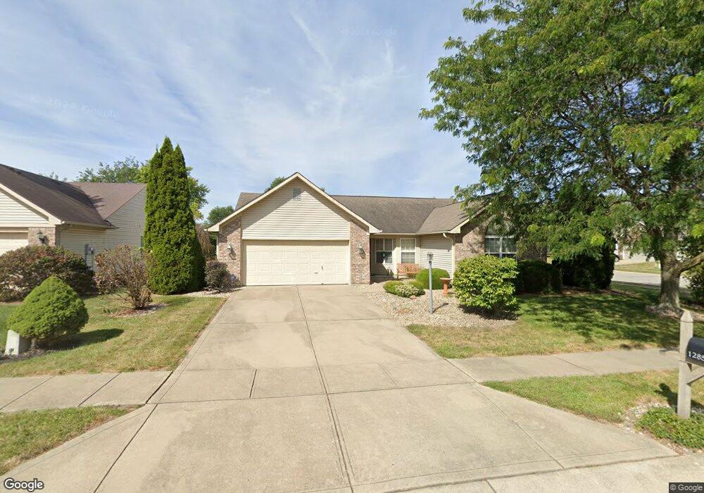
12850 Ramsgate Ct Fishers, IN 46038
Estimated Value: $331,000 - $342,672
3
Beds
2
Baths
1,750
Sq Ft
$193/Sq Ft
Est. Value
About This Home
This home is located at 12850 Ramsgate Ct, Fishers, IN 46038 and is currently estimated at $337,918, approximately $193 per square foot. 12850 Ramsgate Ct is a home located in Hamilton County with nearby schools including Cumberland Road Elementary School, Fishers Junior High School, and Sand Creek Intermediate School.
Ownership History
Date
Name
Owned For
Owner Type
Purchase Details
Closed on
Nov 14, 2006
Sold by
Myers Chad
Bought by
Toole Linda S
Current Estimated Value
Purchase Details
Closed on
Jun 25, 2003
Sold by
Bone John B
Bought by
Myers Chad
Home Financials for this Owner
Home Financials are based on the most recent Mortgage that was taken out on this home.
Original Mortgage
$133,899
Interest Rate
5.4%
Mortgage Type
FHA
Create a Home Valuation Report for This Property
The Home Valuation Report is an in-depth analysis detailing your home's value as well as a comparison with similar homes in the area
Home Values in the Area
Average Home Value in this Area
Purchase History
| Date | Buyer | Sale Price | Title Company |
|---|---|---|---|
| Toole Linda S | -- | None Available | |
| Myers Chad | -- | -- |
Source: Public Records
Mortgage History
| Date | Status | Borrower | Loan Amount |
|---|---|---|---|
| Previous Owner | Myers Chad | $133,899 |
Source: Public Records
Tax History
| Year | Tax Paid | Tax Assessment Tax Assessment Total Assessment is a certain percentage of the fair market value that is determined by local assessors to be the total taxable value of land and additions on the property. | Land | Improvement |
|---|---|---|---|---|
| 2024 | $3,009 | $286,800 | $39,000 | $247,800 |
| 2023 | $3,009 | $279,400 | $39,000 | $240,400 |
| 2022 | $3,029 | $256,800 | $39,000 | $217,800 |
| 2021 | $2,462 | $211,200 | $39,000 | $172,200 |
| 2020 | $2,148 | $189,100 | $39,000 | $150,100 |
| 2019 | $2,055 | $182,200 | $35,400 | $146,800 |
| 2018 | $1,943 | $174,700 | $35,400 | $139,300 |
| 2017 | $1,715 | $160,800 | $35,400 | $125,400 |
| 2016 | $1,621 | $155,100 | $35,400 | $119,700 |
| 2014 | $1,309 | $139,400 | $37,900 | $101,500 |
| 2013 | $1,309 | $138,400 | $37,900 | $100,500 |
Source: Public Records
Map
Nearby Homes
- 12791 Longleaf Ln
- 12991 Wingstem Ct
- 12791 Brewton St
- 11798 & 11842 E 131st St
- 13069 Sinclair Place
- 13022 Saint Andrews Way
- 12903 Turnham Dr
- 10150 Beresford Ct
- 12966 Pleasant View Ln
- 10175 Pamona Ct
- 12364 Blue Sky Dr
- 10480 Creektree Ln
- 13270 Summerwood Ln
- 12638 Granite Ridge Cir
- 12783 Granite Ridge Cir
- 12662 Granite Ridge Cir
- 12807 Granite Ridge Cir
- 12650 Granite Ridge Cir
- 12687 Granite Ridge Cir
- 9080 Teaneck Dr
- 12842 Ramsgate Ct
- 12847 Patrick Ct
- 12834 Ramsgate Ct
- 12839 Patrick Ct
- 9912 Herald Square
- 9902 Herald Square
- 9922 Herald Square
- 12849 Ramsgate Ct
- 12909 Whitehaven Ln
- 12831 Patrick Ct
- 12841 Ramsgate Ct
- 9932 Herald Square
- 12833 Ramsgate Ct
- 12825 Patrick Ct
- 12825 Patrick Ct Unit 2
- 12915 Whitehaven Ln
- 12827 Ramsgate Ct
- 12824 Ramsgate Ct
- 9942 Herald Square
- 12821 Patrick Ct
Your Personal Tour Guide
Ask me questions while you tour the home.