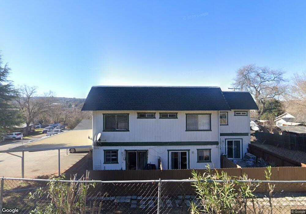
129 Almond St Paso Robles, CA 93446
Estimated Value: $486,094 - $1,179,000
6
Beds
6
Baths
3,136
Sq Ft
$283/Sq Ft
Est. Value
About This Home
This home is located at 129 Almond St, Paso Robles, CA 93446 and is currently estimated at $886,274, approximately $282 per square foot. 129 Almond St is a home located in San Luis Obispo County with nearby schools including Winifred Pifer Elementary School, Daniel Lewis Middle School, and Paso Robles High School.
Ownership History
Date
Name
Owned For
Owner Type
Purchase Details
Closed on
Jun 24, 1999
Sold by
Osborne John S
Bought by
Pruneda Marie Ilda
Current Estimated Value
Home Financials for this Owner
Home Financials are based on the most recent Mortgage that was taken out on this home.
Original Mortgage
$65,000
Interest Rate
7.86%
Mortgage Type
Seller Take Back
Create a Home Valuation Report for This Property
The Home Valuation Report is an in-depth analysis detailing your home's value as well as a comparison with similar homes in the area
Home Values in the Area
Average Home Value in this Area
Purchase History
| Date | Buyer | Sale Price | Title Company |
|---|---|---|---|
| Pruneda Marie Ilda | $115,000 | Chicago Title Co |
Source: Public Records
Mortgage History
| Date | Status | Borrower | Loan Amount |
|---|---|---|---|
| Previous Owner | Pruneda Marie Ilda | $65,000 |
Source: Public Records
Tax History Compared to Growth
Tax History
| Year | Tax Paid | Tax Assessment Tax Assessment Total Assessment is a certain percentage of the fair market value that is determined by local assessors to be the total taxable value of land and additions on the property. | Land | Improvement |
|---|---|---|---|---|
| 2025 | $2,112 | $193,807 | $61,465 | $132,342 |
| 2024 | $2,078 | $190,008 | $60,260 | $129,748 |
| 2023 | $2,078 | $186,283 | $59,079 | $127,204 |
| 2022 | $2,047 | $182,631 | $57,921 | $124,710 |
| 2021 | $2,012 | $179,051 | $56,786 | $122,265 |
| 2020 | $1,985 | $177,216 | $56,204 | $121,012 |
| 2019 | $1,957 | $173,742 | $55,102 | $118,640 |
| 2018 | $1,930 | $170,336 | $54,022 | $116,314 |
| 2017 | $1,815 | $166,997 | $52,963 | $114,034 |
| 2016 | $1,779 | $163,724 | $51,925 | $111,799 |
| 2015 | $1,773 | $161,266 | $51,146 | $110,120 |
| 2014 | $1,711 | $158,108 | $50,145 | $107,963 |
Source: Public Records
Map
Nearby Homes
- 105 Capitol Hill Dr
- 107 Capitol Hill Dr
- 420 Creston Rd
- 613 Navajo Ave
- 112 El Dorado Ct
- 1551 Las Brisas Dr
- 1446 Park St
- 539 Chumash Ct
- 629 Trigo Ln
- 0 Riverside Ave Unit PI25181393
- 506 Navajo Ave
- 147 Via Camelia
- 1803 Pine St
- 523 Rose Ln
- 1810 Park St
- 828 Spring St
- 419 Cherokee Ct
- 1608 Via Flora
- 821 Marlbank Place
- 726 N Trigo Ln
- 112 Capitol Hill Dr
- 121 Almond St Unit a-b
- 121 Almond St Unit 1&2
- 121 Almond St
- 115 Almond St
- 138 Creston Rd
- 1387 Creston Rd
- 130 Creston Rd
- 140 Capitol Hill Dr
- 142 Capitol Hill Dr
- 134 Almond St
- 134 Almond St
- 134 Almond St Unit 25
- 134 Almond St Unit 26
- 134 Almond St
- 122 Creston Rd
- 200 Creston Rd
- 116 Creston Rd
- 122 Almond St