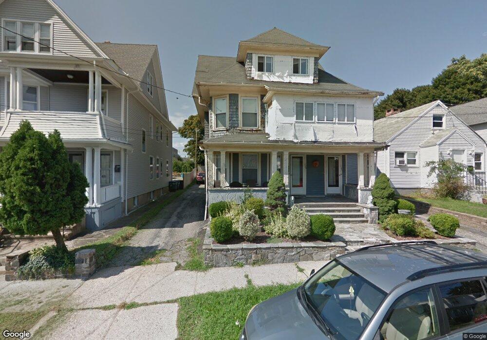
129 Anson St Bridgeport, CT 06606
Brooklawn-Saint Vincent NeighborhoodEstimated Value: $451,054 - $696,000
5
Beds
2
Baths
3,001
Sq Ft
$190/Sq Ft
Est. Value
About This Home
This home is located at 129 Anson St, Bridgeport, CT 06606 and is currently estimated at $569,764, approximately $189 per square foot. 129 Anson St is a home located in Fairfield County with nearby schools including Read School, Central High School, and Catholic Academy of Bridgeport-St. Raphael Academy.
Ownership History
Date
Name
Owned For
Owner Type
Purchase Details
Closed on
Mar 30, 1998
Sold by
Horvath Stephen and Horvath Kathleen
Bought by
Baia John G
Current Estimated Value
Home Financials for this Owner
Home Financials are based on the most recent Mortgage that was taken out on this home.
Original Mortgage
$95,950
Outstanding Balance
$17,991
Interest Rate
6.96%
Mortgage Type
Unknown
Estimated Equity
$551,773
Create a Home Valuation Report for This Property
The Home Valuation Report is an in-depth analysis detailing your home's value as well as a comparison with similar homes in the area
Home Values in the Area
Average Home Value in this Area
Purchase History
| Date | Buyer | Sale Price | Title Company |
|---|---|---|---|
| Baia John G | $101,000 | -- | |
| Baia John G | $101,000 | -- |
Source: Public Records
Mortgage History
| Date | Status | Borrower | Loan Amount |
|---|---|---|---|
| Open | Baia John G | $95,950 | |
| Closed | Baia John G | $95,950 |
Source: Public Records
Tax History
| Year | Tax Paid | Tax Assessment Tax Assessment Total Assessment is a certain percentage of the fair market value that is determined by local assessors to be the total taxable value of land and additions on the property. | Land | Improvement |
|---|---|---|---|---|
| 2025 | $7,872 | $181,180 | $70,300 | $110,880 |
| 2024 | $7,872 | $181,180 | $70,300 | $110,880 |
| 2023 | $7,872 | $181,180 | $70,300 | $110,880 |
| 2022 | $7,872 | $181,180 | $70,300 | $110,880 |
| 2021 | $7,872 | $181,180 | $70,300 | $110,880 |
| 2020 | $7,458 | $138,140 | $47,330 | $90,810 |
| 2019 | $7,458 | $138,140 | $47,330 | $90,810 |
| 2018 | $7,511 | $138,140 | $47,330 | $90,810 |
| 2017 | $7,511 | $138,140 | $47,330 | $90,810 |
| 2016 | $7,511 | $138,140 | $47,330 | $90,810 |
| 2015 | $7,280 | $172,510 | $47,730 | $124,780 |
| 2014 | $7,280 | $172,510 | $47,730 | $124,780 |
Source: Public Records
Map
Nearby Homes
- 248 Salem St
- 51 Marion St Unit 55
- 936 Lindley St
- 92 Lincoln Ave
- 208 Fairview Ave Unit 210
- 329 Ezra St
- 708 Capitol Ave Unit 710
- 74 Harlem Ave
- 457 Summit St
- 25 Westfield Ave
- 123 Harlem Ave
- 926 Hart St
- 916 Hart St
- 254 Wayne St
- 95 Savoy St
- 1265 Lindley St
- 138 Infield St
- 105 Tremont Ave Unit E
- 105 Tremont Ave Unit 2
- 631 Fairview Ave
Your Personal Tour Guide
Ask me questions while you tour the home.