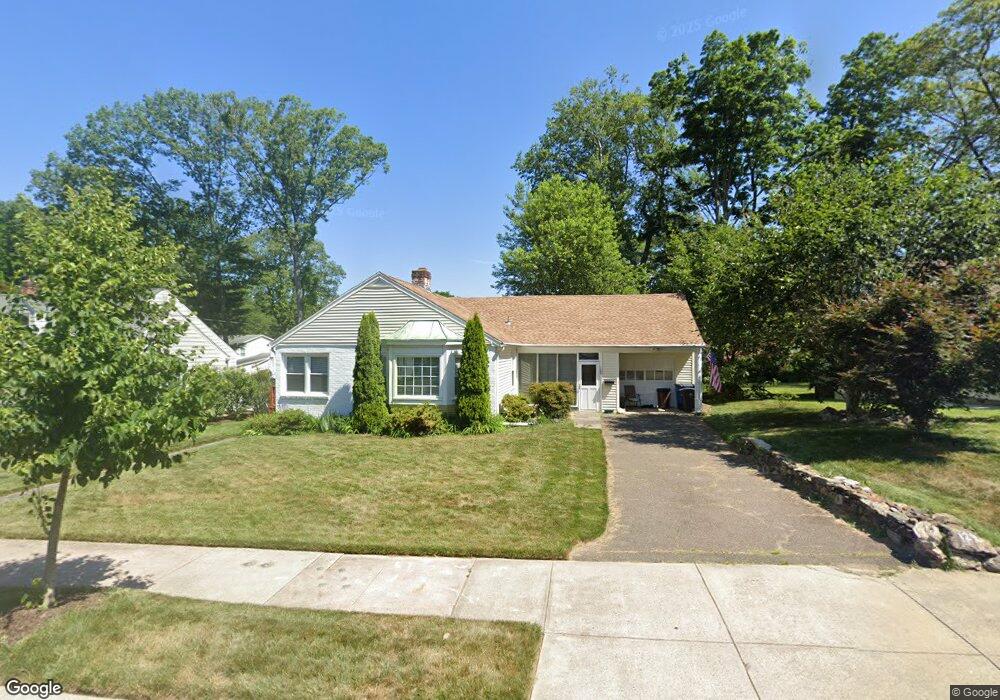
129 Curtis Dr New Haven, CT 06515
Westville NeighborhoodEstimated Value: $342,591 - $379,000
3
Beds
2
Baths
1,184
Sq Ft
$301/Sq Ft
Est. Value
About This Home
This home is located at 129 Curtis Dr, New Haven, CT 06515 and is currently estimated at $356,398, approximately $301 per square foot. 129 Curtis Dr is a home located in New Haven County with nearby schools including Davis Academy for Arts & Design Innovation, Elm City Montessori School, and Hopkins School.
Ownership History
Date
Name
Owned For
Owner Type
Purchase Details
Closed on
Oct 1, 1997
Sold by
Gelernter Joel and Gelernter Cheryl S
Bought by
Lyons Ronald C and Norton Donna L
Current Estimated Value
Home Financials for this Owner
Home Financials are based on the most recent Mortgage that was taken out on this home.
Original Mortgage
$92,000
Interest Rate
7.41%
Mortgage Type
Unknown
Create a Home Valuation Report for This Property
The Home Valuation Report is an in-depth analysis detailing your home's value as well as a comparison with similar homes in the area
Home Values in the Area
Average Home Value in this Area
Purchase History
| Date | Buyer | Sale Price | Title Company |
|---|---|---|---|
| Lyons Ronald C | $93,500 | -- |
Source: Public Records
Mortgage History
| Date | Status | Borrower | Loan Amount |
|---|---|---|---|
| Closed | Lyons Ronald C | $21,000 | |
| Open | Lyons Ronald C | $108,400 | |
| Closed | Lyons Ronald C | $92,000 | |
| Previous Owner | Lyons Ronald C | $40,000 | |
| Closed | Lyons Ronald C | $3,000 |
Source: Public Records
Tax History
| Year | Tax Paid | Tax Assessment Tax Assessment Total Assessment is a certain percentage of the fair market value that is determined by local assessors to be the total taxable value of land and additions on the property. | Land | Improvement |
|---|---|---|---|---|
| 2025 | $6,109 | $155,050 | $53,760 | $101,290 |
| 2024 | $5,969 | $155,050 | $53,760 | $101,290 |
| 2023 | $5,768 | $155,050 | $53,760 | $101,290 |
| 2022 | $6,163 | $155,050 | $53,760 | $101,290 |
| 2021 | $4,988 | $113,680 | $31,850 | $81,830 |
| 2020 | $4,911 | $111,930 | $31,850 | $80,080 |
| 2019 | $4,811 | $111,930 | $31,850 | $80,080 |
| 2018 | $4,811 | $111,930 | $31,850 | $80,080 |
| 2017 | $4,329 | $111,930 | $31,850 | $80,080 |
| 2016 | $4,779 | $115,010 | $41,370 | $73,640 |
| 2015 | $4,779 | $115,010 | $41,370 | $73,640 |
| 2014 | $4,779 | $115,010 | $41,370 | $73,640 |
Source: Public Records
Map
Nearby Homes
- 70 Judwin Ave
- 224 Ray Rd
- 125 Lowin Ave
- 51 Fountain Terrace
- 1 Long Hill Terrace
- 159 Lawncrest Rd
- 107 Glen View Terrace
- 21 Richmond Ave
- 362 Oliver Rd
- 827 Fountain St
- 2095 Chapel St
- 252 Alden Ave
- 27 Valley Place N
- 143 Fountain St Unit A11
- 56 Roger Rd
- 55 Marvel Rd
- 420 Central Ave
- 119 Westwood Rd
- 141 Valley St
- 53 Victory Dr
Your Personal Tour Guide
Ask me questions while you tour the home.