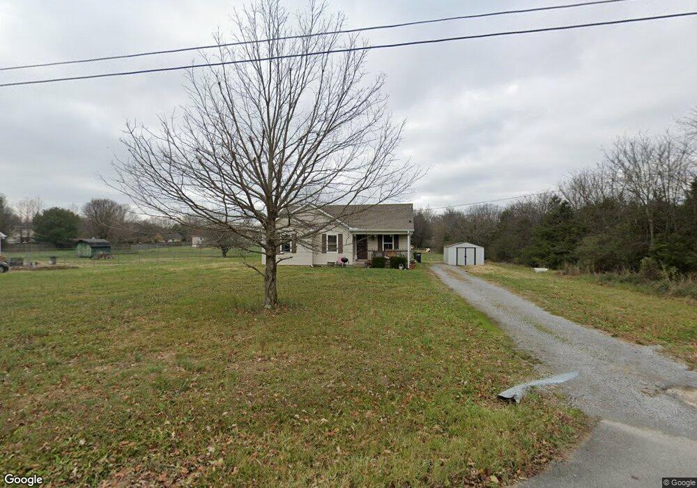
129 Dominic Cir Murfreesboro, TN 37130
Estimated Value: $254,061 - $340,000
--
Bed
2
Baths
1,157
Sq Ft
$264/Sq Ft
Est. Value
About This Home
This home is located at 129 Dominic Cir, Murfreesboro, TN 37130 and is currently estimated at $305,515, approximately $264 per square foot. 129 Dominic Cir is a home located in Rutherford County with nearby schools including Walter Hill Elementary School, Oakland Middle School, and Oakland High School.
Ownership History
Date
Name
Owned For
Owner Type
Purchase Details
Closed on
Feb 26, 2010
Sold by
Abernathy Scott
Bought by
Fuller Melissa M
Current Estimated Value
Home Financials for this Owner
Home Financials are based on the most recent Mortgage that was taken out on this home.
Original Mortgage
$99,170
Outstanding Balance
$66,352
Interest Rate
5.25%
Mortgage Type
FHA
Estimated Equity
$239,163
Purchase Details
Closed on
Nov 15, 2007
Sold by
Daniel Wilson James and Daniel Jent
Bought by
Scott Abernathy
Purchase Details
Closed on
Apr 29, 2005
Sold by
Mark Mcdaniel
Bought by
Daniel Wilson James
Home Financials for this Owner
Home Financials are based on the most recent Mortgage that was taken out on this home.
Original Mortgage
$78,042
Interest Rate
7.05%
Mortgage Type
Purchase Money Mortgage
Create a Home Valuation Report for This Property
The Home Valuation Report is an in-depth analysis detailing your home's value as well as a comparison with similar homes in the area
Home Values in the Area
Average Home Value in this Area
Purchase History
| Date | Buyer | Sale Price | Title Company |
|---|---|---|---|
| Fuller Melissa M | $101,000 | -- | |
| Scott Abernathy | $84,000 | -- | |
| Daniel Wilson James | $97,553 | -- |
Source: Public Records
Mortgage History
| Date | Status | Borrower | Loan Amount |
|---|---|---|---|
| Open | Daniel Wilson James | $99,170 | |
| Previous Owner | Daniel Wilson James | $78,042 |
Source: Public Records
Tax History Compared to Growth
Tax History
| Year | Tax Paid | Tax Assessment Tax Assessment Total Assessment is a certain percentage of the fair market value that is determined by local assessors to be the total taxable value of land and additions on the property. | Land | Improvement |
|---|---|---|---|---|
| 2025 | $1,046 | $55,725 | $13,750 | $41,975 |
| 2024 | $1,046 | $55,725 | $13,750 | $41,975 |
| 2023 | $1,046 | $55,725 | $13,750 | $41,975 |
| 2022 | $878 | $54,300 | $13,750 | $40,550 |
| 2021 | $802 | $36,125 | $8,750 | $27,375 |
| 2020 | $802 | $36,125 | $8,750 | $27,375 |
| 2019 | $802 | $36,125 | $8,750 | $27,375 |
| 2018 | $758 | $36,125 | $0 | $0 |
| 2017 | $718 | $26,775 | $0 | $0 |
| 2016 | $718 | $26,775 | $0 | $0 |
| 2015 | $718 | $26,775 | $0 | $0 |
| 2014 | $666 | $26,775 | $0 | $0 |
| 2013 | -- | $26,350 | $0 | $0 |
Source: Public Records
Map
Nearby Homes
- 102 Marcus Cir
- 336 Royal Garden Dr
- 365 Royal Garden Dr
- 6439 Wade Springs Rd
- 7431 Antietam Ln
- 6834 Riverwalk Blvd
- 120 Greenwing Ct
- 6464 Lebanon Rd
- 3023 Barretts Ridge Dr
- 0 Holly Grove Rd Unit RTC2292369
- 3014 Barretts Ridge Dr
- 3151 Barretts Ridge Dr
- 308 Amazonway Ridge
- 802 Ronald Dr
- 4501 Lebanon Rd
- 5142 Reagan Dr
- 4315 Pennant Ct
- 8988 Big Oak Dr
- 5209 Ticonderoga Ave
- 1 Holly Grove Rd