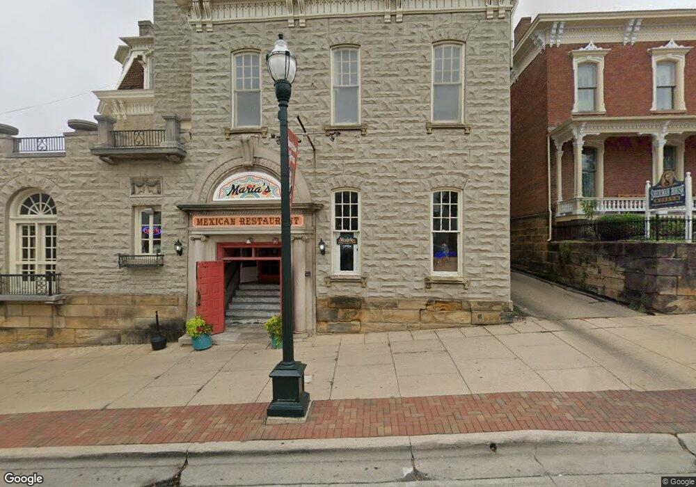
129 E Main St Lancaster, OH 43130
Estimated Value: $366,483
Studio
--
Bath
18,088
Sq Ft
$20/Sq Ft
Est. Value
About This Home
This home is located at 129 E Main St, Lancaster, OH 43130 and is currently estimated at $366,483, approximately $20 per square foot. 129 E Main St is a home located in Fairfield County with nearby schools including Thomas Ewing Junior High School, Lancaster High School, and St Mary Elementary School.
Ownership History
Date
Name
Owned For
Owner Type
Purchase Details
Closed on
Nov 3, 2016
Sold by
Urban Loft Properties Llc
Bought by
Chicos Enterprise Of Ohio Llcl
Current Estimated Value
Purchase Details
Closed on
Apr 26, 2016
Sold by
The Lodge Lancaster Llc
Bought by
Cme Fcu
Purchase Details
Closed on
Dec 20, 2010
Sold by
Lancaster Lodge #570 Benevolent & Protec
Bought by
The Lodge In Lancaster Llc
Home Financials for this Owner
Home Financials are based on the most recent Mortgage that was taken out on this home.
Original Mortgage
$76,000
Interest Rate
4.16%
Mortgage Type
Future Advance Clause Open End Mortgage
Create a Home Valuation Report for This Property
The Home Valuation Report is an in-depth analysis detailing your home's value as well as a comparison with similar homes in the area
Home Values in the Area
Average Home Value in this Area
Purchase History
| Date | Buyer | Sale Price | Title Company |
|---|---|---|---|
| Chicos Enterprise Of Ohio Llcl | $175,000 | Amerititle | |
| Cme Fcu | $200,000 | None Available | |
| The Lodge In Lancaster Llc | $95,000 | Attorney |
Source: Public Records
Mortgage History
| Date | Status | Borrower | Loan Amount |
|---|---|---|---|
| Previous Owner | The Lodge In Lancaster Llc | $76,000 |
Source: Public Records
Tax History
| Year | Tax Paid | Tax Assessment Tax Assessment Total Assessment is a certain percentage of the fair market value that is determined by local assessors to be the total taxable value of land and additions on the property. | Land | Improvement |
|---|---|---|---|---|
| 2025 | $12,274 | $266,690 | $62,260 | $204,430 |
| 2024 | $12,274 | $136,530 | $34,280 | $102,250 |
| 2023 | $8,016 | $136,530 | $34,280 | $102,250 |
| 2022 | $8,032 | $136,530 | $34,280 | $102,250 |
| 2021 | $8,166 | $136,530 | $34,280 | $102,250 |
| 2020 | $4,830 | $136,530 | $34,280 | $102,250 |
| 2019 | $7,926 | $129,060 | $34,280 | $94,780 |
| 2018 | $7,693 | $129,210 | $34,280 | $94,930 |
| 2017 | $7,677 | $127,780 | $34,280 | $93,500 |
| 2016 | $7,471 | $127,780 | $34,280 | $93,500 |
| 2015 | $5,945 | $127,780 | $34,280 | $93,500 |
| 2014 | $5,682 | $127,780 | $34,280 | $93,500 |
| 2013 | $5,682 | $127,780 | $34,280 | $93,500 |
Source: Public Records
Map
Nearby Homes
- 154 E Main St
- 249 N Pearl Ave
- 0 N Columbus St
- 153 King St
- 342 E Chestnut St
- 414 E Walnut St
- 0 Slocum Ave
- 233 Union St
- 429 E Locust St
- 335 Whiley Ave
- 515 N Columbus St
- 515 E Chestnut St
- 526 N Columbus St
- 600 N High St
- 534 E Wheeling St
- 547 E Mulberry St
- 517 N Maple St
- 627 N Columbus St
- 311 E Allen St
- 621 E Mulberry St
- 145 E Main St
- 145 E Main St
- 111 E Main St
- 128 E Wheeling St
- 122 E Wheeling St
- 136 E Wheeling St
- 118 E Wheeling St
- 118 E Wheeling St
- 140 E Wheeling St
- 118 E Main St
- 148 E Wheeling St
- 124 E Main St
- 132 E Main St
- 132 E Main St Unit Floor 2
- 132 E Main St Unit Floor 1
- 112 E Main St
- 112 E Main St
- 112 E Main St
- 112 E Main St Unit First Floor
- 112 E Main St Unit Second Floor
Your Personal Tour Guide
Ask me questions while you tour the home.