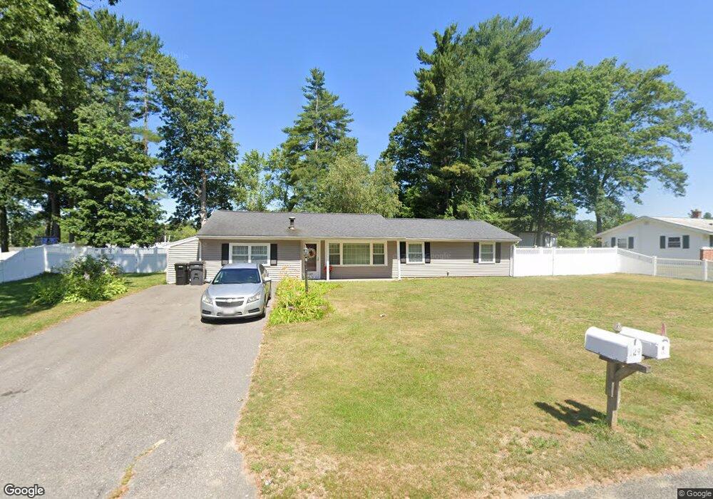
129 Francine Rd Raynham, MA 02767
Estimated Value: $521,000 - $562,000
3
Beds
2
Baths
1,504
Sq Ft
$359/Sq Ft
Est. Value
About This Home
This home is located at 129 Francine Rd, Raynham, MA 02767 and is currently estimated at $539,380, approximately $358 per square foot. 129 Francine Rd is a home located in Bristol County with nearby schools including Merrill Elementary School, LaLiberte Elementary School, and Williams Intermediate School.
Ownership History
Date
Name
Owned For
Owner Type
Purchase Details
Closed on
Oct 22, 2024
Sold by
Adraneda Antonio R
Bought by
Antonio R Adraneda Lt and Adraneda
Current Estimated Value
Purchase Details
Closed on
Aug 16, 1976
Bought by
Adraneda Antonio R and Adraneda Socorro L
Create a Home Valuation Report for This Property
The Home Valuation Report is an in-depth analysis detailing your home's value as well as a comparison with similar homes in the area
Home Values in the Area
Average Home Value in this Area
Purchase History
| Date | Buyer | Sale Price | Title Company |
|---|---|---|---|
| Antonio R Adraneda Lt | -- | None Available | |
| Antonio R Adraneda Lt | -- | None Available | |
| Adraneda Antonio R | $28,000 | -- |
Source: Public Records
Mortgage History
| Date | Status | Borrower | Loan Amount |
|---|---|---|---|
| Previous Owner | Adraneda Antonio R | $65,000 | |
| Previous Owner | Adraneda Antonio R | $50,000 |
Source: Public Records
Tax History Compared to Growth
Tax History
| Year | Tax Paid | Tax Assessment Tax Assessment Total Assessment is a certain percentage of the fair market value that is determined by local assessors to be the total taxable value of land and additions on the property. | Land | Improvement |
|---|---|---|---|---|
| 2025 | $5,514 | $455,700 | $208,500 | $247,200 |
| 2024 | $5,265 | $423,900 | $189,500 | $234,400 |
| 2023 | $4,907 | $360,800 | $170,600 | $190,200 |
| 2022 | $4,821 | $325,100 | $161,100 | $164,000 |
| 2021 | $4,549 | $309,700 | $151,600 | $158,100 |
| 2020 | $4,320 | $299,800 | $144,100 | $155,700 |
| 2019 | $4,131 | $290,300 | $134,600 | $155,700 |
| 2018 | $3,893 | $261,300 | $127,000 | $134,300 |
| 2017 | $3,645 | $242,500 | $121,300 | $121,200 |
| 2016 | $3,417 | $228,100 | $117,500 | $110,600 |
| 2015 | $3,338 | $219,000 | $122,500 | $96,500 |
Source: Public Records
Map
Nearby Homes
- 30 Edward Rd
- 21 Sully Rd
- 53 Queens Cir
- 73 Sherwood Ln
- 930 King St
- 271 King St
- 730 Locust St
- 32 Bear Stump Cir
- 970 N Main St
- 35 Spruce St Unit 1
- 30 Spruce St
- 84 Diniz Dr
- 698 Pine St
- 858 Pine St Unit Lot 27
- 858 Pine St Unit Model
- 40 Country Club Dr
- 2 Maplewood Ln Unit 21-1
- 0 Maplewood Unit 21.3 73426136
- 0 Maplewood Unit 33-1 73420094
- 152 Forgeriver
- 143 Francine Rd
- 140 Edward Rd
- 130 Francine Rd
- 120 Francine Rd
- 109 Francine Rd
- 140 Francine Rd
- 84 Barbara Rd
- 120 Edward Rd
- 152 Edward Rd
- 110 Francine Rd
- 150 Francine Rd
- 99 Francine Rd
- 108 Edward Rd
- 148 Edward Rd
- 148 Nicholas Rd
- 131 Edward Rd
- 134 Nicholas Rd
- 156 Nicholas Rd
- 122 Nicholas Rd
- 119 Edward Rd