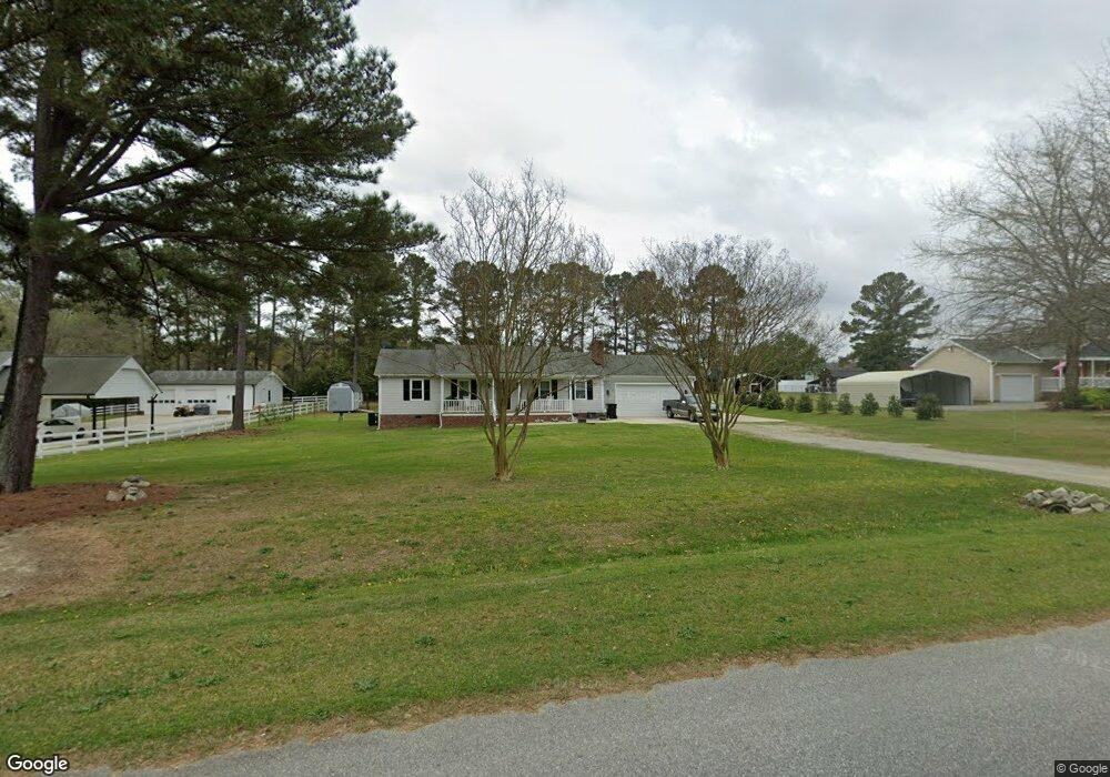
129 Lakeside Cir Willow Spring, NC 27592
Pleasant Grove NeighborhoodEstimated Value: $317,000 - $367,000
3
Beds
2
Baths
1,448
Sq Ft
$233/Sq Ft
Est. Value
About This Home
This home is located at 129 Lakeside Cir, Willow Spring, NC 27592 and is currently estimated at $337,879, approximately $233 per square foot. 129 Lakeside Cir is a home located in Johnston County with nearby schools including Dixon Road Elementary School, McGee's Crossroads Middle School, and West Johnston High School.
Ownership History
Date
Name
Owned For
Owner Type
Purchase Details
Closed on
Oct 24, 2019
Sold by
Opendoor Property N Llc
Bought by
Breault Dit Lafleche and Breault Nathalie
Current Estimated Value
Home Financials for this Owner
Home Financials are based on the most recent Mortgage that was taken out on this home.
Original Mortgage
$60,000
Outstanding Balance
$52,563
Interest Rate
3.5%
Mortgage Type
New Conventional
Estimated Equity
$285,316
Purchase Details
Closed on
Aug 19, 2019
Sold by
Dees Joseph Kent and Dees Jennifer Manning
Bought by
Opeildoor Property N Llc
Home Financials for this Owner
Home Financials are based on the most recent Mortgage that was taken out on this home.
Original Mortgage
$250,000,000
Interest Rate
3.7%
Mortgage Type
Amount Keyed Is An Aggregate Amount
Purchase Details
Closed on
Aug 17, 2016
Sold by
Lakeside Circle Land Trust
Bought by
Dees Joseph Kent and Dees Jennifer Manning
Home Financials for this Owner
Home Financials are based on the most recent Mortgage that was taken out on this home.
Original Mortgage
$173,552
Interest Rate
3.41%
Mortgage Type
VA
Purchase Details
Closed on
Jul 22, 2016
Sold by
Garner Investment Company Llc
Bought by
Lakeside Circle Land Trust
Home Financials for this Owner
Home Financials are based on the most recent Mortgage that was taken out on this home.
Original Mortgage
$173,552
Interest Rate
3.41%
Mortgage Type
VA
Purchase Details
Closed on
Mar 31, 2016
Sold by
Kramer Laurie
Bought by
Garner Investments Company Llc
Purchase Details
Closed on
Oct 6, 2015
Sold by
Connor Cory M O and Connor Heather O
Bought by
Kramer Laurie
Purchase Details
Closed on
Dec 9, 2014
Sold by
Federal Home Loan Mortgage Corporation
Bought by
Connor Cory O and Connor Heather C O
Purchase Details
Closed on
Aug 4, 2003
Sold by
Pulliam David
Bought by
Nowell William T
Purchase Details
Closed on
Jul 1, 2003
Sold by
Nowell William T
Bought by
First Federal Savings Bank
Purchase Details
Closed on
Dec 16, 2002
Sold by
First Federal Savings Bank
Bought by
Myers Brenda B
Create a Home Valuation Report for This Property
The Home Valuation Report is an in-depth analysis detailing your home's value as well as a comparison with similar homes in the area
Home Values in the Area
Average Home Value in this Area
Purchase History
| Date | Buyer | Sale Price | Title Company |
|---|---|---|---|
| Breault Dit Lafleche | $199,500 | None Available | |
| Opeildoor Property N Llc | $202,500 | Os National Llc | |
| Dees Joseph Kent | $170,000 | None Available | |
| Lakeside Circle Land Trust | -- | None Available | |
| Garner Investments Company Llc | $110,000 | Omega Title Insurance Compan | |
| Kramer Laurie | -- | None Available | |
| Connor Cory O | -- | None Available | |
| Nowell William T | $120,000 | -- | |
| First Federal Savings Bank | -- | -- | |
| Myers Brenda B | $86,000 | -- |
Source: Public Records
Mortgage History
| Date | Status | Borrower | Loan Amount |
|---|---|---|---|
| Open | Breault Dit Lafleche | $60,000 | |
| Previous Owner | Opeildoor Property N Llc | $250,000,000 | |
| Previous Owner | Dees Joseph Kent | $173,552 |
Source: Public Records
Tax History
| Year | Tax Paid | Tax Assessment Tax Assessment Total Assessment is a certain percentage of the fair market value that is determined by local assessors to be the total taxable value of land and additions on the property. | Land | Improvement |
|---|---|---|---|---|
| 2025 | $2,307 | $363,340 | $83,900 | $279,440 |
| 2024 | $1,718 | $212,100 | $54,290 | $157,810 |
| 2023 | $1,665 | $212,100 | $54,290 | $157,810 |
| 2022 | $1,718 | $212,100 | $54,290 | $157,810 |
| 2021 | $1,718 | $212,100 | $54,290 | $157,810 |
| 2020 | $1,547 | $184,210 | $54,290 | $129,920 |
| 2019 | $1,418 | $172,980 | $54,290 | $118,690 |
| 2018 | $1,154 | $137,350 | $31,580 | $105,770 |
| 2017 | $1,154 | $137,350 | $31,580 | $105,770 |
| 2016 | $1,154 | $137,350 | $31,580 | $105,770 |
| 2015 | $1,154 | $137,350 | $31,580 | $105,770 |
| 2014 | $1,154 | $137,350 | $31,580 | $105,770 |
Source: Public Records
Map
Nearby Homes
- 3002 Red Cir
- 2004 Little Pond Place
- 55 Edward Ct
- 127 Wagon Trail
- 410 Penwood Rd
- 420 Beulah Milton Dr
- 443 Tranquil Ln
- 40 Broadhead Ct
- 15973 N Carolina 210
- 1941 White Memorial Church Rd
- 444 Everland Pkwy
- 369 Everland Pkwy
- 376 Everland Pkwy
- 71 Suzanne Dr
- 1145 Landmark Rd
- 1139 Landmark Rd
- 76 Kingland Dr
- 33 Cabin Grove Ct
- 16622 N Carolina 210
- 16 Keystone Ct
- 131 Lakeside Cir
- 127 Lakeside Cir
- 619 Canady Ct
- 110 Lakeside Cir
- 000 Lakeside Cir
- 130 Lakeside Cir
- 800 Shadow Lake Dr
- 128 Lakeside Cir
- 615 Canady Ct
- 133 Lakeside Cir
- 613 Canady Ct
- 621 Canady Ct
- 132 Lakeside Cir
- 802 Shadow Lake Dr
- 135 Lakeside Cir
- 801 Shadow Lake Dr
- 134 Lakeside Cir
- 124 Lakeside Cir
- 804 Shadow Lake Dr
- 803 Shadow Lake Dr
Your Personal Tour Guide
Ask me questions while you tour the home.