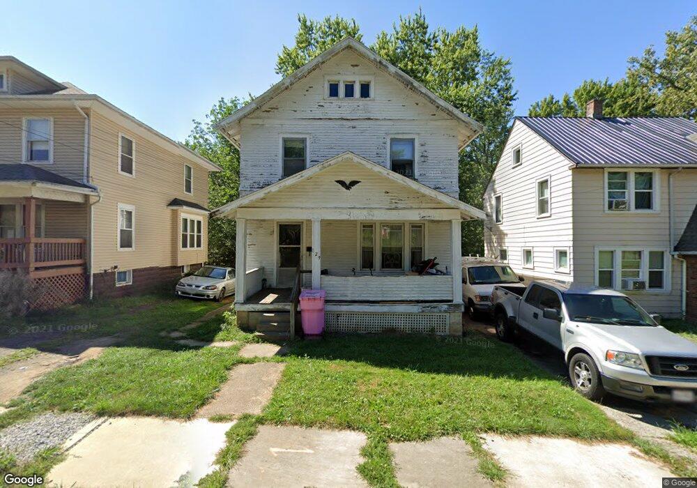
129 Rae Ave Mansfield, OH 44903
Estimated Value: $67,386 - $101,000
3
Beds
1
Bath
1,449
Sq Ft
$57/Sq Ft
Est. Value
About This Home
This home is located at 129 Rae Ave, Mansfield, OH 44903 and is currently estimated at $82,597, approximately $57 per square foot. 129 Rae Ave is a home located in Richland County with nearby schools including Goal Digital Academy, Mansfield Elective Academy, and Interactive Media & Construction (IMAC) Academy.
Ownership History
Date
Name
Owned For
Owner Type
Purchase Details
Closed on
Apr 11, 2019
Sold by
Niedermeier David A and Treasurer Of Richaldn County
Bought by
Jacobs Melody
Current Estimated Value
Purchase Details
Closed on
Oct 30, 1997
Sold by
Clinton W First
Bought by
Niedermeier David A
Home Financials for this Owner
Home Financials are based on the most recent Mortgage that was taken out on this home.
Original Mortgage
$41,900
Interest Rate
8%
Mortgage Type
VA
Purchase Details
Closed on
Jun 5, 1990
Create a Home Valuation Report for This Property
The Home Valuation Report is an in-depth analysis detailing your home's value as well as a comparison with similar homes in the area
Home Values in the Area
Average Home Value in this Area
Purchase History
| Date | Buyer | Sale Price | Title Company |
|---|---|---|---|
| Jacobs Melody | $17,000 | Chicago Ttl Agcy Of North Ct | |
| Niedermeier David A | $44,900 | -- | |
| -- | $25,500 | -- |
Source: Public Records
Mortgage History
| Date | Status | Borrower | Loan Amount |
|---|---|---|---|
| Previous Owner | Niedermeier David A | $41,900 |
Source: Public Records
Tax History
| Year | Tax Paid | Tax Assessment Tax Assessment Total Assessment is a certain percentage of the fair market value that is determined by local assessors to be the total taxable value of land and additions on the property. | Land | Improvement |
|---|---|---|---|---|
| 2024 | $497 | $10,850 | $1,450 | $9,400 |
| 2023 | $508 | $10,850 | $1,450 | $9,400 |
| 2022 | $615 | $11,010 | $1,400 | $9,610 |
| 2021 | $619 | $11,010 | $1,400 | $9,610 |
| 2020 | $633 | $11,010 | $1,400 | $9,610 |
| 2019 | $702 | $11,010 | $1,400 | $9,610 |
| 2018 | $692 | $11,010 | $1,400 | $9,610 |
| 2017 | $769 | $11,010 | $1,400 | $9,610 |
| 2016 | $762 | $12,070 | $2,950 | $9,120 |
| 2015 | $728 | $12,070 | $2,950 | $9,120 |
| 2014 | $718 | $12,070 | $2,950 | $9,120 |
| 2012 | $288 | $12,710 | $3,110 | $9,600 |
Source: Public Records
Map
Nearby Homes
- 10 Gray Ct
- 230 Rae Ave
- 458 W West Dickson Ave
- 81 Penn Ave
- 24 Stewart Ave S
- 212 Penn Ave
- 31 Bartley Ave
- 71 Dawson Ave
- 30 Douglas Ave
- 108 Stewart Ave S
- 0 Lemley Ave Unit 9070540
- 116 Stewart Ave S
- 126 Dawson Ave
- 344 W 5th St
- 368 W 6th St
- 133 Stewart Ave S
- 189 Westwood Ave
- 129 Fairlawn Ave
- 135 Fairlawn Ave
- 143 Fairlawn Ave
Your Personal Tour Guide
Ask me questions while you tour the home.