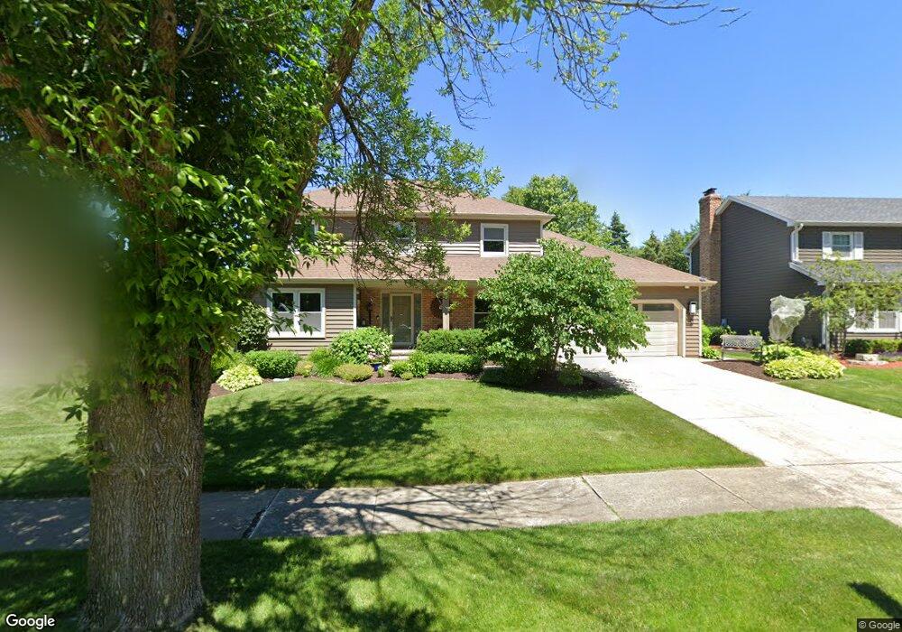
129 Split Oak Rd Naperville, IL 60565
Old Farm NeighborhoodEstimated Value: $522,161 - $633,000
Studio
1
Bath
2,153
Sq Ft
$272/Sq Ft
Est. Value
About This Home
This home is located at 129 Split Oak Rd, Naperville, IL 60565 and is currently estimated at $584,790, approximately $271 per square foot. 129 Split Oak Rd is a home located in DuPage County with nearby schools including Kingsley Elementary School, Lincoln Jr. High School, and Naperville Central High School.
Ownership History
Date
Name
Owned For
Owner Type
Purchase Details
Closed on
Apr 30, 2012
Sold by
Tenison Jack D and Tenison Debra E
Bought by
Tenison Jack D and Tenison Debra E
Current Estimated Value
Create a Home Valuation Report for This Property
The Home Valuation Report is an in-depth analysis detailing your home's value as well as a comparison with similar homes in the area
Home Values in the Area
Average Home Value in this Area
Purchase History
| Date | Buyer | Sale Price | Title Company |
|---|---|---|---|
| Tenison Jack D | -- | None Available |
Source: Public Records
Tax History
| Year | Tax Paid | Tax Assessment Tax Assessment Total Assessment is a certain percentage of the fair market value that is determined by local assessors to be the total taxable value of land and additions on the property. | Land | Improvement |
|---|---|---|---|---|
| 2024 | $8,743 | $158,723 | $62,236 | $96,487 |
| 2023 | $8,373 | $144,860 | $56,800 | $88,060 |
| 2022 | $7,811 | $131,690 | $51,640 | $80,050 |
| 2021 | $7,511 | $126,710 | $49,690 | $77,020 |
| 2020 | $7,344 | $124,440 | $48,800 | $75,640 |
| 2019 | $7,113 | $119,060 | $46,690 | $72,370 |
| 2018 | $6,849 | $115,030 | $45,110 | $69,920 |
| 2017 | $6,329 | $111,150 | $43,590 | $67,560 |
| 2016 | $6,087 | $111,140 | $43,580 | $67,560 |
| 2015 | $6,020 | $104,660 | $41,040 | $63,620 |
| 2014 | $5,884 | $94,110 | $37,310 | $56,800 |
| 2013 | $5,796 | $89,700 | $37,400 | $52,300 |
Source: Public Records
Map
Nearby Homes
- 2023 Springside Dr
- 233 Briarheath Ln
- 2245 Petworth Ct Unit 202C
- 381 Prairie Knoll Dr
- 96 Midhurst Ct Unit 201
- 47 Glencoe Ct Unit 102D
- 34 Glencoe Ct Unit 202B
- 2206 Worthing Dr
- 332 Prairie Knoll Dr
- 270 Pebblestone Rd
- 2221 Woodland Cir
- 48 Starling Ln
- 362 Ripley Ct
- 18 Newgate Ave
- 321 Carriage Hill Rd
- 2049 Dorval Dr
- 307 Leeds Ct
- 628 Flock Ave Unit 3
- 2438 Wendover Dr
- 1751 S Washington St Unit 1
- 125 Split Oak Rd
- 121 Split Oak Rd
- 128 Split Oak Rd
- 124 Split Oak Rd
- 132 Split Oak Rd
- 120 Split Oak Rd
- 117 Split Oak Rd
- 124 Kingswood Ct
- 141 Split Oak Rd
- 126 Kingswood Ct
- 122 Kingswood Ct
- 128 Kingswood Ct
- 116 Split Oak Rd
- 118 Kingswood Ct
- 117 Coventry Ct
- 145 Split Oak Rd
- 130 Kingswood Ct
- 113 Coventry Ct
- 114 Kingswood Ct
Your Personal Tour Guide
Ask me questions while you tour the home.