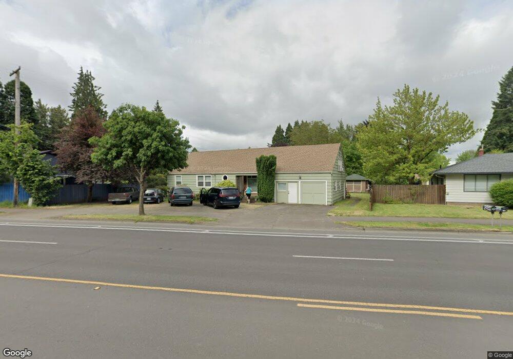
1290 River Rd Eugene, OR 97404
River Road NeighborhoodEstimated Value: $404,000 - $425,280
3
Beds
1
Bath
1,454
Sq Ft
$286/Sq Ft
Est. Value
About This Home
This home is located at 1290 River Rd, Eugene, OR 97404 and is currently estimated at $415,320, approximately $285 per square foot. 1290 River Rd is a home located in Lane County with nearby schools including Howard Elementary School, Kelly Middle School, and North Eugene High School.
Ownership History
Date
Name
Owned For
Owner Type
Purchase Details
Closed on
Jun 27, 2018
Sold by
Bradley Dale K and Bradley Dale Kent
Bought by
Bradley Dale K and Bradley Shawna
Current Estimated Value
Home Financials for this Owner
Home Financials are based on the most recent Mortgage that was taken out on this home.
Original Mortgage
$182,000
Outstanding Balance
$157,424
Interest Rate
4.6%
Mortgage Type
New Conventional
Estimated Equity
$257,896
Purchase Details
Closed on
Nov 8, 2006
Sold by
Bradley Leslie Kearns
Bought by
Bradley Dale Kent
Purchase Details
Closed on
Dec 21, 1999
Sold by
Widders Anna L
Bought by
Bradley Dale Kent and Bradley Leslie Kearns
Home Financials for this Owner
Home Financials are based on the most recent Mortgage that was taken out on this home.
Original Mortgage
$112,400
Interest Rate
7.69%
Create a Home Valuation Report for This Property
The Home Valuation Report is an in-depth analysis detailing your home's value as well as a comparison with similar homes in the area
Home Values in the Area
Average Home Value in this Area
Purchase History
| Date | Buyer | Sale Price | Title Company |
|---|---|---|---|
| Bradley Dale K | -- | Western Title & Escrow | |
| Bradley Dale Kent | -- | None Available | |
| Bradley Dale Kent | $124,900 | Cascade Title Co |
Source: Public Records
Mortgage History
| Date | Status | Borrower | Loan Amount |
|---|---|---|---|
| Open | Bradley Dale K | $182,000 | |
| Closed | Bradley Dale Kent | $112,400 |
Source: Public Records
Tax History
| Year | Tax Paid | Tax Assessment Tax Assessment Total Assessment is a certain percentage of the fair market value that is determined by local assessors to be the total taxable value of land and additions on the property. | Land | Improvement |
|---|---|---|---|---|
| 2025 | $3,009 | $179,097 | -- | -- |
| 2024 | $2,976 | $173,881 | -- | -- |
| 2023 | $2,976 | $168,817 | $0 | $0 |
| 2022 | $2,799 | $163,900 | $0 | $0 |
| 2021 | $2,603 | $159,127 | $0 | $0 |
| 2020 | $2,622 | $154,493 | $0 | $0 |
| 2019 | $2,529 | $149,994 | $0 | $0 |
| 2018 | $2,359 | $141,384 | $0 | $0 |
| 2017 | $2,272 | $141,384 | $0 | $0 |
| 2016 | $2,210 | $137,266 | $0 | $0 |
| 2015 | $2,156 | $133,268 | $0 | $0 |
| 2014 | $2,157 | $129,386 | $0 | $0 |
Source: Public Records
Map
Nearby Homes
- 260 Greenleaf Ave
- 172 Norman Ave
- 154 Norman Ave
- 1483 Barton St
- 1487 Barton St
- 1665 Evergreen Dr
- 32 Marion Ln
- 1010 Horn Ln
- 315 Heritage Ave
- 1708 River Rd
- 172 Oakleigh Ln Unit 513
- 172 Oakleigh Ln Unit 221
- 574 Wimbledon Ct
- 1314 Dalton Dr
- 1010 Elkay Dr
- 606 Wimbledon Ct
- 389 Maxwell Rd
- 2874 Riverwalk Loop
- 2709 Riverwalk Loop
- 820 Park Terrace
Your Personal Tour Guide
Ask me questions while you tour the home.