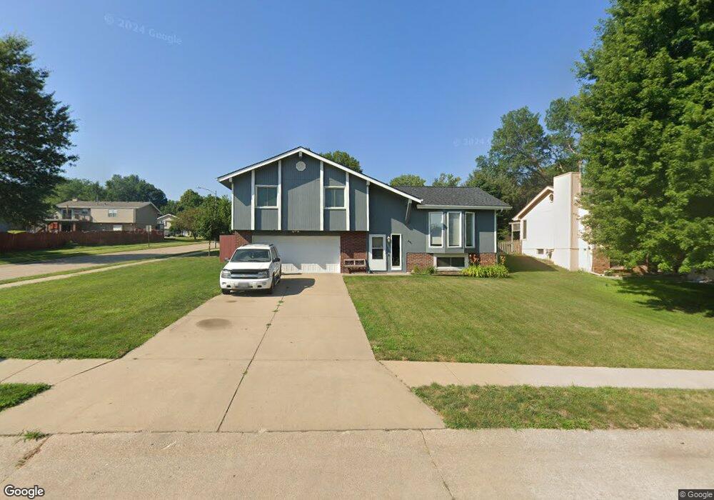
12905 Crown Point Ave Omaha, NE 68164
Standing Bear NeighborhoodEstimated Value: $281,000 - $298,000
3
Beds
2
Baths
1,638
Sq Ft
$176/Sq Ft
Est. Value
About This Home
This home is located at 12905 Crown Point Ave, Omaha, NE 68164 and is currently estimated at $287,741, approximately $175 per square foot. 12905 Crown Point Ave is a home located in Douglas County with nearby schools including Prairie Wind Elementary School, Alfonza W. Davis Middle School, and Omaha Christian Academy.
Ownership History
Date
Name
Owned For
Owner Type
Purchase Details
Closed on
Apr 16, 2021
Sold by
Powers Trevor J and Powers Casandra L
Bought by
Powers Trevor J and Powers Casandra L
Current Estimated Value
Home Financials for this Owner
Home Financials are based on the most recent Mortgage that was taken out on this home.
Original Mortgage
$175,000
Outstanding Balance
$158,130
Interest Rate
3.05%
Mortgage Type
New Conventional
Estimated Equity
$129,611
Purchase Details
Closed on
Sep 21, 2011
Sold by
St Clair John P and St Clair Lisa
Bought by
Powers Trevor J and Roth Casandra L
Home Financials for this Owner
Home Financials are based on the most recent Mortgage that was taken out on this home.
Original Mortgage
$129,628
Interest Rate
4.4%
Mortgage Type
FHA
Create a Home Valuation Report for This Property
The Home Valuation Report is an in-depth analysis detailing your home's value as well as a comparison with similar homes in the area
Home Values in the Area
Average Home Value in this Area
Purchase History
| Date | Buyer | Sale Price | Title Company |
|---|---|---|---|
| Powers Trevor J | -- | Investors Title Insurance Co | |
| Powers Trevor J | $133,000 | Nebraska Land Title & Abstra |
Source: Public Records
Mortgage History
| Date | Status | Borrower | Loan Amount |
|---|---|---|---|
| Open | Powers Trevor J | $175,000 | |
| Closed | Powers Trevor J | $129,628 |
Source: Public Records
Tax History Compared to Growth
Tax History
| Year | Tax Paid | Tax Assessment Tax Assessment Total Assessment is a certain percentage of the fair market value that is determined by local assessors to be the total taxable value of land and additions on the property. | Land | Improvement |
|---|---|---|---|---|
| 2025 | $3,931 | $254,500 | $30,700 | $223,800 |
| 2024 | $5,129 | $243,100 | $30,700 | $212,400 |
| 2023 | $5,129 | $243,100 | $30,700 | $212,400 |
| 2022 | $3,881 | $181,800 | $30,700 | $151,100 |
| 2021 | $3,848 | $181,800 | $30,700 | $151,100 |
| 2020 | $3,513 | $164,100 | $30,700 | $133,400 |
| 2019 | $3,174 | $147,800 | $32,800 | $115,000 |
| 2018 | $3,178 | $147,800 | $32,800 | $115,000 |
| 2017 | $2,792 | $129,200 | $32,800 | $96,400 |
| 2016 | $3,092 | $144,100 | $20,100 | $124,000 |
| 2015 | $2,852 | $134,700 | $18,800 | $115,900 |
| 2014 | $2,852 | $134,700 | $18,800 | $115,900 |
Source: Public Records
Map
Nearby Homes
- 13041 Crown Point Ave
- 12934 Hartman Ave
- 6217 N 131st Ave
- 6201 N 132nd St
- 13222 Ellison Ave
- 12630 Park Lane Cir
- 5417 N 134th Ave
- 5403 N 134th Ave
- 12933 Camden Ave
- 13484 Camden Ave
- 12959 Redman Cir
- 13502 Whitmore St
- Edmon Plan at Westbrook Hills
- Hamilton Plan at Westbrook Hills
- Fremont Plan at Westbrook Hills
- 13521 Whitmore St
- 13708 Camden Ave
- 12729 Fowler Cir
- 4636 N 126th Ave
- 13611 Whitmore St
- 12911 Crown Point Ave
- 12906 Laurel Ave
- 12829 Crown Point Ave
- 12917 Crown Point Ave
- 12912 Laurel Ave
- 12822 Laurel Ave
- 12918 Laurel Ave
- 12823 Crown Point Ave
- 12923 Crown Point Ave
- 12826 Crown Point Ave
- 12816 Laurel Ave
- 12924 Laurel Ave
- 12929 Crown Point Ave
- 12820 Crown Point Ave
- 12817 Crown Point Ave
- 12909 Laurel Ave
- 12810 Laurel Ave
- 12917 Laurel Ave
- 12814 Crown Point Ave
- 12823 Laurel Ave