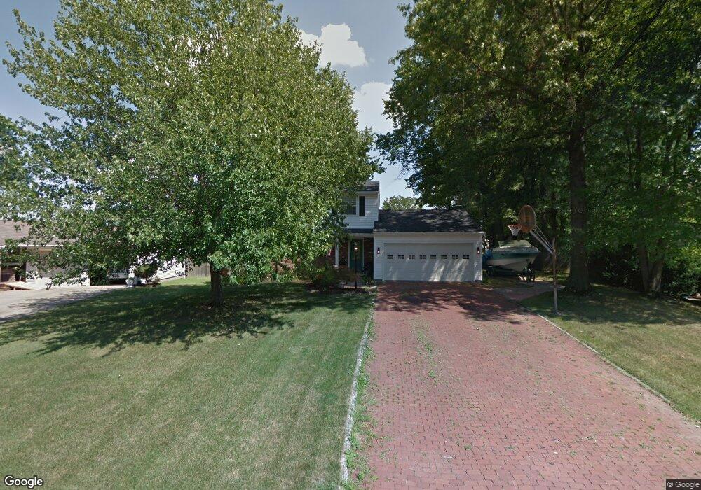
1293 Cedarwood Dr Mineral Ridge, OH 44440
Austintown NeighborhoodEstimated Value: $197,000 - $240,000
3
Beds
2
Baths
1,392
Sq Ft
$158/Sq Ft
Est. Value
About This Home
This home is located at 1293 Cedarwood Dr, Mineral Ridge, OH 44440 and is currently estimated at $220,115, approximately $158 per square foot. 1293 Cedarwood Dr is a home located in Mahoning County with nearby schools including Seaborn Elementary School, Mineral Ridge High School, and Stambaugh Charter Academy.
Ownership History
Date
Name
Owned For
Owner Type
Purchase Details
Closed on
Apr 19, 2019
Sold by
Rabel William T and Rabel Charlene M
Bought by
Rabel William T and Rabel Charlene M
Current Estimated Value
Purchase Details
Closed on
Apr 11, 1977
Bought by
Rabel William T and C M
Create a Home Valuation Report for This Property
The Home Valuation Report is an in-depth analysis detailing your home's value as well as a comparison with similar homes in the area
Home Values in the Area
Average Home Value in this Area
Purchase History
| Date | Buyer | Sale Price | Title Company |
|---|---|---|---|
| Rabel William T | -- | None Available | |
| Rabel William T | -- | -- |
Source: Public Records
Tax History Compared to Growth
Tax History
| Year | Tax Paid | Tax Assessment Tax Assessment Total Assessment is a certain percentage of the fair market value that is determined by local assessors to be the total taxable value of land and additions on the property. | Land | Improvement |
|---|---|---|---|---|
| 2024 | $3,211 | $62,320 | $7,700 | $54,620 |
| 2023 | $3,181 | $62,320 | $7,700 | $54,620 |
| 2022 | $2,657 | $45,930 | $7,700 | $38,230 |
| 2021 | $2,658 | $45,930 | $7,700 | $38,230 |
| 2020 | $2,667 | $45,930 | $7,700 | $38,230 |
| 2019 | $2,631 | $41,240 | $7,700 | $33,540 |
| 2018 | $2,537 | $41,240 | $7,700 | $33,540 |
| 2017 | $2,517 | $41,240 | $7,700 | $33,540 |
| 2016 | $2,518 | $39,700 | $7,000 | $32,700 |
| 2015 | $2,446 | $39,700 | $7,000 | $32,700 |
| 2014 | $2,461 | $39,700 | $7,000 | $32,700 |
| 2013 | $2,441 | $39,700 | $7,000 | $32,700 |
Source: Public Records
Map
Nearby Homes
- 5085 Winslow Dr
- 1239 Woodledge Dr
- 1760 Dumont Dr
- 0 W Webb Rd
- 1467 E County Line Rd
- 1684 Morris St
- 1445 E County Line Rd
- 21 E Liberty St
- 3872 Main St
- 3907 Edwards St
- 3579 Bee St
- 645 Carlin Dr
- 6360 Meander Glen Dr
- 3474 S Main St
- 6393 Meander Glen Dr
- 3440 Lakeside Dr
- 0 W Liberty Unit 5153649
- 5231 W Rockwell Rd
- 2555 Walnut St
- 4028 Lanterman Rd
- 1287 Cedarwood Dr
- 1299 Cedarwood Dr
- 5140 Clearfield Dr
- 1305 Cedarwood Dr
- 1284 Cedarwood Dr
- 1281 Cedarwood Dr
- 5136 Clearfield Dr
- 1292 Cedarwood Dr
- 1282 Cedarwood Dr
- 5147 Clearfield Dr
- 1310 Cedarwood Dr
- 5143 Clearfield Dr
- 1311 Cedarwood Dr
- 5139 Clearfield Dr
- 1275 Cedarwood Dr
- 1276 Cedarwood Dr
- 1318 Cedarwood Dr
- 5135 Clearfield Dr
- 1294 Raspberry Ln
- 1317 Cedarwood Dr