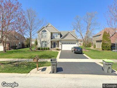
1294 Hall St Unit 2 Sugar Grove, IL 60554
Estimated Value: $417,016 - $476,000
--
Bed
--
Bath
2,246
Sq Ft
$202/Sq Ft
Est. Value
About This Home
This home is located at 1294 Hall St Unit 2, Sugar Grove, IL 60554 and is currently estimated at $454,254, approximately $202 per square foot. 1294 Hall St Unit 2 is a home located in Kane County with nearby schools including Kaneland John Shields Elementary School, Harter Middle School, and Kaneland Senior High School.
Ownership History
Date
Name
Owned For
Owner Type
Purchase Details
Closed on
Jul 21, 2004
Sold by
Neuman Homes Inc
Bought by
Szewczyk Diane M
Current Estimated Value
Home Financials for this Owner
Home Financials are based on the most recent Mortgage that was taken out on this home.
Original Mortgage
$150,000
Interest Rate
6.4%
Mortgage Type
Purchase Money Mortgage
Create a Home Valuation Report for This Property
The Home Valuation Report is an in-depth analysis detailing your home's value as well as a comparison with similar homes in the area
Home Values in the Area
Average Home Value in this Area
Purchase History
| Date | Buyer | Sale Price | Title Company |
|---|---|---|---|
| Szewczyk Diane M | $285,000 | Chicago Title Insurance Comp |
Source: Public Records
Mortgage History
| Date | Status | Borrower | Loan Amount |
|---|---|---|---|
| Open | Szewczyk Diane M | $200,000 | |
| Closed | Szewczyk Diane M | $38,000 | |
| Closed | Szewczyk Diane | $146,000 | |
| Closed | Szewczyk Diane | $40,000 | |
| Closed | Szewczyk Diane | $30,000 | |
| Closed | Szewczyk Diane M | $150,000 |
Source: Public Records
Tax History Compared to Growth
Tax History
| Year | Tax Paid | Tax Assessment Tax Assessment Total Assessment is a certain percentage of the fair market value that is determined by local assessors to be the total taxable value of land and additions on the property. | Land | Improvement |
|---|---|---|---|---|
| 2023 | $8,932 | $105,472 | $27,699 | $77,773 |
| 2022 | $8,614 | $97,370 | $25,571 | $71,799 |
| 2021 | $8,298 | $92,663 | $24,335 | $68,328 |
| 2020 | $8,178 | $90,686 | $23,816 | $66,870 |
| 2019 | $8,048 | $87,721 | $23,037 | $64,684 |
| 2018 | $7,534 | $80,631 | $22,145 | $58,486 |
| 2017 | $7,297 | $77,004 | $21,149 | $55,855 |
| 2016 | $7,118 | $73,611 | $20,217 | $53,394 |
| 2015 | -- | $74,008 | $18,810 | $55,198 |
| 2014 | -- | $70,767 | $17,986 | $52,781 |
| 2013 | -- | $71,511 | $18,175 | $53,336 |
Source: Public Records
Map
Nearby Homes
- 1284 Mcdole Dr Unit 2
- 1340 Slater St
- 1165 Mcdole Dr Unit 1
- 985 Pinecrest Dr
- 896 Black Walnut Dr
- 954 Black Walnut Dr
- 947 Lakeridge Ct
- 933 Lakeridge Ct
- 6.63 Acres Denny Rd
- 792 Black Walnut Dr
- 35 Walnut Cir
- 868 Edgewood Dr
- 750 Tudor Ct
- 731 Queens Gate Cir Unit 1
- 684 Greenfield Rd
- 11 Fernilee Ct
- 706 Brighton Dr
- 744 Merrill New Rd
- 1246 Verona Ridge Dr Unit 3
- 11 Hardwick Ct
- 1294 Hall St Unit 2
- 1290 Hall St
- 1298 Hall St
- 1293 Mcdole Dr
- 1297 Mcdole Dr Unit 2
- 1291 Mcdole Dr Unit 2
- 1288 Hall St
- 1293 Hall St
- 1287 Mcdole Dr
- 1297 Hall St Unit 2
- 1289 Hall St Unit 2
- 1284 Hall St
- 1306 Hall St
- 1303 Mcdole Dr
- 1285 Mcdole Dr
- 1294 Dorr Dr Unit 2
- 1305 Hall St
- 1290 Mcdole Dr Unit 2
- 1288 Mcdole Dr
- 1298 Dorr Dr