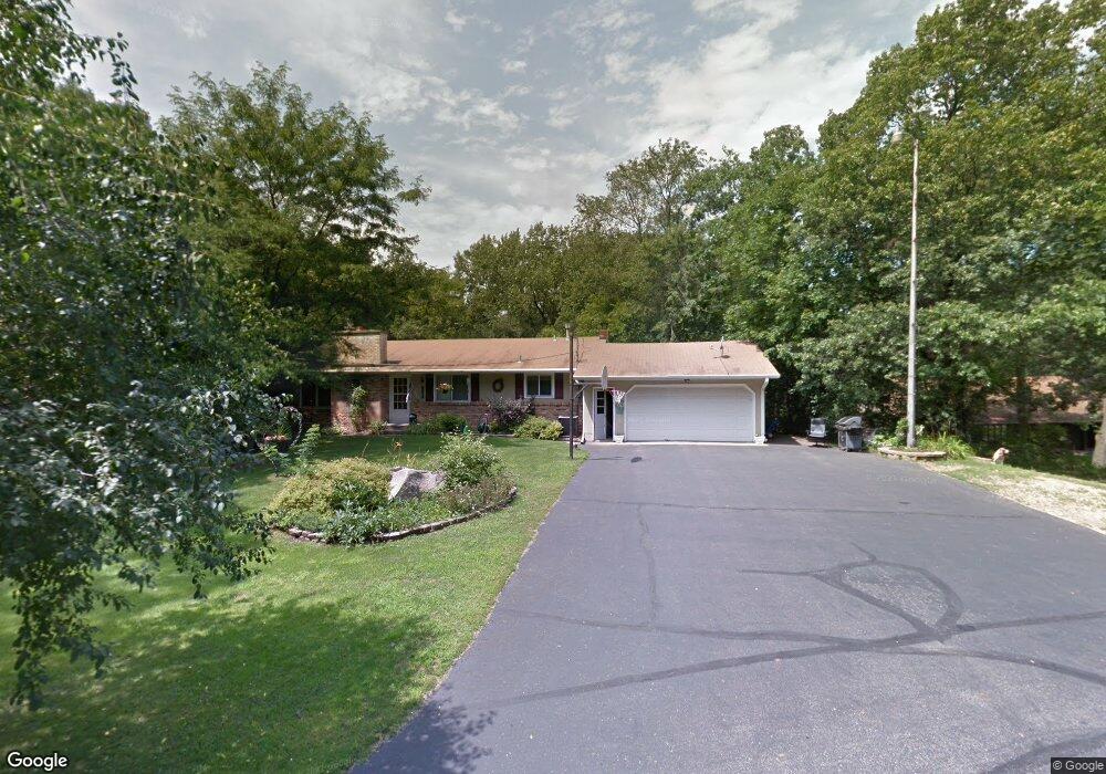
12965 Bengal Ave W Rosemount, MN 55068
Estimated Value: $370,000 - $460,030
4
Beds
3
Baths
2,240
Sq Ft
$192/Sq Ft
Est. Value
About This Home
This home is located at 12965 Bengal Ave W, Rosemount, MN 55068 and is currently estimated at $429,008, approximately $191 per square foot. 12965 Bengal Ave W is a home located in Dakota County with nearby schools including Red Pine Elementary School, Rosemount Middle School, and Rosemount Senior High School.
Ownership History
Date
Name
Owned For
Owner Type
Purchase Details
Closed on
Nov 8, 2024
Sold by
Schmidt Paul and Schmidt Mary
Bought by
Schmidt Denise and Schmidt Timothy
Current Estimated Value
Home Financials for this Owner
Home Financials are based on the most recent Mortgage that was taken out on this home.
Original Mortgage
$352,450
Outstanding Balance
$348,915
Interest Rate
6.08%
Mortgage Type
New Conventional
Estimated Equity
$80,093
Create a Home Valuation Report for This Property
The Home Valuation Report is an in-depth analysis detailing your home's value as well as a comparison with similar homes in the area
Home Values in the Area
Average Home Value in this Area
Purchase History
| Date | Buyer | Sale Price | Title Company |
|---|---|---|---|
| Schmidt Denise | $371,000 | -- |
Source: Public Records
Mortgage History
| Date | Status | Borrower | Loan Amount |
|---|---|---|---|
| Open | Schmidt Denise | $352,450 |
Source: Public Records
Tax History Compared to Growth
Tax History
| Year | Tax Paid | Tax Assessment Tax Assessment Total Assessment is a certain percentage of the fair market value that is determined by local assessors to be the total taxable value of land and additions on the property. | Land | Improvement |
|---|---|---|---|---|
| 2024 | $5,800 | $418,700 | $123,700 | $295,000 |
| 2023 | $5,800 | $404,900 | $125,100 | $279,800 |
| 2022 | $3,666 | $381,800 | $124,600 | $257,200 |
| 2021 | $3,508 | $323,300 | $108,300 | $215,000 |
| 2020 | $3,636 | $303,600 | $103,200 | $200,400 |
| 2019 | $3,276 | $302,700 | $98,300 | $204,400 |
| 2018 | $3,078 | $286,400 | $93,600 | $192,800 |
| 2017 | $3,303 | $261,600 | $89,200 | $172,400 |
| 2016 | $3,122 | $268,000 | $98,800 | $169,200 |
| 2015 | $2,941 | $242,128 | $93,029 | $149,099 |
| 2014 | -- | $226,986 | $87,443 | $139,543 |
| 2013 | -- | $216,207 | $80,264 | $135,943 |
Source: Public Records
Map
Nearby Homes
- 2645 132nd Ct W
- 12470 Blanca Ave W
- 2067 Bonaire Path W
- 13433 Brick Path
- 13566 Birdsong Pth
- 2574 136th St W Unit 102
- 2337 136th Ct W
- 2301 136th St W
- 2300 136th Ct W
- 2373 136th Ct W
- 13404 Avila Ave
- 13635 Brick Path
- 13290 Cadogan Way
- 13638 Brass Pkwy Unit 32
- 13420 Cadogan Way
- 13360 Cadogan Way
- 13370 Cadogan Way
- 13341 Cadogan Way
- 13380 Cadogan Way
- 13351 Cadogan Way
- 12895 Bengal Ave W
- XXXXX Bengal Ave W
- 12995 Bengal Ave W
- 12930 Bengal Ave W
- 12962 Bengal Ave W
- 2261 130th St W
- 2305 2305 130th-Street-w
- 2305 130th St W
- 12865 Bengal Ave W
- 1020 130th St W
- 12845 Bengal Ave W
- 2193 130th Way W
- 2090 130th Way W
- 2141 130th St W
- 2113 130th Way W
- 2192 128th St W
- 2400 2400 126th-Street-w
- 2168 128th St W
- 2152 2152 128th-Street-w
- 12795 Bengal Ave W