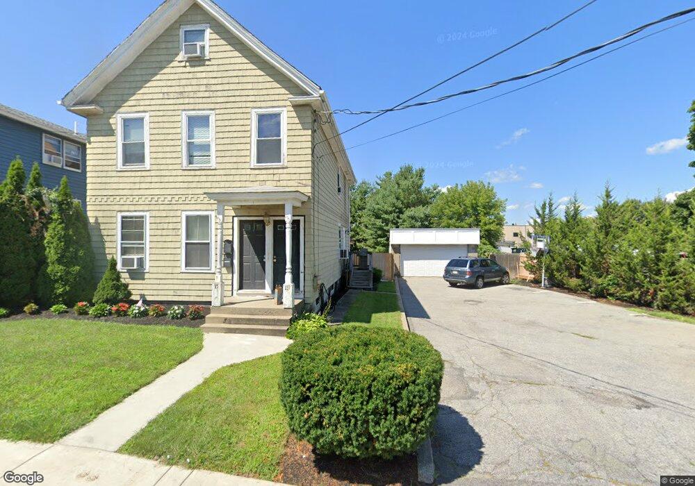
13 Cedar St Unit 15 Waltham, MA 02453
South Side NeighborhoodEstimated Value: $908,000 - $1,016,170
6
Beds
3
Baths
1,804
Sq Ft
$535/Sq Ft
Est. Value
About This Home
This home is located at 13 Cedar St Unit 15, Waltham, MA 02453 and is currently estimated at $965,293, approximately $535 per square foot. 13 Cedar St Unit 15 is a home located in Middlesex County with nearby schools including Henry Whittemore Elementary School, John W. Mcdevitt Middle School, and Waltham Sr High School.
Ownership History
Date
Name
Owned For
Owner Type
Purchase Details
Closed on
Aug 20, 2004
Sold by
Langston Brain Dow S and Langston Brain Leslie
Bought by
Brisson Joann
Current Estimated Value
Home Financials for this Owner
Home Financials are based on the most recent Mortgage that was taken out on this home.
Original Mortgage
$258,400
Outstanding Balance
$128,392
Interest Rate
6.03%
Mortgage Type
Purchase Money Mortgage
Estimated Equity
$836,901
Purchase Details
Closed on
May 29, 2003
Sold by
Bastarache Charles J and Bastarache Donna M
Bought by
Carrafiello Dennis C
Home Financials for this Owner
Home Financials are based on the most recent Mortgage that was taken out on this home.
Original Mortgage
$350,413
Interest Rate
5.86%
Mortgage Type
Purchase Money Mortgage
Create a Home Valuation Report for This Property
The Home Valuation Report is an in-depth analysis detailing your home's value as well as a comparison with similar homes in the area
Home Values in the Area
Average Home Value in this Area
Purchase History
| Date | Buyer | Sale Price | Title Company |
|---|---|---|---|
| Brisson Joann | $323,000 | -- | |
| Carrafiello Dennis C | $412,250 | -- |
Source: Public Records
Mortgage History
| Date | Status | Borrower | Loan Amount |
|---|---|---|---|
| Open | Brisson Joann | $258,400 | |
| Previous Owner | Carrafiello Dennis C | $350,413 |
Source: Public Records
Tax History Compared to Growth
Tax History
| Year | Tax Paid | Tax Assessment Tax Assessment Total Assessment is a certain percentage of the fair market value that is determined by local assessors to be the total taxable value of land and additions on the property. | Land | Improvement |
|---|---|---|---|---|
| 2025 | $8,157 | $830,700 | $426,000 | $404,700 |
| 2024 | $7,619 | $790,400 | $426,000 | $364,400 |
| 2023 | $7,618 | $738,200 | $388,000 | $350,200 |
| 2022 | $7,688 | $690,100 | $354,300 | $335,800 |
| 2021 | $7,195 | $635,600 | $320,500 | $315,100 |
| 2020 | $7,175 | $600,400 | $303,700 | $296,700 |
| 2019 | $6,885 | $543,800 | $300,600 | $243,200 |
| 2018 | $6,247 | $495,400 | $278,300 | $217,100 |
| 2017 | $5,904 | $470,100 | $253,000 | $217,100 |
| 2016 | $5,393 | $440,600 | $223,500 | $217,100 |
| 2015 | $5,256 | $400,300 | $219,300 | $181,000 |
Source: Public Records
Map
Nearby Homes
- 9 John St
- 39 Clinton St Unit 2
- 39 Clinton St Unit 1
- 28-32 Calvary St
- 308 Newton St Unit 1
- 180 River St Unit 9
- 240 River St
- 176 River St
- 312 Newton St Unit 1A
- 266-274 River St
- 162 Myrtle St Unit 1
- 138 Myrtle St Unit 2
- 301 River St
- 81 Alder St
- 42 Alder St
- 61 Hall St Unit 9
- 61 Hall St Unit 7
- 76 Taft Ave Unit 1
- 76 Taft Ave
- 76 Taft Ave Unit 2
- 17 Cedar St Unit 19
- 57 Cedar St
- 12 Cedar St
- 12 Cedar St Unit 2
- 12 Cedar St Unit 1
- 66 Oak St Unit 70
- 16 Cedar St
- 16 Cedar St Unit 1
- 64 Oak St
- 64 Oak St Unit 1
- 64 Oak St
- 64 Oak St Unit B
- 18 Cedar St Unit 1
- 68 Oak St Unit 68
- 58-60 Oak St
- 14 Cedar St
- 58 Oak St Unit 60
- 1 Boland St
- 56 Oak St
- 48-50 Oak St Unit 48