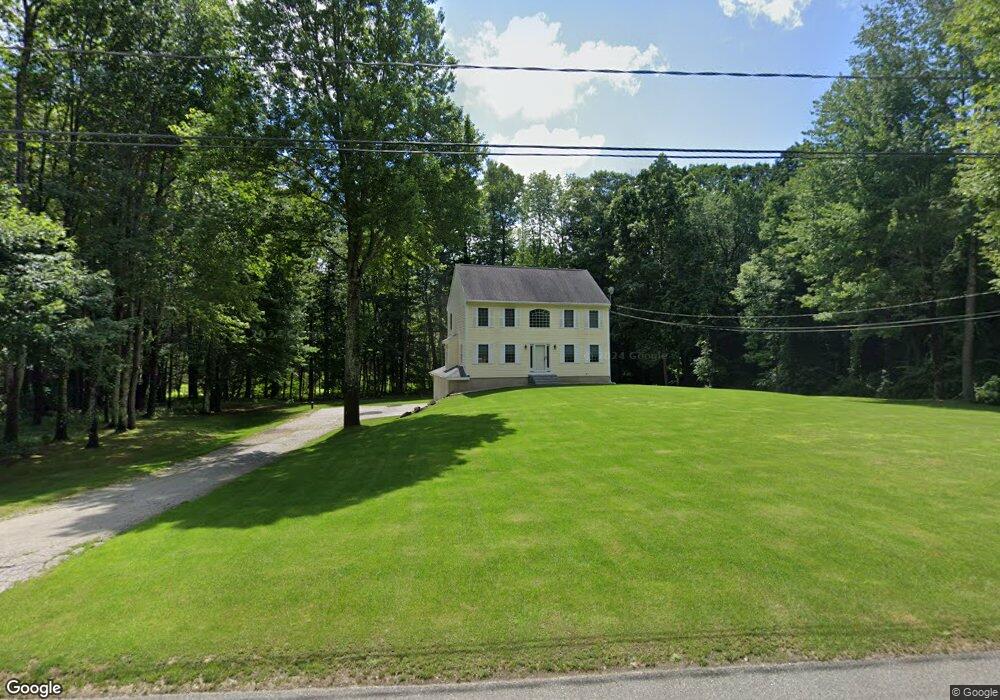
13 Ginaco Rd Epping, NH 03042
Estimated Value: $636,886 - $758,000
4
Beds
3
Baths
1,872
Sq Ft
$369/Sq Ft
Est. Value
About This Home
This home is located at 13 Ginaco Rd, Epping, NH 03042 and is currently estimated at $691,222, approximately $369 per square foot. 13 Ginaco Rd is a home located in Rockingham County with nearby schools including Epping Elementary School, Epping Middle School, and Epping High School.
Ownership History
Date
Name
Owned For
Owner Type
Purchase Details
Closed on
Sep 25, 2017
Sold by
Dore John P
Bought by
Dore John P and Dore Gina M
Current Estimated Value
Purchase Details
Closed on
Jun 30, 2000
Sold by
Robert Maslowski Bldr
Bought by
Dore John P
Home Financials for this Owner
Home Financials are based on the most recent Mortgage that was taken out on this home.
Original Mortgage
$170,900
Interest Rate
8.59%
Purchase Details
Closed on
Jan 21, 2000
Sold by
Costa Natalie M
Bought by
Dog Patch Acres Llc
Home Financials for this Owner
Home Financials are based on the most recent Mortgage that was taken out on this home.
Original Mortgage
$140,300
Interest Rate
7.84%
Create a Home Valuation Report for This Property
The Home Valuation Report is an in-depth analysis detailing your home's value as well as a comparison with similar homes in the area
Home Values in the Area
Average Home Value in this Area
Purchase History
| Date | Buyer | Sale Price | Title Company |
|---|---|---|---|
| Dore John P | -- | -- | |
| Dore John P | $179,900 | -- | |
| Dog Patch Acres Llc | $52,500 | -- |
Source: Public Records
Mortgage History
| Date | Status | Borrower | Loan Amount |
|---|---|---|---|
| Previous Owner | Dog Patch Acres Llc | $170,900 | |
| Previous Owner | Dog Patch Acres Llc | $140,300 |
Source: Public Records
Tax History Compared to Growth
Tax History
| Year | Tax Paid | Tax Assessment Tax Assessment Total Assessment is a certain percentage of the fair market value that is determined by local assessors to be the total taxable value of land and additions on the property. | Land | Improvement |
|---|---|---|---|---|
| 2024 | $8,455 | $335,100 | $113,400 | $221,700 |
| 2023 | $7,841 | $335,100 | $113,400 | $221,700 |
| 2022 | $7,536 | $335,100 | $113,400 | $221,700 |
| 2021 | $7,513 | $335,100 | $113,400 | $221,700 |
| 2020 | $7,922 | $335,100 | $113,400 | $221,700 |
| 2019 | $3,979 | $258,700 | $94,100 | $164,600 |
| 2018 | $6,711 | $258,700 | $94,100 | $164,600 |
| 2017 | $6,711 | $258,700 | $94,100 | $164,600 |
| 2016 | $6,711 | $258,700 | $94,100 | $164,600 |
| 2015 | $6,711 | $258,700 | $94,100 | $164,600 |
| 2014 | $6,149 | $251,800 | $94,100 | $157,700 |
| 2013 | $6,111 | $251,800 | $94,100 | $157,700 |
Source: Public Records
Map
Nearby Homes
- 20 Towle Rd
- 288 N River Rd
- 384 N River Rd
- 8 Mulberry Ln
- 21A Highland Ave Unit 21A
- 22 Dorothy Dr
- 153 Coffin Rd Unit 4
- 153 Coffin Rd Unit 5
- 153 Coffin Rd Unit 32
- 290 Calef Hwy Unit A6
- 5A Connor Ct Unit 5A
- 13 Elm St
- 15 Bartlett St
- 156 Hedding Rd
- 23 Camp Lee Rd
- 16B Lunas Ave Unit 16B
- 100 Megans Way
- 101 Megans Way Unit 101
- 96 Megans Way
- 97 Megans Way Unit 97