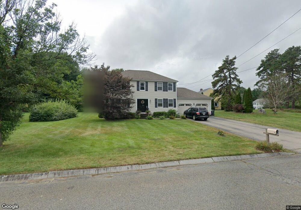
13 Marthas Way Franklin, MA 02038
Estimated Value: $726,000 - $785,000
3
Beds
2
Baths
1,728
Sq Ft
$438/Sq Ft
Est. Value
About This Home
This home is located at 13 Marthas Way, Franklin, MA 02038 and is currently estimated at $757,598, approximately $438 per square foot. 13 Marthas Way is a home located in Norfolk County with nearby schools including Helen Keller Elementary School, Annie Sullivan Middle School, and Franklin High School.
Ownership History
Date
Name
Owned For
Owner Type
Purchase Details
Closed on
Nov 8, 1999
Sold by
Ubertini Ronald J
Bought by
Canty Neil P and Canty Kathleen T
Current Estimated Value
Home Financials for this Owner
Home Financials are based on the most recent Mortgage that was taken out on this home.
Original Mortgage
$229,500
Outstanding Balance
$69,957
Interest Rate
7.73%
Mortgage Type
Purchase Money Mortgage
Estimated Equity
$687,641
Purchase Details
Closed on
May 28, 1993
Sold by
Marianne Bldg Corp
Bought by
Ubertini Ronald J
Home Financials for this Owner
Home Financials are based on the most recent Mortgage that was taken out on this home.
Original Mortgage
$120,000
Interest Rate
7.41%
Mortgage Type
Purchase Money Mortgage
Create a Home Valuation Report for This Property
The Home Valuation Report is an in-depth analysis detailing your home's value as well as a comparison with similar homes in the area
Purchase History
| Date | Buyer | Sale Price | Title Company |
|---|---|---|---|
| Canty Neil P | $270,000 | -- | |
| Ubertini Ronald J | $180,000 | -- |
Source: Public Records
Mortgage History
| Date | Status | Borrower | Loan Amount |
|---|---|---|---|
| Open | Ubertini Ronald J | $229,500 | |
| Previous Owner | Ubertini Ronald J | $175,000 | |
| Previous Owner | Ubertini Ronald J | $53,000 | |
| Previous Owner | Ubertini Ronald J | $120,000 |
Source: Public Records
Tax History
| Year | Tax Paid | Tax Assessment Tax Assessment Total Assessment is a certain percentage of the fair market value that is determined by local assessors to be the total taxable value of land and additions on the property. | Land | Improvement |
|---|---|---|---|---|
| 2025 | $7,310 | $629,100 | $328,000 | $301,100 |
| 2024 | $7,286 | $618,000 | $328,000 | $290,000 |
| 2023 | $6,992 | $555,800 | $279,600 | $276,200 |
| 2022 | $6,519 | $464,000 | $220,100 | $243,900 |
| 2021 | $6,716 | $458,400 | $247,100 | $211,300 |
| 2020 | $6,357 | $438,100 | $237,000 | $201,100 |
| 2019 | $6,269 | $427,600 | $226,900 | $200,700 |
| 2018 | $5,845 | $399,000 | $218,800 | $180,200 |
| 2017 | $5,581 | $382,800 | $202,600 | $180,200 |
| 2016 | $5,714 | $394,100 | $217,500 | $176,600 |
| 2015 | $5,687 | $383,200 | $206,600 | $176,600 |
| 2014 | $5,170 | $357,800 | $181,200 | $176,600 |
Source: Public Records
Map
Nearby Homes
- 75 Jordan Rd
- 3 Oak View Terrace Unit 3
- 30 Longobardi Dr Unit 30
- 14 Waites Crossing
- 9 Elliot Mills Unit 5
- 8 Elliot Mills Unit 30
- 5 Elliot Mills Unit 3
- 7 Elliot Mills Unit 4
- 10 Elliot Mills Unit 29
- 204 Lincoln St
- 17 Longhill Rd
- 20 Waites Crossing
- 19 Waites Crossing
- 13 Waites Crossing
- 62 Uncas Ave
- 14 Pleasant St Unit B
- 90 E Central St Unit 103
- 90 E Central St Unit 106
- 90 E Central St Unit 304
- 90 E Central St Unit 202
Your Personal Tour Guide
Ask me questions while you tour the home.