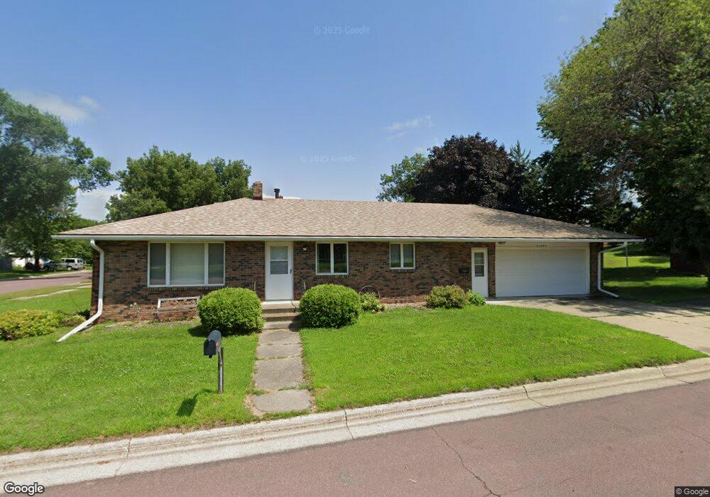
13 N Range Rd Springfield, MN 56087
Estimated Value: $137,000 - $221,000
3
Beds
2
Baths
1,324
Sq Ft
$144/Sq Ft
Est. Value
About This Home
This home is located at 13 N Range Rd, Springfield, MN 56087 and is currently estimated at $190,716, approximately $144 per square foot. 13 N Range Rd is a home located in Brown County with nearby schools including Springfield Elementary School, Springfield Secondary School, and St. Raphael Elementary School.
Ownership History
Date
Name
Owned For
Owner Type
Purchase Details
Closed on
Nov 8, 2023
Sold by
Bielen Craig and Bielen Lori
Bought by
Bielen Craig and Bielen Lori
Current Estimated Value
Purchase Details
Closed on
Sep 2, 2011
Sold by
Maurer Lucille M and Maurer John A
Bought by
Anderson Janice M
Home Financials for this Owner
Home Financials are based on the most recent Mortgage that was taken out on this home.
Original Mortgage
$72,000
Interest Rate
4.32%
Create a Home Valuation Report for This Property
The Home Valuation Report is an in-depth analysis detailing your home's value as well as a comparison with similar homes in the area
Purchase History
| Date | Buyer | Sale Price | Title Company |
|---|---|---|---|
| Bielen Craig | -- | None Listed On Document | |
| Anderson Janice M | -- | -- |
Source: Public Records
Mortgage History
| Date | Status | Borrower | Loan Amount |
|---|---|---|---|
| Previous Owner | Anderson Janice M | $72,000 |
Source: Public Records
Tax History
| Year | Tax Paid | Tax Assessment Tax Assessment Total Assessment is a certain percentage of the fair market value that is determined by local assessors to be the total taxable value of land and additions on the property. | Land | Improvement |
|---|---|---|---|---|
| 2024 | $2,830 | $173,600 | $9,000 | $164,600 |
| 2023 | $2,676 | $164,100 | $7,800 | $156,300 |
| 2022 | $2,254 | $133,500 | $6,800 | $126,700 |
| 2021 | $2,016 | $120,800 | $5,900 | $114,900 |
| 2020 | $1,992 | $117,900 | $5,900 | $112,000 |
| 2019 | $1,958 | $116,400 | $5,900 | $110,500 |
| 2018 | $1,858 | $115,600 | $5,900 | $109,700 |
| 2017 | $1,686 | $114,600 | $5,900 | $108,700 |
| 2016 | $1,664 | $102,267 | $0 | $0 |
| 2015 | -- | $0 | $0 | $0 |
| 2014 | -- | $0 | $0 | $0 |
| 2013 | -- | $0 | $0 | $0 |
Source: Public Records
Map
Nearby Homes
- 502 W Lincoln St
- 124 N Park Ave
- 111 N Park Ave
- 18 S Spring Ave
- 118 N O Connell Ave
- 40494 U S 14
- 401 S County Road 5 Unit 102
- xxx E Appel St
- Lot 5-8 E Winona St
- 23789 490th Ave
- 109 White St N
- 213 Brown St W
- 26609 County Road 45
- 13384 300th Ave
- 0 Co Rd 20 at 300th Ave Unit NOC6334138
- 210 2nd St E
- 118 Somerville Ave
- 411 Vernon Ave
- 605 Water St SW
- 0 9th Ave E Co Rd 15 Unit NOC6334620
- 623 W Lincoln St
- 619 W Lincoln St
- N N Range Rd
- 611 611 W Lincoln St
- 724 W Central St
- 620 W Lincoln St
- 101 N Range Rd
- 802 W Central St
- 716 W Central St
- 616 W Lincoln St
- 120 N Range Rd
- 607 W Lincoln St
- 712 W Central St
- 612 W Lincoln St
- 601 W Lincoln St
- 610 W Lincoln St
- 706 W Central St
- 602 W Lincoln St
- 623 W Rock St
- 717 W Central St
Your Personal Tour Guide
Ask me questions while you tour the home.