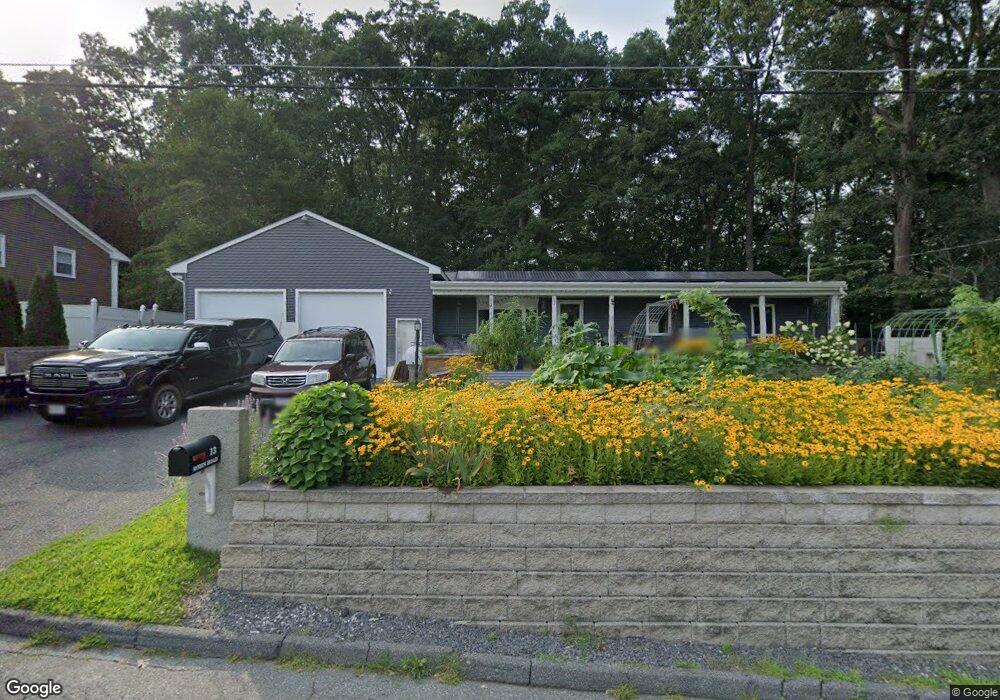
13 Robin Rd Milford, MA 01757
Estimated Value: $483,000 - $530,000
3
Beds
1
Bath
1,152
Sq Ft
$441/Sq Ft
Est. Value
About This Home
This home is located at 13 Robin Rd, Milford, MA 01757 and is currently estimated at $507,880, approximately $440 per square foot. 13 Robin Rd is a home located in Worcester County with nearby schools including Milford High School.
Ownership History
Date
Name
Owned For
Owner Type
Purchase Details
Closed on
Jun 16, 2025
Sold by
Packard Lt and Packard
Bought by
Weisman Warren
Current Estimated Value
Home Financials for this Owner
Home Financials are based on the most recent Mortgage that was taken out on this home.
Original Mortgage
$520,000
Outstanding Balance
$518,198
Interest Rate
6.76%
Mortgage Type
VA
Estimated Equity
-$10,318
Purchase Details
Closed on
Jul 25, 2022
Sold by
Packard Mark E and Packard Robbi
Bought by
Packard Lt
Purchase Details
Closed on
Jul 15, 2010
Sold by
Packard Mark E
Bought by
Packard Mark E and Packard Robbi
Home Financials for this Owner
Home Financials are based on the most recent Mortgage that was taken out on this home.
Original Mortgage
$241,511
Interest Rate
5.25%
Mortgage Type
FHA
Purchase Details
Closed on
Jun 13, 2006
Sold by
Packard Sandra L
Bought by
Packard Mark E
Purchase Details
Closed on
Apr 10, 1998
Sold by
Packard Lee E
Bought by
Packard Sandra L
Create a Home Valuation Report for This Property
The Home Valuation Report is an in-depth analysis detailing your home's value as well as a comparison with similar homes in the area
Home Values in the Area
Average Home Value in this Area
Purchase History
| Date | Buyer | Sale Price | Title Company |
|---|---|---|---|
| Weisman Warren | $520,000 | None Available | |
| Weisman Warren | $520,000 | None Available | |
| Packard Lt | -- | None Available | |
| Packard Lt | -- | None Available | |
| Packard Mark E | -- | -- | |
| Packard Mark E | -- | -- | |
| Packard Mark E | -- | -- | |
| Packard Mark E | $264,000 | -- | |
| Packard Mark E | $264,000 | -- | |
| Packard Sandra L | $25,000 | -- | |
| Packard Sandra L | $25,000 | -- |
Source: Public Records
Mortgage History
| Date | Status | Borrower | Loan Amount |
|---|---|---|---|
| Open | Weisman Warren | $520,000 | |
| Closed | Weisman Warren | $520,000 | |
| Previous Owner | Packard Mark E | $241,511 |
Source: Public Records
Tax History Compared to Growth
Tax History
| Year | Tax Paid | Tax Assessment Tax Assessment Total Assessment is a certain percentage of the fair market value that is determined by local assessors to be the total taxable value of land and additions on the property. | Land | Improvement |
|---|---|---|---|---|
| 2025 | $5,277 | $412,300 | $179,400 | $232,900 |
| 2024 | $5,188 | $390,400 | $172,200 | $218,200 |
| 2023 | $5,034 | $348,400 | $148,900 | $199,500 |
| 2022 | $4,951 | $321,700 | $136,300 | $185,400 |
| 2021 | $4,874 | $305,000 | $136,300 | $168,700 |
| 2020 | $4,609 | $288,800 | $136,300 | $152,500 |
| 2019 | $4,588 | $277,400 | $136,300 | $141,100 |
| 2018 | $4,398 | $265,600 | $132,800 | $132,800 |
| 2017 | $4,293 | $255,700 | $132,800 | $122,900 |
| 2016 | $4,321 | $251,500 | $132,800 | $118,700 |
| 2015 | $4,321 | $246,200 | $125,600 | $120,600 |
Source: Public Records
Map
Nearby Homes
- 9 Robin Rd
- 44 Silver Hill Rd
- 13 Hemlock Ln
- 54 Village Cir Unit 54
- 56 Village Cir
- 1 Tyler St
- 250 Congress St
- 44 Woodridge Rd
- 21 Shadowbrook Ln Unit 13
- 4 Kennedy Ln Unit 49
- 8 Colonial Rd
- 10 Shadowbrook Ln Unit 24
- 4 Shadowbrook Ln Unit 31
- 8 Shadowbrook Ln Unit 39
- 18 Shadowbrook Ln Unit 40
- 20 Senate Rd
- 19 Shadowbrook Ln Unit 13
- 11 Shadowbrook Ln Unit 9
- 9 Shadowbrook Ln Unit 27
- 3 Shadowbrook Ln Unit 3