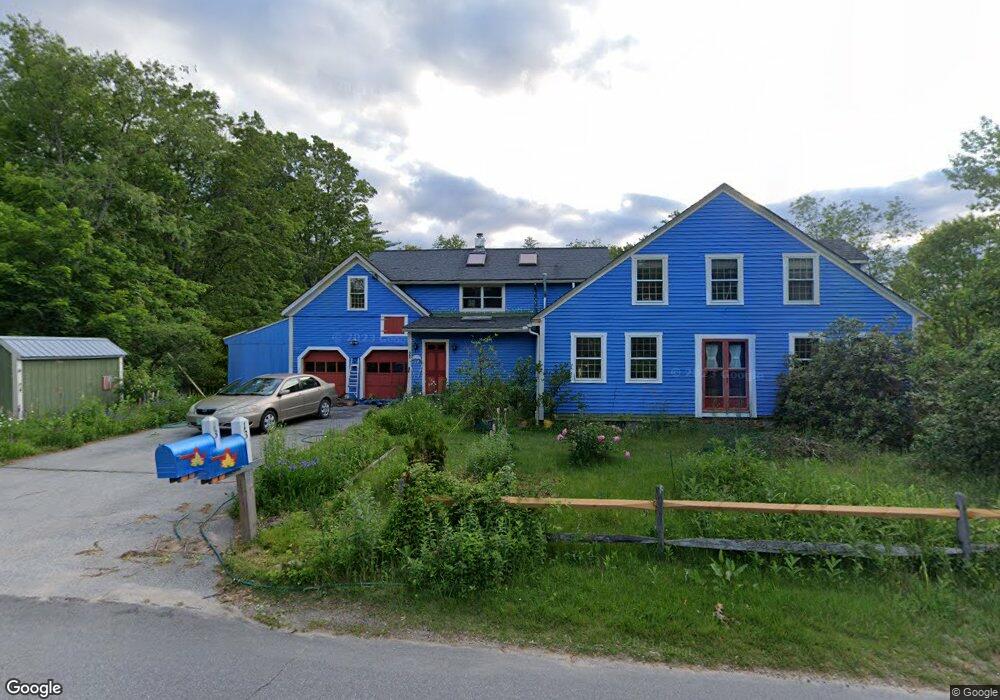
13 S Bennington Rd Bennington, NH 03442
Estimated Value: $385,000 - $491,000
3
Beds
2
Baths
2,561
Sq Ft
$167/Sq Ft
Est. Value
About This Home
This home is located at 13 S Bennington Rd, Bennington, NH 03442 and is currently estimated at $427,507, approximately $166 per square foot. 13 S Bennington Rd is a home with nearby schools including Pierce Elementary School, Great Brook School, and Conval Regional High School.
Ownership History
Date
Name
Owned For
Owner Type
Purchase Details
Closed on
May 29, 2013
Sold by
Davis Barbara M
Bought by
Maple Christopher M
Current Estimated Value
Purchase Details
Closed on
Oct 16, 2000
Sold by
Collemacine Domenic and Collemacine Angela J
Bought by
Byrne Lee F and Byrne Kelly A
Home Financials for this Owner
Home Financials are based on the most recent Mortgage that was taken out on this home.
Original Mortgage
$123,850
Interest Rate
7.89%
Create a Home Valuation Report for This Property
The Home Valuation Report is an in-depth analysis detailing your home's value as well as a comparison with similar homes in the area
Home Values in the Area
Average Home Value in this Area
Purchase History
| Date | Buyer | Sale Price | Title Company |
|---|---|---|---|
| Maple Christopher M | $230,000 | -- | |
| Byrne Lee F | $130,400 | -- |
Source: Public Records
Mortgage History
| Date | Status | Borrower | Loan Amount |
|---|---|---|---|
| Previous Owner | Byrne Lee F | $123,850 |
Source: Public Records
Tax History
| Year | Tax Paid | Tax Assessment Tax Assessment Total Assessment is a certain percentage of the fair market value that is determined by local assessors to be the total taxable value of land and additions on the property. | Land | Improvement |
|---|---|---|---|---|
| 2024 | $4,579 | $203,800 | $51,000 | $152,800 |
| 2023 | $6,552 | $203,800 | $51,000 | $152,800 |
| 2022 | $6,450 | $203,800 | $51,000 | $152,800 |
| 2020 | $2,051 | $203,800 | $51,000 | $152,800 |
| 2019 | $6,029 | $208,400 | $51,000 | $157,400 |
| 2018 | $5,553 | $170,800 | $44,000 | $126,800 |
| 2017 | $5,455 | $170,800 | $44,000 | $126,800 |
| 2016 | $5,428 | $170,800 | $44,000 | $126,800 |
| 2015 | $5,223 | $170,800 | $44,000 | $126,800 |
| 2014 | $4,987 | $170,800 | $44,000 | $126,800 |
| 2013 | $4,968 | $195,600 | $56,000 | $139,600 |
Source: Public Records
Map
Nearby Homes
- 8 Main St
- 10 Old Stagecoach Rd
- 25 Halcyon Place
- 31 Moose Brook Ln
- 137 Muzzy Hill Rd
- 155 Gillis Hill Rd
- 13 Elm St
- 44 Buttercup Ln
- 18 Antrim Rd
- 1388 Forest Rd
- 7 Spring Hill Rd
- 008-043-001 School House Rd
- 008-043-000 School House Rd
- Lot R11-11-1 Forest Rd
- Lot 7-13 Mountain Rd
- 146 Old Bennington Rd
- 12 Thompson Crossing Unit 231-1-1
- 38 Main St
- 29 Bonds Corner Rd
- 1195 Bennington Rd
- 1 Old Greenfield Rd
- 14 S Bennington Rd
- 8 S Bennington Rd
- 8 S Bennington Rd
- 6 Old Greenfield Rd
- 9 S Bennington Rd
- 5 S Bennington Rd
- 1-16-1 S Bennington Rd
- 1-16-2 S Bennington Rd
- 4 S Bennington Rd
- 9 Greenfield Rd
- 8 Acre St
- 35 S Bennington Rd
- 14 Acre St
- 16 Acre St
- 18 Acre St
- 10 Greenfield Rd Unit Rear
- 10 Greenfield Rd
- 43 S Bennington Rd
- 7 Acre St
Your Personal Tour Guide
Ask me questions while you tour the home.