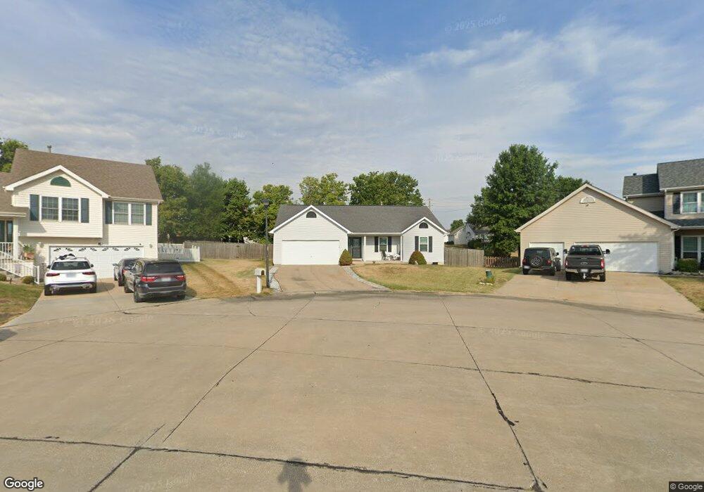
13 Spangle Way Dr O Fallon, MO 63366
Estimated Value: $356,000 - $374,129
3
Beds
2
Baths
1,720
Sq Ft
$215/Sq Ft
Est. Value
About This Home
This home is located at 13 Spangle Way Dr, O Fallon, MO 63366 and is currently estimated at $369,032, approximately $214 per square foot. 13 Spangle Way Dr is a home located in St. Charles County with nearby schools including Rock Creek Elementary School, Fort Zumwalt West Middle School, and Fort Zumwalt West High School.
Ownership History
Date
Name
Owned For
Owner Type
Purchase Details
Closed on
May 15, 1998
Sold by
Ed Crow Corp
Bought by
Taylor David P and Taylor Theresa E
Current Estimated Value
Home Financials for this Owner
Home Financials are based on the most recent Mortgage that was taken out on this home.
Original Mortgage
$108,129
Outstanding Balance
$21,146
Interest Rate
7.11%
Mortgage Type
FHA
Estimated Equity
$347,886
Purchase Details
Closed on
Apr 7, 1998
Sold by
Company Kaplan Development And Investment
Bought by
Ed Crow Corp
Home Financials for this Owner
Home Financials are based on the most recent Mortgage that was taken out on this home.
Original Mortgage
$108,129
Outstanding Balance
$21,146
Interest Rate
7.11%
Mortgage Type
FHA
Estimated Equity
$347,886
Create a Home Valuation Report for This Property
The Home Valuation Report is an in-depth analysis detailing your home's value as well as a comparison with similar homes in the area
Home Values in the Area
Average Home Value in this Area
Purchase History
| Date | Buyer | Sale Price | Title Company |
|---|---|---|---|
| Taylor David P | -- | -- | |
| Ed Crow Corp | -- | -- |
Source: Public Records
Mortgage History
| Date | Status | Borrower | Loan Amount |
|---|---|---|---|
| Open | Taylor David P | $108,129 | |
| Closed | Ed Crow Corp | $86,902 |
Source: Public Records
Tax History Compared to Growth
Tax History
| Year | Tax Paid | Tax Assessment Tax Assessment Total Assessment is a certain percentage of the fair market value that is determined by local assessors to be the total taxable value of land and additions on the property. | Land | Improvement |
|---|---|---|---|---|
| 2025 | $3,617 | $62,117 | -- | -- |
| 2023 | $3,618 | $54,625 | $0 | $0 |
| 2022 | $3,271 | $45,920 | $0 | $0 |
| 2021 | $3,274 | $45,920 | $0 | $0 |
| 2020 | $3,131 | $42,555 | $0 | $0 |
| 2019 | $3,138 | $42,555 | $0 | $0 |
| 2018 | $2,931 | $37,933 | $0 | $0 |
| 2017 | $2,893 | $37,933 | $0 | $0 |
| 2016 | $2,705 | $35,335 | $0 | $0 |
| 2015 | $2,515 | $35,335 | $0 | $0 |
| 2014 | $2,356 | $32,552 | $0 | $0 |
Source: Public Records
Map
Nearby Homes
- 5 Prescott Ct
- 7 Cherokee Sunset Ct
- 66 Hickory Meadows Ct
- 1222 Pinehurst Club Ct
- 19 Millers Ct
- 114 Cloverleaf Meadows Ct
- 158 Weatherby Landing Dr
- New Build Berkshire II "D" @ Inverness
- New Build Berkshire "A" @ Inverness
- 130 Royal Troon Dr
- 4 Challenger (Grand Columbia) Ct
- TBB Glenwyck "A"@inverness
- 217 Roaring River Dr
- New Build Berkshire "C" @ Inverness
- The Grand Magnolia Plan at Columbia Meadows
- The Grand Columbia Plan at Columbia Meadows
- The Grand Columbia II Plan at Columbia Meadows
- The Magnolia Plan at Columbia Meadows
- The Columbia Plan at Columbia Meadows
- 4 Challenger Ct
- 11 Spangle Way Dr
- 15 Spangle Way Dr
- 1144 Ivy Point Dr
- 1148 Ivy Point Dr
- 1140 Ivy Point Dr
- 1152 Ivy Point Dr
- 17 Spangle Way Dr
- 9 Spangle Way Dr
- 1136 Ivy Point Dr
- 14 Spangle Way Dr
- 1156 Ivy Point Dr
- 1132 Ivy Point Dr
- 19 Spangle Way Dr
- 7 Spangle Way Dr
- 8 Spangle Way Dr
- 1145 Ivy Point Dr
- 1149 Ivy Point Dr
- 18 Spangle Way Dr
- 1141 Ivy Point Dr
- 1160 Ivy Point Dr