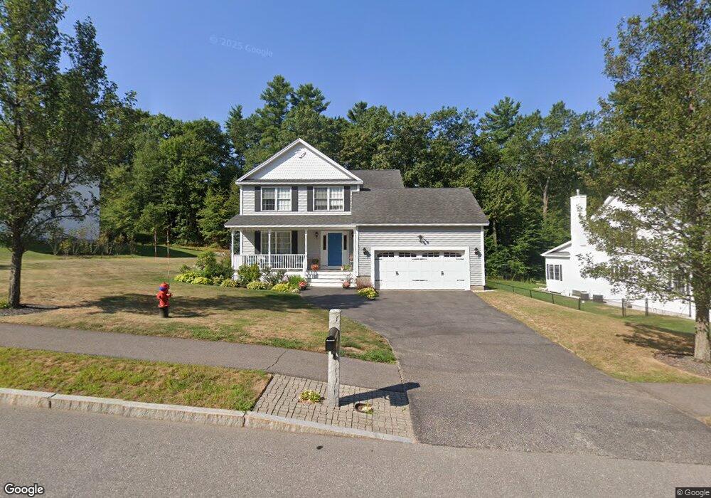
13 University Cir Hooksett, NH 03106
Estimated Value: $639,000 - $737,000
3
Beds
3
Baths
2,016
Sq Ft
$343/Sq Ft
Est. Value
About This Home
This home is located at 13 University Cir, Hooksett, NH 03106 and is currently estimated at $690,799, approximately $342 per square foot. 13 University Cir is a home located in Merrimack County with nearby schools including Fred C. Underhill School, Hooksett Memorial School, and David R. Cawley Middle School.
Ownership History
Date
Name
Owned For
Owner Type
Purchase Details
Closed on
Sep 13, 2023
Sold by
Economu William and Economu Marlene
Bought by
Economu Marlene Ft and Economu
Current Estimated Value
Purchase Details
Closed on
Jun 1, 2010
Sold by
Corsair Park Developme
Bought by
Economu William and Economu Marlene
Home Financials for this Owner
Home Financials are based on the most recent Mortgage that was taken out on this home.
Original Mortgage
$66,500
Interest Rate
5.13%
Mortgage Type
Purchase Money Mortgage
Create a Home Valuation Report for This Property
The Home Valuation Report is an in-depth analysis detailing your home's value as well as a comparison with similar homes in the area
Home Values in the Area
Average Home Value in this Area
Purchase History
| Date | Buyer | Sale Price | Title Company |
|---|---|---|---|
| Economu Marlene Ft | -- | None Available | |
| Economu William | $292,000 | -- |
Source: Public Records
Mortgage History
| Date | Status | Borrower | Loan Amount |
|---|---|---|---|
| Previous Owner | Economu William | $90,000 | |
| Previous Owner | Economu William | $66,500 |
Source: Public Records
Tax History Compared to Growth
Tax History
| Year | Tax Paid | Tax Assessment Tax Assessment Total Assessment is a certain percentage of the fair market value that is determined by local assessors to be the total taxable value of land and additions on the property. | Land | Improvement |
|---|---|---|---|---|
| 2024 | $9,750 | $574,900 | $182,000 | $392,900 |
| 2023 | $9,187 | $574,900 | $182,000 | $392,900 |
| 2022 | $7,876 | $327,500 | $107,700 | $219,800 |
| 2021 | $7,277 | $327,500 | $107,700 | $219,800 |
| 2020 | $7,372 | $327,500 | $107,700 | $219,800 |
| 2019 | $7,058 | $327,500 | $107,700 | $219,800 |
| 2018 | $7,244 | $327,500 | $107,700 | $219,800 |
| 2017 | $7,391 | $276,400 | $85,900 | $190,500 |
| 2016 | $7,294 | $276,400 | $85,900 | $190,500 |
| 2015 | $5,777 | $276,400 | $85,900 | $190,500 |
| 2014 | $5,035 | $276,400 | $85,900 | $190,500 |
| 2013 | -- | $276,400 | $85,900 | $190,500 |
Source: Public Records
Map
Nearby Homes
- 12 Crawford Ln
- 14 Manor Dr Unit D
- 12 Manor Dr Unit B
- 1821 Hooksett Rd
- 2 Memory Ln
- 1601 Hooksett Rd
- 2 Wedgewood Cir Unit 14
- 46 Moose Pond Terrace
- 65 Marlette Ave
- 62 Pine St
- 254 W River Rd
- 15 Sullivan Dr
- 2 Cheryl Dr
- 15 Main St
- 245 W River Rd
- 10 Lane Dr
- 53 Cross Rd
- 19 Sullivan Dr
- 422 Dawn Dr Unit 23
- 427 Dawn Dr Unit 15
- 13 University Cir
- 13 University Cir
- 13 University Cir
- 13 University Cir Unit 13-12
- 13 University Cir
- 13 University Cir
- 13 University Cir
- 13 University Cir
- 13 University Cir
- 13 University Cir
- 13 University Cir
- 13 University Cir
- 13 University Cir
- 13 University Cir
- 13 University Cir
- 13 University Cir
- 13 University Cir
- 13 University Cir
- 13 University Cir
- 13 University Cir