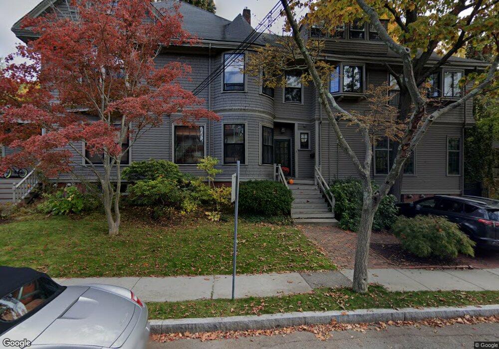
130 Brattle St Unit A Cambridge, MA 02138
West Cambridge NeighborhoodEstimated Value: $4,595,000 - $5,559,000
5
Beds
5
Baths
5,545
Sq Ft
$937/Sq Ft
Est. Value
About This Home
This home is located at 130 Brattle St Unit A, Cambridge, MA 02138 and is currently estimated at $5,197,048, approximately $937 per square foot. 130 Brattle St Unit A is a home located in Middlesex County with nearby schools including St Peter School, Cambridge Montessori School, and Cambridge Friends School.
Ownership History
Date
Name
Owned For
Owner Type
Purchase Details
Closed on
Aug 2, 2005
Sold by
Mack Daniel John and Mack David Anthony
Bought by
Blotnick Judith K
Current Estimated Value
Purchase Details
Closed on
Jun 10, 1997
Sold by
Kahn Alvin and North Betty
Bought by
Mack John E
Home Financials for this Owner
Home Financials are based on the most recent Mortgage that was taken out on this home.
Original Mortgage
$552,000
Interest Rate
7.98%
Mortgage Type
Purchase Money Mortgage
Create a Home Valuation Report for This Property
The Home Valuation Report is an in-depth analysis detailing your home's value as well as a comparison with similar homes in the area
Home Values in the Area
Average Home Value in this Area
Purchase History
| Date | Buyer | Sale Price | Title Company |
|---|---|---|---|
| Blotnick Judith K | $2,450,000 | -- | |
| Mack John E | $850,000 | -- |
Source: Public Records
Mortgage History
| Date | Status | Borrower | Loan Amount |
|---|---|---|---|
| Previous Owner | Mack John E | $600,000 | |
| Previous Owner | Mack John E | $552,000 |
Source: Public Records
Tax History
| Year | Tax Paid | Tax Assessment Tax Assessment Total Assessment is a certain percentage of the fair market value that is determined by local assessors to be the total taxable value of land and additions on the property. | Land | Improvement |
|---|---|---|---|---|
| 2025 | $35,469 | $5,585,600 | $0 | $5,585,600 |
| 2024 | $34,700 | $5,861,500 | $0 | $5,861,500 |
| 2023 | $30,255 | $5,163,000 | $0 | $5,163,000 |
| 2022 | $29,440 | $4,972,900 | $0 | $4,972,900 |
| 2021 | $28,079 | $4,799,800 | $0 | $4,799,800 |
| 2020 | $25,143 | $4,372,700 | $0 | $4,372,700 |
| 2019 | $24,084 | $4,054,500 | $0 | $4,054,500 |
| 2018 | $24,551 | $3,726,800 | $0 | $3,726,800 |
| 2017 | $23,809 | $3,668,600 | $0 | $3,668,600 |
| 2016 | $23,226 | $3,322,800 | $0 | $3,322,800 |
| 2015 | $23,056 | $2,948,400 | $0 | $2,948,400 |
| 2014 | $22,748 | $2,714,600 | $0 | $2,714,600 |
Source: Public Records
Map
Nearby Homes
- 46 Foster St
- 3 Berkeley Place
- 35 Willard St
- 4 Craigie St Unit 2
- 153 Brattle St
- 22 Concord Ave Unit 10
- 22 Concord Ave Unit 11
- 14 Concord Ave Unit 624
- 157 Brattle St
- 1010 Memorial Dr Unit 6F
- 159 Brattle St
- 44 Garden St
- 992 Memorial Dr Unit 106
- 5 Brewer St Unit 5
- 58 Shepard St
- 172 Brattle St
- 985 Memorial Dr Unit 603
- 985 Memorial Dr Unit 303
- 984 Memorial Dr Unit 984-503
- 15 Madison St Unit 1
Your Personal Tour Guide
Ask me questions while you tour the home.