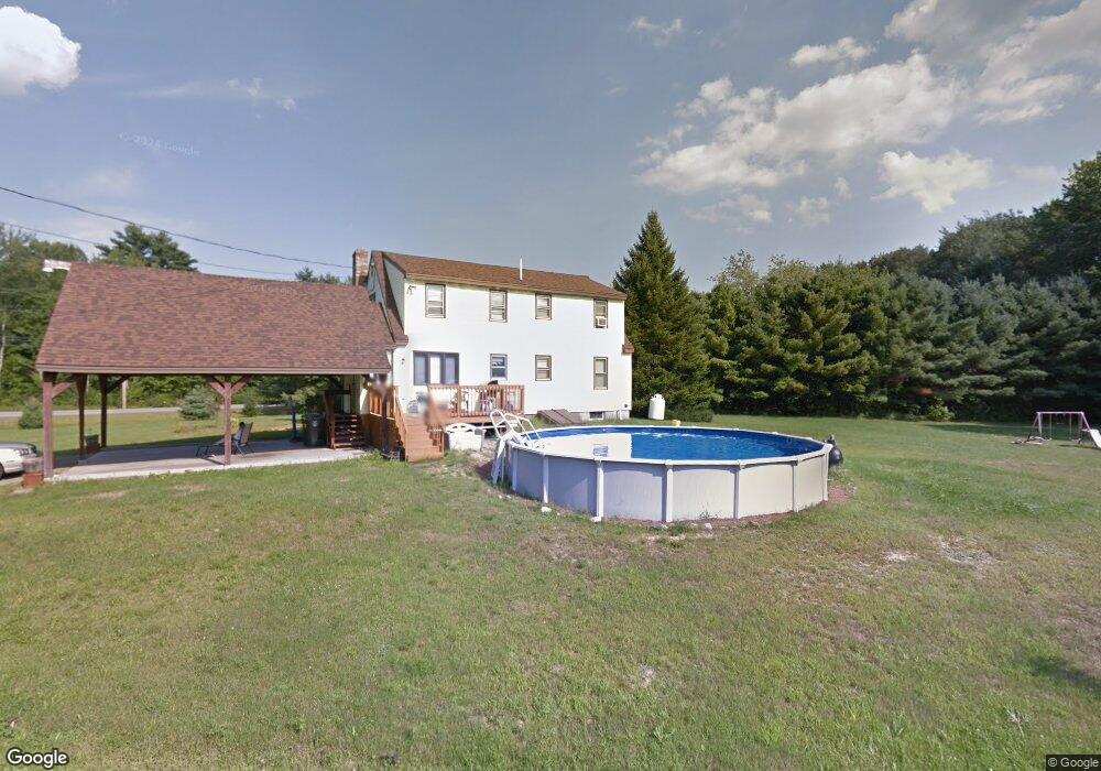
130 Buxton Rd Saco, ME 04072
North Saco NeighborhoodEstimated Value: $470,132 - $509,000
4
Beds
2
Baths
1,544
Sq Ft
$319/Sq Ft
Est. Value
About This Home
This home is located at 130 Buxton Rd, Saco, ME 04072 and is currently estimated at $492,783, approximately $319 per square foot. 130 Buxton Rd is a home located in York County with nearby schools including C K Burns School, Saco Middle School, and Saint James School.
Ownership History
Date
Name
Owned For
Owner Type
Purchase Details
Closed on
Apr 4, 2011
Sold by
Laskey Laura J
Bought by
Bedell Sarah W and Bedell Scott B
Current Estimated Value
Home Financials for this Owner
Home Financials are based on the most recent Mortgage that was taken out on this home.
Original Mortgage
$200,679
Outstanding Balance
$139,993
Interest Rate
5.04%
Mortgage Type
FHA
Estimated Equity
$352,790
Create a Home Valuation Report for This Property
The Home Valuation Report is an in-depth analysis detailing your home's value as well as a comparison with similar homes in the area
Home Values in the Area
Average Home Value in this Area
Purchase History
| Date | Buyer | Sale Price | Title Company |
|---|---|---|---|
| Bedell Sarah W | -- | -- |
Source: Public Records
Mortgage History
| Date | Status | Borrower | Loan Amount |
|---|---|---|---|
| Open | Bedell Sarah W | $200,679 |
Source: Public Records
Tax History
| Year | Tax Paid | Tax Assessment Tax Assessment Total Assessment is a certain percentage of the fair market value that is determined by local assessors to be the total taxable value of land and additions on the property. | Land | Improvement |
|---|---|---|---|---|
| 2024 | $4,951 | $352,400 | $148,500 | $203,900 |
| 2023 | $5,198 | $352,400 | $148,500 | $203,900 |
| 2022 | $4,711 | $257,000 | $113,000 | $144,000 |
| 2021 | $4,526 | $239,700 | $101,700 | $138,000 |
| 2020 | $4,243 | $215,700 | $89,700 | $126,000 |
| 2019 | $4,180 | $215,700 | $89,700 | $126,000 |
| 2018 | $4,019 | $207,400 | $81,400 | $126,000 |
| 2017 | $3,744 | $193,200 | $74,400 | $118,800 |
| 2016 | $3,552 | $182,900 | $58,100 | $124,800 |
| 2015 | $3,473 | $180,700 | $58,100 | $122,600 |
| 2014 | $3,365 | $180,700 | $58,100 | $122,600 |
| 2013 | $3,357 | $180,700 | $58,100 | $122,600 |
Source: Public Records
Map
Nearby Homes
- 4 Primrose Ln
- 18 Buxton Rd
- 5 Coltons Way
- 4 Spool St Unit 101
- 43 New County Rd
- 9 Nottingham Dr
- 51 Sancho Dr
- 6 Lina Ave
- 18A Garfield St
- 0 Simpson Rd
- 7 Hubbard St
- 8 Oakland St
- 5 Brentwood Cir
- TBD Oakland St
- 00 Cottonwood Dr
- 22 Tasker St Unit 11
- 22 Tasker St Unit 10
- 2 Labonte Ave E
- 3 Labonte Ave E
- 224 North St Unit 105
Your Personal Tour Guide
Ask me questions while you tour the home.