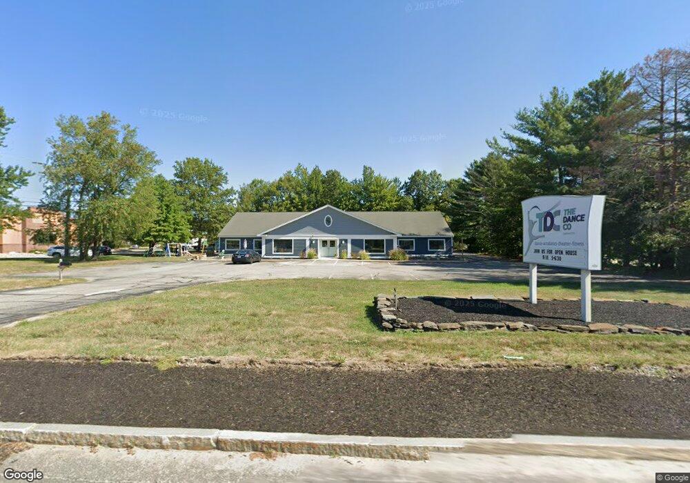
130 State Route 101a Amherst, NH 03031
Estimated Value: $1,745,390
--
Bed
--
Bath
8,500
Sq Ft
$205/Sq Ft
Est. Value
About This Home
This home is located at 130 State Route 101a, Amherst, NH 03031 and is currently estimated at $1,745,390, approximately $205 per square foot. 130 State Route 101a is a home located in Hillsborough County with nearby schools including Wilkins Elementary School, Amherst Middle School, and Souhegan Cooperative High School.
Ownership History
Date
Name
Owned For
Owner Type
Purchase Details
Closed on
May 10, 2019
Sold by
Ladeau Georger J
Bought by
Wilkerson Enterprises Llc
Current Estimated Value
Home Financials for this Owner
Home Financials are based on the most recent Mortgage that was taken out on this home.
Original Mortgage
$460,000
Outstanding Balance
$401,072
Interest Rate
4%
Mortgage Type
New Conventional
Estimated Equity
$1,344,318
Purchase Details
Closed on
Dec 31, 2013
Sold by
Ladeau Richard J
Bought by
Ladeau George J
Create a Home Valuation Report for This Property
The Home Valuation Report is an in-depth analysis detailing your home's value as well as a comparison with similar homes in the area
Home Values in the Area
Average Home Value in this Area
Purchase History
| Date | Buyer | Sale Price | Title Company |
|---|---|---|---|
| Wilkerson Enterprises Llc | $919,533 | -- | |
| Ladeau George J | $400,000 | -- |
Source: Public Records
Mortgage History
| Date | Status | Borrower | Loan Amount |
|---|---|---|---|
| Open | Wilkerson Enterprises Llc | $460,000 | |
| Previous Owner | Ladeau George J | $310,000 | |
| Previous Owner | Ladeau George J | $500,000 |
Source: Public Records
Tax History Compared to Growth
Tax History
| Year | Tax Paid | Tax Assessment Tax Assessment Total Assessment is a certain percentage of the fair market value that is determined by local assessors to be the total taxable value of land and additions on the property. | Land | Improvement |
|---|---|---|---|---|
| 2024 | $17,748 | $774,000 | $324,100 | $449,900 |
| 2023 | $16,935 | $774,000 | $324,100 | $449,900 |
| 2022 | $16,355 | $774,000 | $324,100 | $449,900 |
| 2021 | $16,494 | $774,000 | $324,100 | $449,900 |
| 2020 | $19,369 | $680,100 | $308,700 | $371,400 |
| 2019 | $16,510 | $612,400 | $308,700 | $303,700 |
| 2018 | $4,490 | $612,400 | $308,700 | $303,700 |
| 2017 | $15,929 | $612,400 | $308,700 | $303,700 |
| 2016 | $15,371 | $612,400 | $308,700 | $303,700 |
| 2015 | $15,565 | $587,800 | $315,000 | $272,800 |
| 2014 | $15,671 | $587,800 | $315,000 | $272,800 |
| 2013 | $15,547 | $587,800 | $315,000 | $272,800 |
Source: Public Records
Map
Nearby Homes
- 25 Eastern Ave
- 206 S Merrimack Rd
- 15 Four Winds Rd
- 77 Mooar Hill Rd
- 6 Veterans Rd Unit 15
- 3 Roedean Dr Unit C-207
- 101-2 Seaverns Bridge Rd
- 103 Seaverns Bridge Rd
- 80 Peaslee Rd
- 201 Millwright Dr
- 105 Seaverns Bridge Rd
- 218 Millwright Dr Unit 218
- 16 Captain Danforth Ln
- 1 County Rd
- 8 Pilgrim Cir
- 11 Queens Way
- 5 Dumaine Ave Unit B
- 5 Dumaine Ave Unit N
- 77 Deerwood Dr Unit E
- 75 Deerwood Dr Unit B
- 130 New Hampshire 101a
- 2 Truell Rd
- 4 Truell Rd
- 1 Truell Rd
- 5 Truell Rd
- 6 Truell Rd
- 125 State Route 101a Unit 35
- 125 Nh 101a Unit 35
- 135 State Route 101a
- 135 Route101a Hwy
- 135 New Hampshire 101a
- 8 Truell Rd
- 141 New Hampshire 101a
- 141 State Route 101a
- 5 Willow Ln
- 2 Craftsman Ln
- 2 Craftsman Ln Unit 1
- 2 N Hollis Rd
- 4 Craftsman Ln Unit 2
- 6 Willow Ln