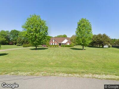
130 Surevue Dr Murfreesboro, TN 37127
Plainview NeighborhoodEstimated Value: $482,716 - $575,000
--
Bed
3
Baths
2,449
Sq Ft
$216/Sq Ft
Est. Value
About This Home
This home is located at 130 Surevue Dr, Murfreesboro, TN 37127 and is currently estimated at $529,929, approximately $216 per square foot. 130 Surevue Dr is a home located in Rutherford County with nearby schools including Buchanan Elementary School, Whitworth-Buchanan Middle School, and Riverdale High School.
Ownership History
Date
Name
Owned For
Owner Type
Purchase Details
Closed on
Mar 30, 2006
Sold by
Gentry Wheat William
Bought by
Kerstetter David L and Kerstetter Barbara G
Current Estimated Value
Home Financials for this Owner
Home Financials are based on the most recent Mortgage that was taken out on this home.
Original Mortgage
$196,720
Interest Rate
6.2%
Purchase Details
Closed on
Jun 21, 2004
Sold by
Patrick Staley and Patrick Catherine
Bought by
Wheat William G and Wheat Allison R
Home Financials for this Owner
Home Financials are based on the most recent Mortgage that was taken out on this home.
Original Mortgage
$152,000
Interest Rate
4.88%
Create a Home Valuation Report for This Property
The Home Valuation Report is an in-depth analysis detailing your home's value as well as a comparison with similar homes in the area
Home Values in the Area
Average Home Value in this Area
Purchase History
| Date | Buyer | Sale Price | Title Company |
|---|---|---|---|
| Kerstetter David L | $245,900 | -- | |
| Wheat William G | $190,000 | -- |
Source: Public Records
Mortgage History
| Date | Status | Borrower | Loan Amount |
|---|---|---|---|
| Open | Kerstetter David Lawrence | $40,000 | |
| Closed | Kerstetter Barbara G Dav | $140,688 | |
| Closed | Wheat William G | $196,720 | |
| Previous Owner | Wheat William G | $152,000 | |
| Previous Owner | Wheat William G | $38,000 | |
| Previous Owner | Staley Patrick L | $126,500 | |
| Previous Owner | Staley Patrick L | $130,500 |
Source: Public Records
Tax History Compared to Growth
Tax History
| Year | Tax Paid | Tax Assessment Tax Assessment Total Assessment is a certain percentage of the fair market value that is determined by local assessors to be the total taxable value of land and additions on the property. | Land | Improvement |
|---|---|---|---|---|
| 2024 | $1,916 | $102,100 | $15,825 | $86,275 |
| 2023 | $1,916 | $102,100 | $15,825 | $86,275 |
| 2022 | $1,659 | $102,625 | $15,825 | $86,800 |
| 2021 | $1,616 | $72,825 | $12,950 | $59,875 |
| 2020 | $1,616 | $72,825 | $12,950 | $59,875 |
| 2019 | $1,616 | $72,825 | $12,950 | $59,875 |
| 2018 | $1,529 | $72,825 | $0 | $0 |
| 2017 | $1,492 | $55,675 | $0 | $0 |
| 2016 | $1,492 | $55,675 | $0 | $0 |
| 2015 | $1,492 | $55,675 | $0 | $0 |
| 2014 | $1,384 | $55,675 | $0 | $0 |
| 2013 | -- | $56,200 | $0 | $0 |
Source: Public Records
Map
Nearby Homes
- 4357 Aurora Cir
- 4349 Doral Dr
- 4211 Aurora Cir Unit 5
- 4332 Doral Dr
- 4257 Aurora Cir
- 1840 Bethpage Dr
- 4311 Spyglass Dr
- 4312 Spyglass Dr
- 4305 Doral Dr
- 1508 Sunray Dr
- 1843 Streamsong Dr
- 1845 Streamsong Dr
- 1847 Streamsong Dr
- 4204 Spyglass Dr
- 4203 Sarazen Ln
- 4218 Golden Sun Ct
- 5616 Maples Retreat Dr
- 3639 Lavender Trail
- 3927 Runyan Cove
- 4003 Runyan Cove