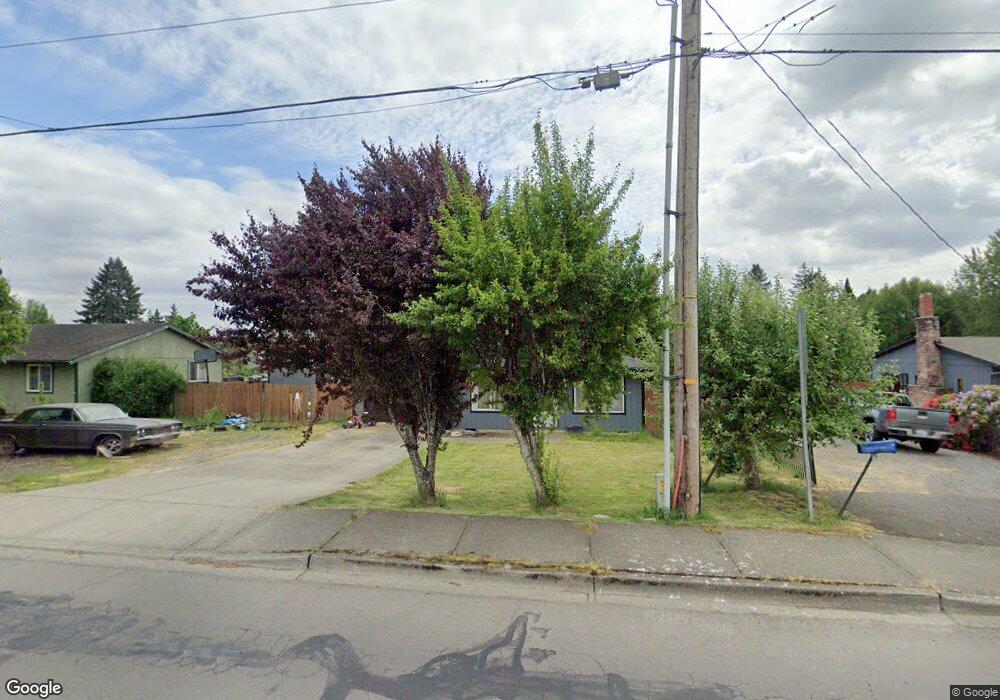
130 W 10th St La Center, WA 98629
Estimated Value: $383,534 - $407,000
3
Beds
2
Baths
1,008
Sq Ft
$393/Sq Ft
Est. Value
About This Home
This home is located at 130 W 10th St, La Center, WA 98629 and is currently estimated at $396,178, approximately $393 per square foot. 130 W 10th St is a home located in Clark County with nearby schools including La Center Elementary School, La Center Middle School, and La Center High School.
Ownership History
Date
Name
Owned For
Owner Type
Purchase Details
Closed on
Oct 6, 2003
Sold by
Kerr Curtis K and Kerr Dawn M
Bought by
Williams William and Williams Twila
Current Estimated Value
Home Financials for this Owner
Home Financials are based on the most recent Mortgage that was taken out on this home.
Original Mortgage
$126,022
Outstanding Balance
$59,051
Interest Rate
6.27%
Mortgage Type
FHA
Estimated Equity
$337,127
Create a Home Valuation Report for This Property
The Home Valuation Report is an in-depth analysis detailing your home's value as well as a comparison with similar homes in the area
Home Values in the Area
Average Home Value in this Area
Purchase History
| Date | Buyer | Sale Price | Title Company |
|---|---|---|---|
| Williams William | $128,032 | Fidelity National Title |
Source: Public Records
Mortgage History
| Date | Status | Borrower | Loan Amount |
|---|---|---|---|
| Open | Williams William | $126,022 |
Source: Public Records
Tax History Compared to Growth
Tax History
| Year | Tax Paid | Tax Assessment Tax Assessment Total Assessment is a certain percentage of the fair market value that is determined by local assessors to be the total taxable value of land and additions on the property. | Land | Improvement |
|---|---|---|---|---|
| 2025 | $2,689 | $299,509 | $134,943 | $164,566 |
| 2024 | $2,582 | $290,938 | $134,943 | $155,995 |
| 2023 | $2,474 | $290,915 | $131,013 | $159,902 |
| 2022 | $2,346 | $269,371 | $112,754 | $156,617 |
| 2021 | $2,267 | $226,717 | $90,203 | $136,514 |
| 2020 | $2,170 | $206,374 | $83,760 | $122,614 |
| 2019 | $2,079 | $193,242 | $75,384 | $117,858 |
| 2018 | $1,871 | $188,456 | $0 | $0 |
| 2017 | $1,591 | $167,705 | $0 | $0 |
| 2016 | $1,559 | $151,348 | $0 | $0 |
| 2015 | $1,521 | $138,155 | $0 | $0 |
| 2014 | -- | $128,858 | $0 | $0 |
| 2013 | -- | $114,989 | $0 | $0 |
Source: Public Records
Map
Nearby Homes
- 1202 W Avocet Place
- 124 W 12th Way
- 136 W 13th Way
- 1003 E Southview Heights Dr
- 135 E Airedale Ave
- 1503 W Alder Place
- 101 W 15th Cir
- 642 E Pioneer Loop
- 313 E Caribou Ct
- 313 E Caribou Ct Unit 24
- 0000 NW 9th Ave
- 790 E 15th Cir
- 120 W 19th St
- Grandview Plan at Stephens Hillside Farm
- Chelan Plan at Stephens Hillside Farm
- Baker Plan at Stephens Hillside Farm
- Cashmere Plan at Stephens Hillside Farm
- Brier Plan at Stephens Hillside Farm
- Deschutes Plan at Stephens Hillside Farm
- Everson Plan at Stephens Hillside Farm
- 116 W 10th St
- 1017 W 8th Cir
- 140 W 10th St
- 880 Aspen Ave
- 185 W 10th St
- 171 W 10th St
- 200 W 10th St
- 810 Aspen Ave
- 135 W 10th St
- 135 W 10th St
- 1033 W 8th Cir
- 230 W 10th St
- 1000 E Southview Heights Dr
- 225 W 10th St
- 225 W 10th St
- 1020 W 8th Cir
- 1110 Aspen Ave
- 879 Aspen Ave
- 1104 W Pacific Place
- 710 Aspen Ave