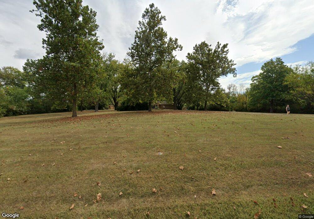
1301 SW Scherer Rd Lees Summit, MO 64082
Estimated Value: $458,000 - $646,517
3
Beds
5
Baths
3,797
Sq Ft
$138/Sq Ft
Est. Value
About This Home
This home is located at 1301 SW Scherer Rd, Lees Summit, MO 64082 and is currently estimated at $525,879, approximately $138 per square foot. 1301 SW Scherer Rd is a home located in Jackson County with nearby schools including Hawthorn Hill Elementary School, Summit Lakes Middle School, and Lee's Summit West High School.
Ownership History
Date
Name
Owned For
Owner Type
Purchase Details
Closed on
Nov 21, 1995
Sold by
King Sandra Kay and Harvey Louise Marie
Bought by
Smith Darrell L and Smith Carol A
Current Estimated Value
Home Financials for this Owner
Home Financials are based on the most recent Mortgage that was taken out on this home.
Original Mortgage
$118,800
Interest Rate
7.48%
Mortgage Type
Purchase Money Mortgage
Create a Home Valuation Report for This Property
The Home Valuation Report is an in-depth analysis detailing your home's value as well as a comparison with similar homes in the area
Home Values in the Area
Average Home Value in this Area
Purchase History
| Date | Buyer | Sale Price | Title Company |
|---|---|---|---|
| Smith Darrell L | $132,000 | -- |
Source: Public Records
Mortgage History
| Date | Status | Borrower | Loan Amount |
|---|---|---|---|
| Closed | Smith Darrell L | $118,800 |
Source: Public Records
Tax History Compared to Growth
Tax History
| Year | Tax Paid | Tax Assessment Tax Assessment Total Assessment is a certain percentage of the fair market value that is determined by local assessors to be the total taxable value of land and additions on the property. | Land | Improvement |
|---|---|---|---|---|
| 2025 | $5,378 | $85,652 | $20,683 | $64,969 |
| 2024 | $5,378 | $74,480 | $26,832 | $47,648 |
| 2023 | $5,339 | $74,480 | $26,832 | $47,648 |
| 2022 | $5,476 | $67,830 | $9,500 | $58,330 |
| 2021 | $5,589 | $67,830 | $9,500 | $58,330 |
| 2020 | $4,945 | $59,427 | $9,500 | $49,927 |
| 2019 | $4,810 | $59,427 | $9,500 | $49,927 |
| 2018 | $4,787 | $54,887 | $10,167 | $44,720 |
| 2017 | $4,715 | $54,887 | $10,167 | $44,720 |
| 2016 | $4,715 | $53,512 | $14,572 | $38,940 |
| 2014 | $4,810 | $53,512 | $14,572 | $38,940 |
Source: Public Records
Map
Nearby Homes
- 1021 SW Redbuck Cir
- 1608 SW Hedgewood Ln
- 1521 SW Hedgewood Ln
- 1152 SW Pacific Cir
- 1025 SW Pacific Dr
- 1016 SW Pacific Dr
- 2018 SW Red Barn Ln
- 1052 SW Twin Creek Dr
- 1501 SW Shelby Dr
- 1647 SW Highland Dr
- 1123 SW Hoke Dr
- 949 SW Daney Dr
- 1412 SW Madison St
- 804 SW Murray Rd
- 907 SW Lea Dr
- 411 SW Glendana St
- 2313 SW Woodhaven Ct
- 2822 SW Hearthstone Place
- 1600 SW 27th St
- 1616 SW 27th St
- 1201 SW Scherer Rd
- 1840 SW Ward Rd
- 1701 SW Scherer Rd
- 2126 NW Ashurst Dr
- 2122 NW Ashurst Dr
- 2105 NW Ashurst Dr
- 2113 NW Ashurst Dr
- 2121 NW Ashurst Dr
- 2118 NW Ashurst Dr
- 2106 NW Ashurst Dr
- 2126 NW Ashurst Dr
- 1041 SW Redbuck Cir
- 1450 SW Winthrop Dr
- 1408 SW Pacific Dr
- 1448 SW Winthrop Dr
- 1409 SW Pacific Dr
- 1444 SW Winthrop Dr
- 1442 SW Winthrop Dr
- 1637 SW Hedgewood Ln
- 1404 SW Pacific Dr
