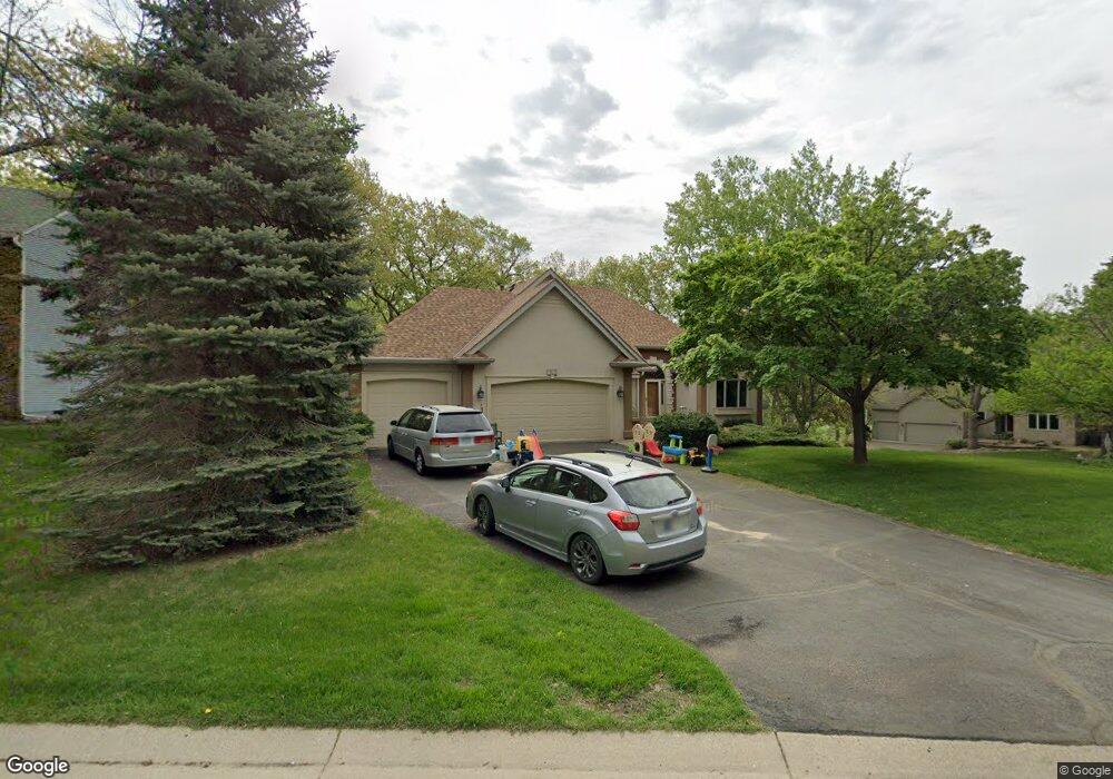
13020 Hershey Way Saint Paul, MN 55124
Alimagnet NeighborhoodEstimated Value: $571,000 - $591,940
4
Beds
3
Baths
2,996
Sq Ft
$194/Sq Ft
Est. Value
About This Home
This home is located at 13020 Hershey Way, Saint Paul, MN 55124 and is currently estimated at $580,485, approximately $193 per square foot. 13020 Hershey Way is a home located in Dakota County with nearby schools including Echo Park Elementary School of Leadership, Engineering & Technology, Falcon Ridge Middle School, and Apple Valley Senior High School.
Ownership History
Date
Name
Owned For
Owner Type
Purchase Details
Closed on
Jan 13, 2018
Sold by
Witt James R and Witt Patricia A
Bought by
Witt James R and Witt Patricia A
Current Estimated Value
Create a Home Valuation Report for This Property
The Home Valuation Report is an in-depth analysis detailing your home's value as well as a comparison with similar homes in the area
Home Values in the Area
Average Home Value in this Area
Purchase History
| Date | Buyer | Sale Price | Title Company |
|---|---|---|---|
| Witt James R | -- | None Available | |
| Merchant John John | $507,000 | -- |
Source: Public Records
Mortgage History
| Date | Status | Borrower | Loan Amount |
|---|---|---|---|
| Closed | Merchant John John | $405,600 |
Source: Public Records
Tax History Compared to Growth
Tax History
| Year | Tax Paid | Tax Assessment Tax Assessment Total Assessment is a certain percentage of the fair market value that is determined by local assessors to be the total taxable value of land and additions on the property. | Land | Improvement |
|---|---|---|---|---|
| 2024 | $5,910 | $552,800 | $136,400 | $416,400 |
| 2023 | $5,910 | $518,700 | $136,700 | $382,000 |
| 2022 | $4,884 | $495,100 | $132,500 | $362,600 |
| 2021 | $4,800 | $420,700 | $115,200 | $305,500 |
| 2020 | $4,894 | $404,900 | $109,700 | $295,200 |
| 2019 | $4,271 | $400,600 | $104,500 | $296,100 |
| 2018 | $4,281 | $367,300 | $99,500 | $267,800 |
| 2017 | $4,412 | $352,800 | $94,800 | $258,000 |
| 2016 | $4,091 | $345,200 | $90,300 | $254,900 |
| 2015 | $4,347 | $309,925 | $86,117 | $223,808 |
| 2014 | -- | $332,270 | $83,607 | $248,663 |
| 2013 | -- | $317,555 | $76,877 | $240,678 |
Source: Public Records
Map
Nearby Homes
- 13101 Heritage Way
- 110 Pony Ln E
- 13345 Huntington Cir
- 13306 Huntington Cir
- 13420 Gull Ct
- 12867 Pennock Ave
- 108 Hidden Meadow Rd
- 2708 Lassen Ct
- 13749 Heywood Ct
- 13591 Hollybrook Way
- 13599 Hollybrook Dr
- 13609 Hollybrook Dr
- 13613 Hollybrook Dr
- 13731 Hollybrook Cir
- 13751 Hollybrook Cir
- 13727 Hollybrook Cir
- The Sophia Plan at Eagle Pointe - Townhomes
- The Amelia Plan at Eagle Pointe - Townhomes
- The Magnolia Plan at Eagle Pointe - Townhomes
- The Nolan Plan at Eagle Pointe - Townhomes
- 13000 Hershey Way
- 13037 Hialeah Path
- 13035 Hialeah Path
- 13032 Hialeah Path
- 12995 Hershey Way
- 8299 131st St W
- 13033 Hialeah Path
- 8255 Palomino Dr
- 8295 131st St W
- 13010 Hialeah Path
- 12975 Hershey Way
- 12980 Hershey Way
- 13089 Herald Cir
- 13100 Palomino Dr
- 13107 Heritage Way
- 13102 Palomino Dr
- 13085 Herald Cir
- 13113 Heritage Way
- 13093 Herald Cir
- 13108 Palomino Dr